Home » Satellite Images » US States » Connecticut
Satellite Image of Connecticut
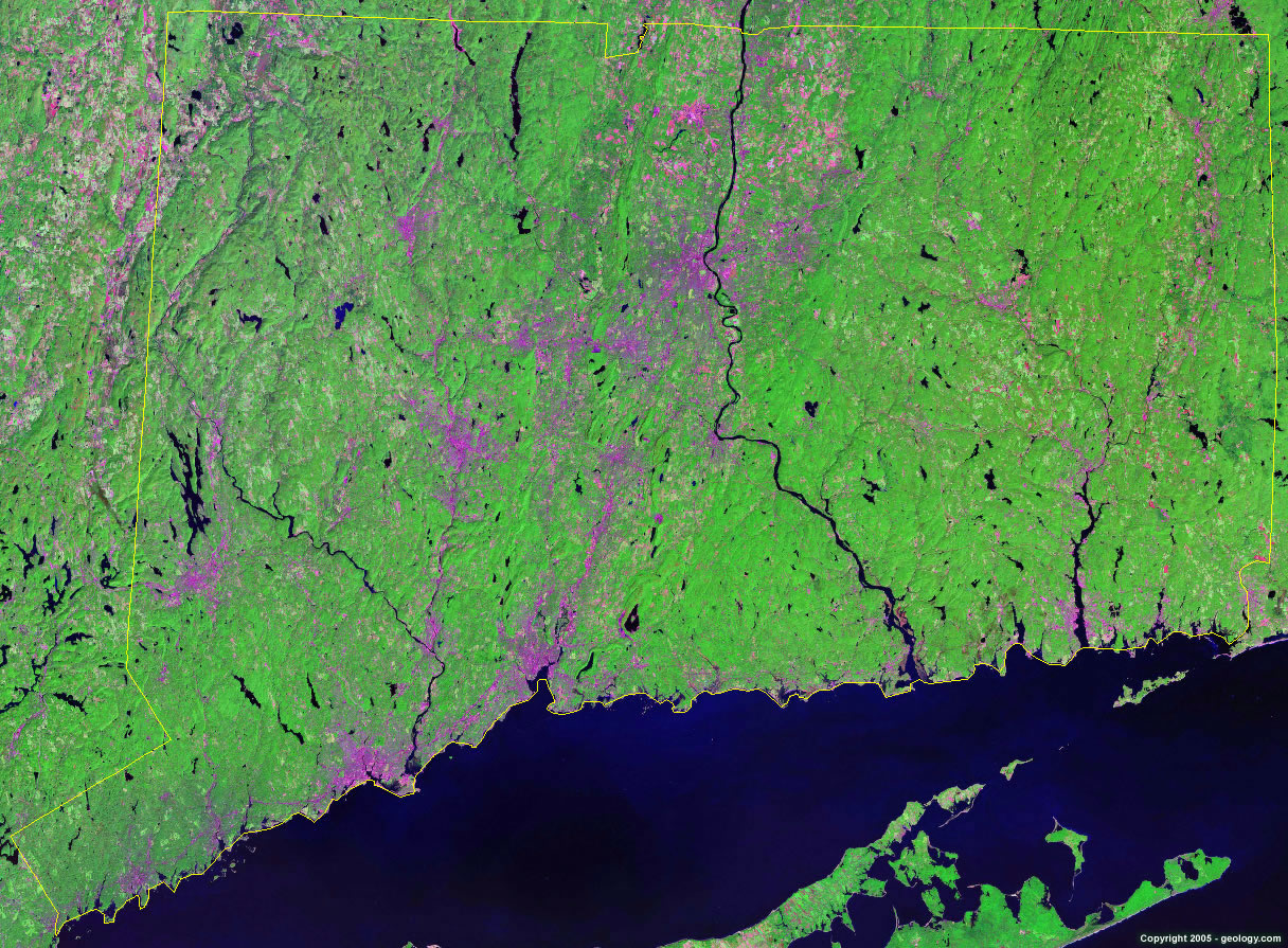
Connecticut Satellite Image - View Cities, Rivers, Lakes & Environment
Satellite Images for Neighboring States:
Massachusetts New York Rhode IslandThis is a Landsat GeoCover 2000 satellite image map of Connecticut. Cities, rivers, lakes, mountains and other features shown in this image include:
Connecticut Cities:
Bloomfield, CT
Bridgeport, CT
Danbury, CT
East Haven, CT
Fairfield, CT
Greenwich, CT
Hamden, CT
Hartford, CT
Hazardville, CT
Manchester, CT
Meriden, CT
Middletown, CT
Milford, CT
Naugatuck, CT
New Britain, CT
New Haven, CT
New London, CT
Newington, CT
Norwalk, CT
Norwich, CT
Pawcatuck, CT
Putnam, CT
Shelton, CT
Southington, CT
Stamford, CT
Storrs, CT
Stratford, CT
Torrington, CT
Trumbull, CT
Vernon, CT
Waterbury, CT
West Haven, CT
Wethersfield, CT
Willimantic, CT
Windsor, CT
Winsted, CT
Connecticut Rivers, Lakes, Water Features:
Amston Lake
Bantam Lake
Barkhamsted Reservoir
Bashan Lake
Beach Pond
Bolton Lakes
Colebrook River Lake
Compensating Reservoir
Connecticut River
Crystal Pond
Farmington River
Gardner Lake
Green Fall Pond
Hemlock Reservoir
Housatonic River
Lake Candlewood
Lake Gaillard
Lake Konomoc
Lake Lillinonah
Lake Waramaug
Lake Zoar
Long Pond
Mashapaug Pond
Mono Pond
Moodus Reservoir
Nepaug Reservoir
Oxoboxo Lake
Pachaug Pond
Powers Lake
Quaddick Reservoir
Quinebaug River
Rogers Lake
Saugatuck Reservoir
Shenipsit Lake
Shepaug Reservoir
Shepaug River
Shetucket River
Thames River
Twin Lakes
Upper Shepaug Reservoir
Williams Pond
Woodbridge Lake
Other Prominent Connecticut Features:
Connecticut farm land
Fishers Island
Gardiners Island
Long Island Sound
Long Island
Plum Island
Totoket Mountain
West Mountains
ADVERTISEMENT
More Satellite Images
 State Satellite Images: Color Landsat views of all 50 states. Spectacular images.
 Use Google Earth for FREE: Browse seamless worldwide satellite images. Free.
 Earth from Space at Night: Composite images show worldwide patterns of night light and heat.
 Oil & Gas Fields from Space at Night: Drill pad lighting and flaring make them stand out at night.
 Country Satellite Images: Satellite images for over 170 countries from Landsat GeoCover data.
  Satellite Views of US Cities: Images of 120 cities and their surrounding environment.
 Land Below Sea Level: The top ten locations where land is below the level of the ocean.
  Satellite Views of 64 World Cities: Spectacular images showing the city and surrounding environment.
Copyright information: The images on this page were composed by Angela King and are copyright by Geology.com. These images are not available for use beyond our websites. If you would like to share them with others, please link to this page. The satellite image was produced using Landsat data from NASA.