Home » Satellite Images » US States » Nevada
Satellite Image of Nevada
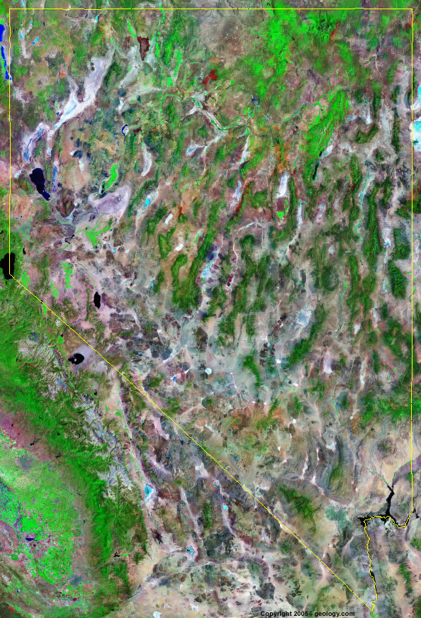
Nevada Satellite Image - View Cities, Rivers, Lakes & Environment
Satellite Images for Neighboring States:
Arizona California Idaho Oregon UtahThis is a Landsat GeoCover 2000 satellite image map of Nevada. Cities, rivers, lakes, mountains and other features shown in this image include:
Nevada Cities:
Battle Mountain, NV
Carson City, NV
Elko, NV
Ely, NV
Henderson, NV
Las Vegas, NV
Reno, NV
Sparks, NV
Nevada Rivers, Lakes, Water Features:
Colorado River
Humboldt River
Lake Mead
Lake Mojave
Lake Tahoe
Lower Lake
Meadow Valley WAsh
Pyramid Lake
Ruby Lake
Rye Patch Reservoir
Truckee River
Walker Lake
Other Prominent Nevada Features:
Big Smoky Valley
Black Rock Desert
Butte Mountains
Clan Alpine Mountains
Clover Mountains
Delamar Mountains
Egan Range
Grant Range
Independence Mountains
Monitor Range
Mormon Mountains
Owyhee Desert
Pancake Range
Pequop Mountains
Ruby Mountains
Santa Rosa Range
Shoshone Mountains
Spring Mountains
Stillwater Range
Toiyabe Range
ADVERTISEMENT
More Satellite Images
 State Satellite Images: Color Landsat views of all 50 states. Spectacular images.
 Use Google Earth for FREE: Browse seamless worldwide satellite images. Free.
 Earth from Space at Night: Composite images show worldwide patterns of night light and heat.
 Oil & Gas Fields from Space at Night: Drill pad lighting and flaring make them stand out at night.
 Country Satellite Images: Satellite images for over 170 countries from Landsat GeoCover data.
  Satellite Views of US Cities: Images of 120 cities and their surrounding environment.
 Land Below Sea Level: The top ten locations where land is below the level of the ocean.
  Satellite Views of 64 World Cities: Spectacular images showing the city and surrounding environment.
Copyright information: The images on this page were composed by Angela King and are copyright by Geology.com. These images are not available for use beyond our websites. If you would like to share them with others, please link to this page. The satellite image was produced using Landsat data from NASA.