Home » Satellite Images » US States » Utah
Satellite Image of Utah
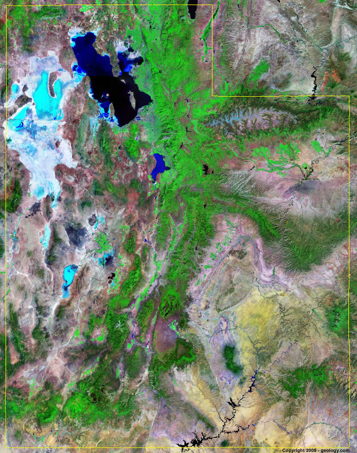
Utah Satellite Image - View Cities, Rivers, Lakes & Environment
Satellite Images for Neighboring States:
Arizona Colorado Idaho Nevada New Mexico WyomingThis is a Landsat GeoCover 2000 satellite image map of Utah. Cities, rivers, lakes, mountains and other features shown in this image include:
Utah Cities:
Brigham City, UT
Ogden, UT
Provo, UT
Salt Lake City, UT
Utah Rivers, Lakes, Water Features:
Bear Lake
Beaver River
Colorado River
Duchesne River
Flaming Gorge Reservoir
Great Salt Lake
Green River
Lake Powell
San Juan River
Sevier Lake
Sevier River
Strawberry River
Utah Lake
Other Prominent Utah Features:
Bad Land Cliffs
Bear River Range
Book Cliffs
Castle Valley
Circle Cliffs
Confusion Range
Daipparowits Plateau
Great Salt Lake Desert
Grouse Creek Mountains
Henry Mountains
San Rafael Desert
Sevier Desert
Sevier Plateau
Unita Mountains
Wasatch Plateau
ADVERTISEMENT
More Satellite Images
 State Satellite Images: Color Landsat views of all 50 states. Spectacular images.
 Use Google Earth for FREE: Browse seamless worldwide satellite images. Free.
 Earth from Space at Night: Composite images show worldwide patterns of night light and heat.
 Oil & Gas Fields from Space at Night: Drill pad lighting and flaring make them stand out at night.
 Country Satellite Images: Satellite images for over 170 countries from Landsat GeoCover data.
  Satellite Views of US Cities: Images of 120 cities and their surrounding environment.
 Land Below Sea Level: The top ten locations where land is below the level of the ocean.
  Satellite Views of 64 World Cities: Spectacular images showing the city and surrounding environment.
Copyright information: The images on this page were composed by Angela King and are copyright by Geology.com. These images are not available for use beyond our websites. If you would like to share them with others, please link to this page. The satellite image was produced using Landsat data from NASA.