Home » Satellite Images » US States » Wisconsin
Satellite Image of Wisconsin
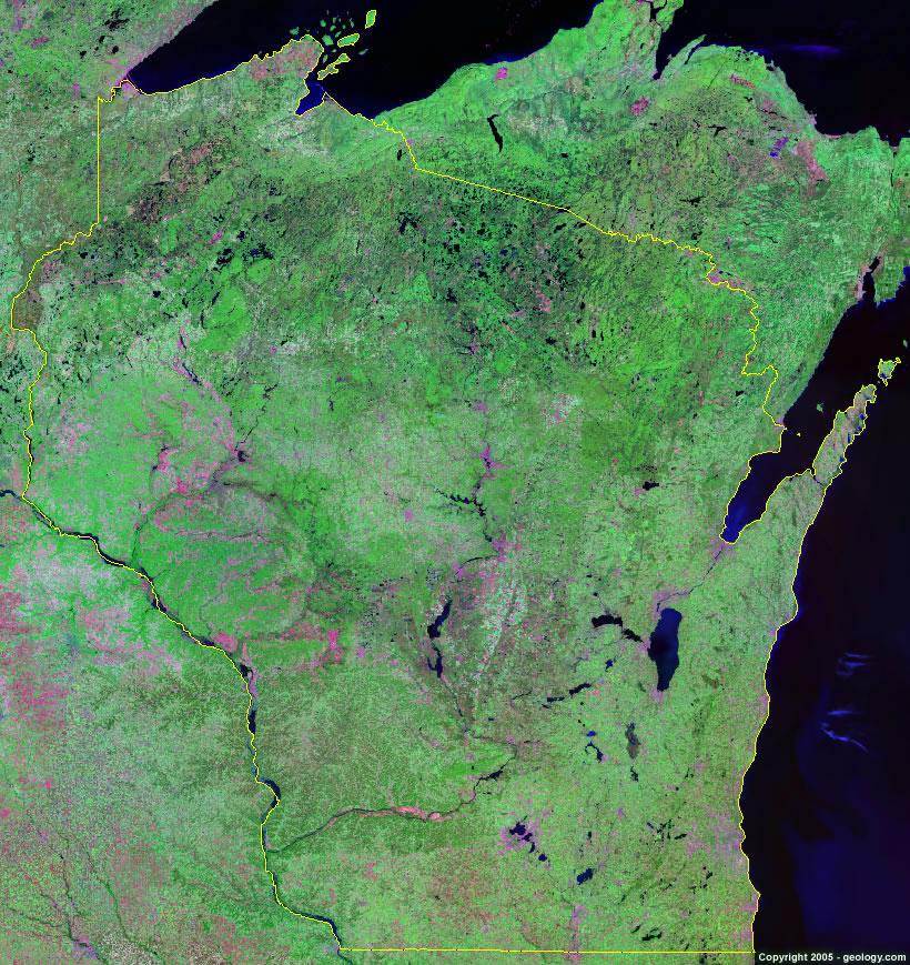
Wisconsin Satellite Image - View Cities, Rivers, Lakes & Environment
Satellite Images for Neighboring States:
Illinois Iowa Michigan MinnesotaThis is a Landsat GeoCover 2000 satellite image map of Wisconsin. Cities, rivers, lakes, mountains and other features shown in this image include:
Wisconsin Cities:
Appleton, WI
Beloit, WI
Eau Claire, WI
Fond du Lac, WI
Green Bay, WI
Janesville, WI
Kenosha, WI
La Crosse, WI
Madison, WI
Milwaukee, WI
Oshkosh, WI
Racine, WI
Superior, WI
Wausau, WI
Wisconsin Rivers, Lakes, Water Features:
Beaver Dam Lake
Big Eau Pleine Reservoir
Black River
Castle Rock Lake
Chippewa River
Green Lake
Lake Chippewa
Lake DuBay
Lake Geneva
Lake Mendota
Lake Michigan
Lake Monona
Lake Poygan
Lake Superior
Lake Waubesa
Lake Winnebago
Mississippi River
Petenwell Lake
Puckaway Lake
Shawano Lake
St. Croix River
Turtle Flambeau Flowage
Wisconsin River
Other Prominent Wisconsin Features:
Apostle Islands
Door Peninsula
Green Bay
Superior Uplands
Wisconsin farm land
ADVERTISEMENT
More Satellite Images
 State Satellite Images: Color Landsat views of all 50 states. Spectacular images.
 Use Google Earth for FREE: Browse seamless worldwide satellite images. Free.
 Earth from Space at Night: Composite images show worldwide patterns of night light and heat.
 Oil & Gas Fields from Space at Night: Drill pad lighting and flaring make them stand out at night.
 Country Satellite Images: Satellite images for over 170 countries from Landsat GeoCover data.
  Satellite Views of US Cities: Images of 120 cities and their surrounding environment.
 Land Below Sea Level: The top ten locations where land is below the level of the ocean.
  Satellite Views of 64 World Cities: Spectacular images showing the city and surrounding environment.
Copyright information: The images on this page were composed by Angela King and are copyright by Geology.com. These images are not available for use beyond our websites. If you would like to share them with others, please link to this page. The satellite image was produced using Landsat data from NASA.