Home » US Maps » Massachusetts Maps
Massachusetts Map Collection
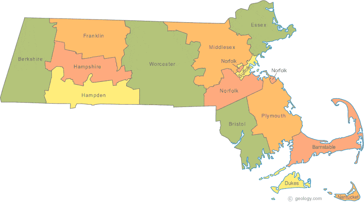
Massachusetts County Map:
This map shows Massachusetts's 7 counties and 7 census areas. Also available is a detailed Massachusetts County Map with county seat cities.
ADVERTISEMENT


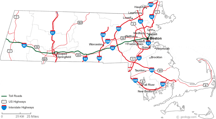
Map of Massachusetts Cities:
This map shows many of Massachusetts's important cities and most important roads. Important north - south routes include: Interstate 91, Interstate 93, Interstate 95, Interstate 195, Interstate 395 and Interstate 495. Important east - west routes include: Interstate 90 and Interstate 290. We also have a more detailed Map of Massachusetts Cities.
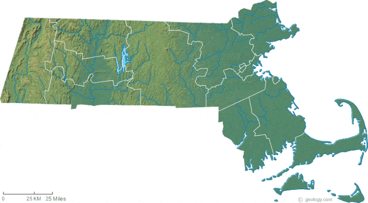
Massachusetts Physical Map:
This Massachusetts shaded relief map shows the major physical features of the state. For other nice views of the state, see our Massachusetts Satellite image or the Massachusetts map by Google.
ADVERTISEMENT
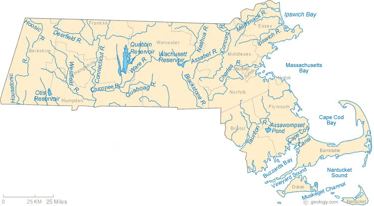
Massachusetts Rivers Map:
This map shows the major streams and rivers of Massachusetts and some of the larger lakes. The state is within the Atlantic Ocean Watershed. Most of these lakes and streams can be clearly seen on the Massachusetts Satellite Image. We also have a page about Massachusetts water resources.
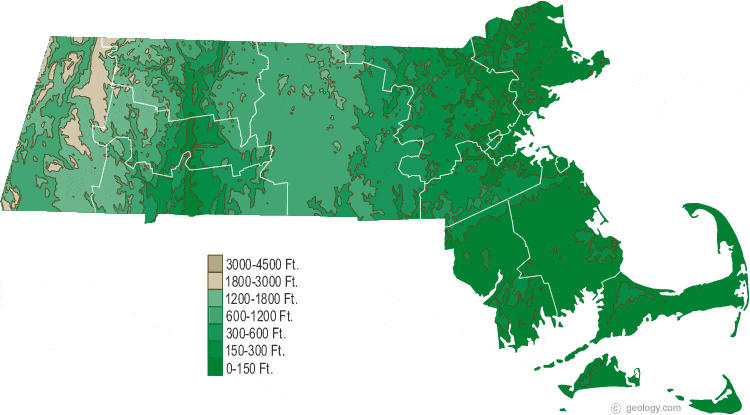
Massachusetts Elevation Map:
This is a generalized topographic map of Massachusetts. It shows elevation trends across the state. Detailed topographic maps and aerial photos of Massachusetts are available in the Geology.com store. See our state high points map to learn about Mt. Greylock at 3,491 feet - the highest point in Massachusetts. The lowest point is the Atlantic Ocean at Sea Level.