Home » World Maps » Africa » Angola
Angola Map and Satellite Image
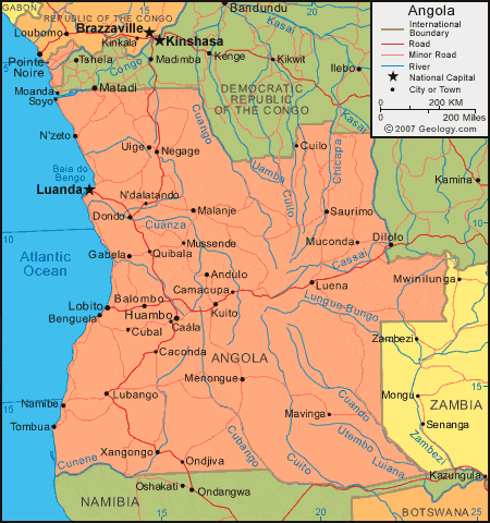
| Angola is located in southwestern Africa. Angola is bordered by the Atlantic Ocean to the west, the Democratic Republic of the Congo to the north and east, Zambia to the east, and Botswana and Namibia to the south. The exclave province of Cabinda is bordered by the Atlantic Ocean to the west, the Republic of the Congo to the north, and the Democratic Republic of the Congo to the southeast. |
ADVERTISEMENT
Angola Bordering Countries:
Democratic Republic of the Congo, Republic of the Congo, Namibia, ZambiaRegional Maps:
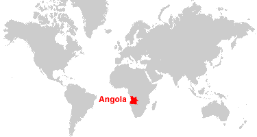
Map of Africa, World MapWhere is Angola?
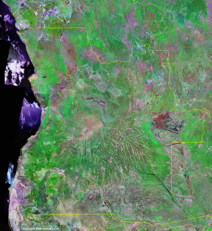
Angola Satellite Image
ADVERTISEMENT

Explore Angola Using Google Earth:
Google Earth is a free program from Google that allows you to explore satellite images showing the cities and landscapes of Angola and all of Africa in fantastic detail. It works on your desktop computer, tablet, or mobile phone. The images in many areas are detailed enough that you can see houses, vehicles and even people on a city street. Google Earth is free and easy-to-use.
Angola on a World Wall Map:
Angola is one of nearly 200 countries illustrated on our Blue Ocean Laminated Map of the World. This map shows a combination of political and physical features. It includes country boundaries, major cities, major mountains in shaded relief, ocean depth in blue color gradient, along with many other features. This is a great map for students, schools, offices and anywhere that a nice map of the world is needed for education, display or decor.
Angola On a Large Wall Map of Africa:
If you are interested in Angola and the geography of Africa our large laminated map of Africa might be just what you need. It is a large political map of Africa that also shows many of the continent's physical features in color or shaded relief. Major lakes, rivers, cities, roads, country boundaries, coastlines and surrounding islands are all shown on the map.Angola Cities:
Andulo, Balombo, Benguela, Caconda, Caiundo, Camacupa, Cambulo, Canzar, Cuango, Cubal, Cuilo, Dondo, Gabela, Huambo, Kuito, Lobito, Lovua, Luanda, Lubango, Lucapa, Luena, M'banza Congo, Malanje, Mavinga, Menongue, Muconda, Mussende, Namibe, N'dalatando, Negage, N'zeto, Quibala, Quinzau, Saurimo, Songo, Soyo, Tombua, Uige and Xangongo Ondjiva.Angola Locations:
Atlantic Ocean, Baia de Bengo, Caculuvar River, Cassai River, Chicapa River, Congo River, Cuando River, Cuango River, Cuanza River, Cubango River, Cuilo River, Cuito River, Cunene River, Luangue River, Luena River, Lungue-Bungo River, Quembo River, Umba River, Utembo Luiana and Zambeze River.Angola Natural Resources:
Angola's metal resources include iron ore, copper, gold and bauxite. Commercial deposits of petroleum, diamonds, phosphates, feldspar and uranium are also present.Angola Natural Hazards:
The country of Angola has locally heavy rainfall, which causes periodic flooding on the plateau.Angola Environmental Issues:
The country of Angola has deforestation of its tropical rain forest, in response to both international demand for tropical timber and the domestic use for fuel. This results in loss of biodiversity. The country's population pressure influences the overuse of pastures, and the subsequent soil erosion and desertification. The soil erosion contributes to water pollution, siltation of rivers and dams, and inadequate supplies of potable water.
ADVERTISEMENT