Home » World Maps » Africa » Benin
Benin Map and Satellite Image
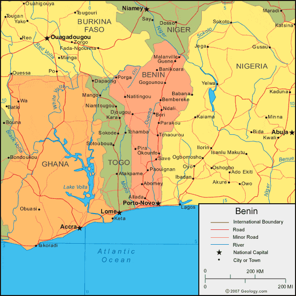
| Benin is located in western Africa. Benin is bordered by the Bight of Benin to the south, Nigeria to the east, Niger to the north, Burkina Faso to the northwest, and Togo to the west. |
ADVERTISEMENT
Benin Bordering Countries:
Burkina Faso, Niger, Nigeria, TogoRegional Maps:
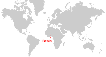
Map of Africa, World MapWhere is Benin?
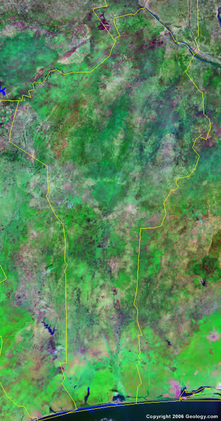
Benin Satellite Image
ADVERTISEMENT

Explore Benin Using Google Earth:
Google Earth is a free program from Google that allows you to explore satellite images showing the cities and landscapes of Benin and all of Africa in fantastic detail. It works on your desktop computer, tablet, or mobile phone. The images in many areas are detailed enough that you can see houses, vehicles and even people on a city street. Google Earth is free and easy-to-use.
Benin on a World Wall Map:
Benin is one of nearly 200 countries illustrated on our Blue Ocean Laminated Map of the World. This map shows a combination of political and physical features. It includes country boundaries, major cities, major mountains in shaded relief, ocean depth in blue color gradient, along with many other features. This is a great map for students, schools, offices and anywhere that a nice map of the world is needed for education, display or decor.
Benin On a Large Wall Map of Africa:
If you are interested in Benin and the geography of Africa our large laminated map of Africa might be just what you need. It is a large political map of Africa that also shows many of the continent's physical features in color or shaded relief. Major lakes, rivers,cities, roads, country boundaries, coastlines and surrounding islands are all shown on the map.Benin Cities:
Abomey, Allada, Babana, Banikoara, Bembereke, Birni, Bohicon, Bori, Cotonou, Counarou, Djidja, Djougou, Gogounou, Grand Popo, Guene, Kandi, Lokossa, Malanville, Natitingou, Ndali, Okounfo, Ouidah, Paouignan, Parakou, Pira, Pobe, Porga, Porto-Novo, Sakete, Save, Sonsoro and Tchaourou.Benin Locations:
Atlantic Ocean, Bight of Benin, Gulf of Guinea, Oti River and Oueme River.Benin Natural Resources:
Benin has exploitable deposits of limestone and marble and the potential for a small amount of offshore oil. Timber is also a resource.Benin Natural Hazards:
Natural hazards for Benin include the hot, dry, dusty harmattan wind. This may affect the northern part of the country from December to March.Benin Environmental Issues:
Some environmental issues for Benin, in western Africa, are: deforestation; desertification; inadequate supplies of potable water. As well as these land and water issues, the country's wildlife populations are threatened by poaching.
ADVERTISEMENT