Home » World Maps » Africa » Burkina Faso
Burkina Faso Map and Satellite Image
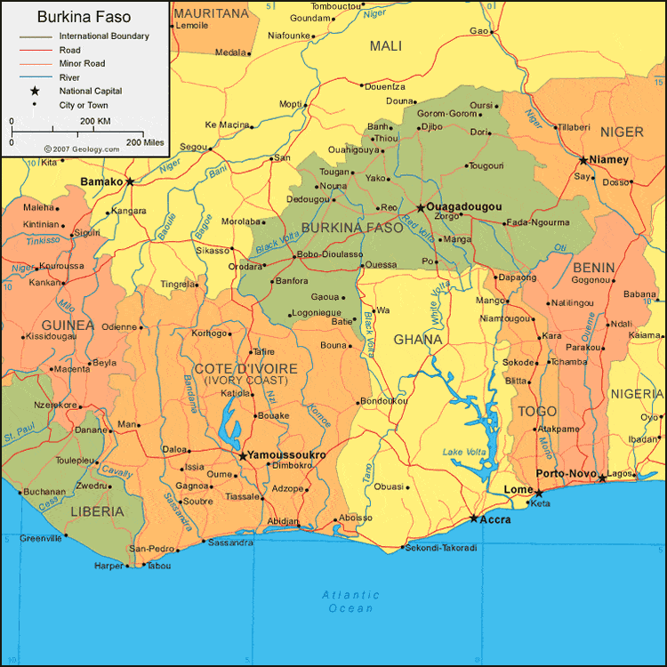
| Burkina Faso is located in western Africa. Burkina Faso is bordered by Mali to the north, Niger to the east, and Cote d'Ivoire (Ivory Coast), Ghana, Togo, and Benin to the south. |
ADVERTISEMENT
Burkina Faso Bordering Countries:
Benin, Cote d'Ivoire, Ghana, Mali, Niger, TogoRegional Maps:
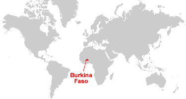
Map of Africa, World MapWhere is Burkina Faso?
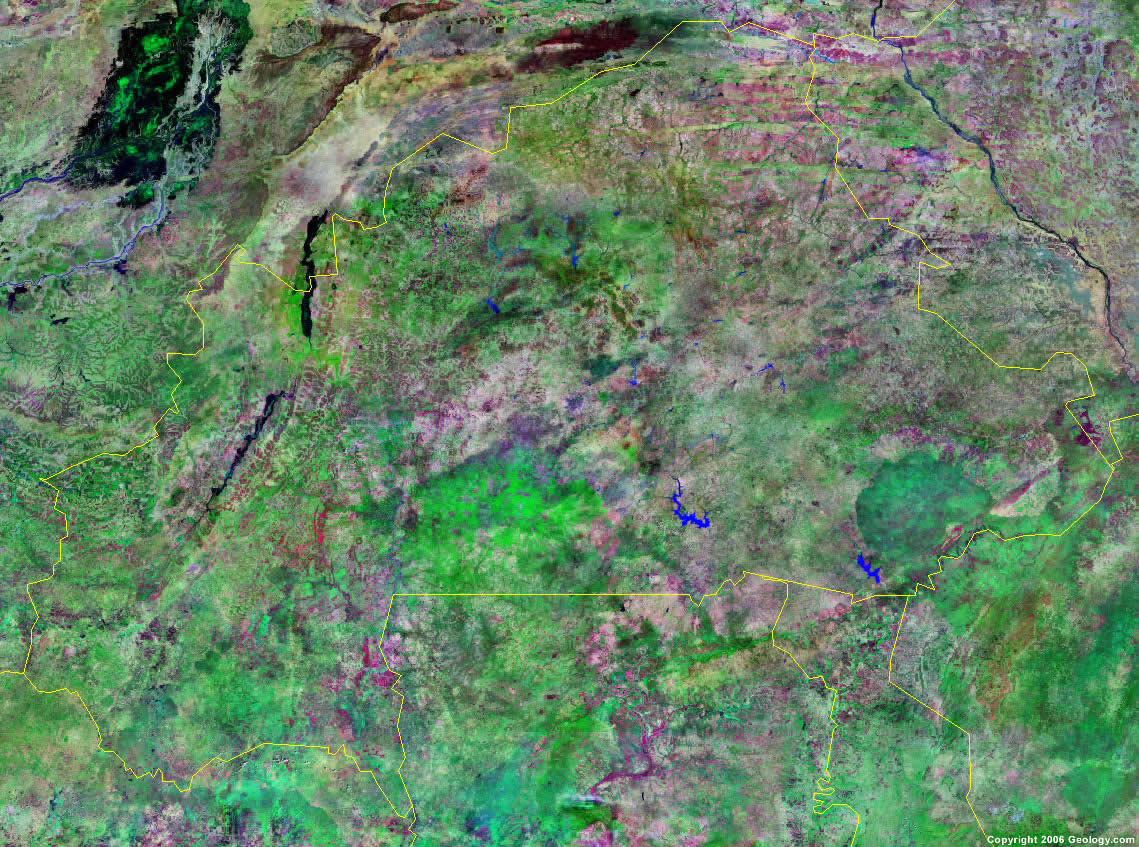
Burkina Faso Satellite Image
ADVERTISEMENT

Explore Burkina Faso Using Google Earth:
Google Earth is a free program from Google that allows you to explore satellite images showing the cities and landscapes of Burkina Faso and all of Africa in fantastic detail. It works on your desktop computer, tablet, or mobile phone. The images in many areas are detailed enough that you can see houses, vehicles and even people on a city street. Google Earth is free and easy-to-use.
Burkina Faso on a World Wall Map:
Burkina Faso is one of nearly 200 countries illustrated on our Blue Ocean Laminated Map of the World. This map shows a combination of political and physical features. It includes country boundaries, major cities, major mountains in shaded relief, ocean depth in blue color gradient, along with many other features. This is a great map for students, schools, offices and anywhere that a nice map of the world is needed for education, display or decor.
Burkina Faso On a Large Wall Map of Africa:
If you are interested in Burkina Faso and the geography of Africa our large laminated map of Africa might be just what you need. It is a large political map of Africa that also shows many of the continent's physical features in color or shaded relief. Major lakes, rivers, cities, roads, country boundaries, coastlines and surrounding islands are all shown on the map.Burkina Faso Cities:
Banfora, Banh, Batie, Biba, Bobo Diouslasso, Cassou, Coala, Dedougou, Djibo, Dori, Fada Ngourma, Gacua, Gorom Gorom, Kaya, Koudougou, Leo, Logoniegue, Mane, Manga, Nouna, Orodara, Ouagadougou, Ouahigouya, Ouessa, Oursi, Po, Reo, Sebba, Tenkodogo, Thiou, Tougan, Tougouri, Yako and Zorgo.Burkina Faso Locations:
Mouhoun (Black Volta) River, Nazinon (Red Volta) River, Nakanbe (White Volta) River and oti River.Burkina Faso Natural Resources:
Burkina Faso's mineral resources include manganese, gold, phosphates, limestone, marble, pumice and salt.Burkina Faso Natural Hazards:
The country of Burkina Faso has natural hazards, which include recurring droughts.Burkina Faso Environmental Issues:
Burkina Faso, in western Africa, has had recent droughts and desertification, which has severely affected their agricultural activities, population distribution, and economy. Some of the country's environmental issues stem from overgrazing, soil degradation, and deforestation.
ADVERTISEMENT