Home » World Maps » South America » Colombia
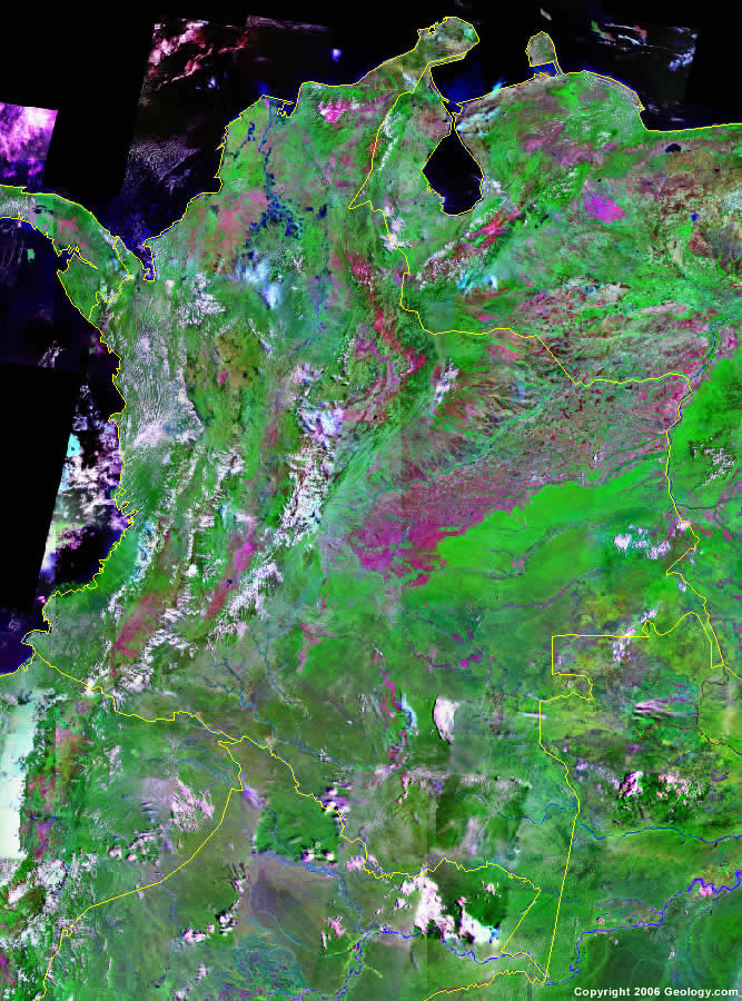
Colombia Map and Satellite Image
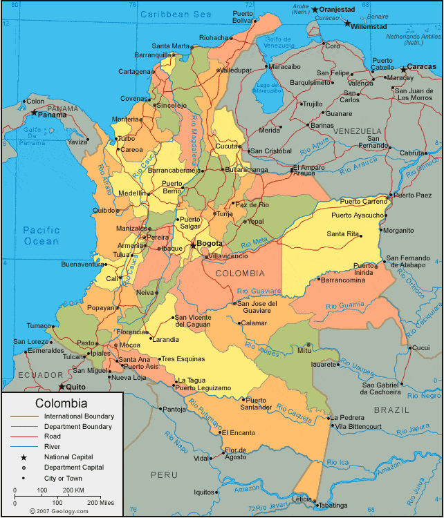
| Colombia is located in northwestern South America. Colombia is bordered by the Caribbean Sea to the north, Venezuela and Brazil to the east, Peru and Ecuador to the south, and the Pacific Ocean and Panama to the west. |
ADVERTISEMENT
Colombia Bordering Countries:
Brazil, Ecuador, Panama, Peru, VenezuelaRegional Maps:
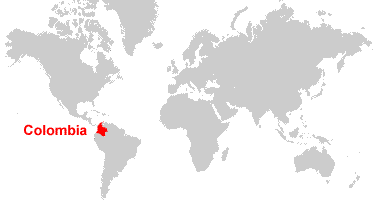
Map of South America, World MapWhere is Colombia?
Colombia Satellite Image
ADVERTISEMENT

Explore Colombia Using Google Earth:
Google Earth is a free program from Google that allows you to explore satellite images showing the cities and landscapes of Colombia and all of South America in fantastic detail. It works on your desktop computer, tablet, or mobile phone. The images in many areas are detailed enough that you can see houses, vehicles and even people on a city street. Google Earth is free and easy-to-use.
Colombia on a World Wall Map:
Colombia is one of nearly 200 countries illustrated on our Blue Ocean Laminated Map of the World. This map shows a combination of political and physical features. It includes country boundaries, major cities, major mountains in shaded relief, ocean depth in blue color gradient, along with many other features. This is a great map for students, schools, offices and anywhere that a nice map of the world is needed for education, display or decor.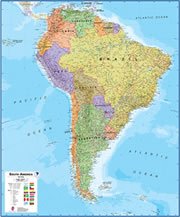
Colombia On a Large Wall Map of South America:
If you are interested in Colombia and the geography of South America our large laminated map of South America might be just what you need. It is a large political map of South America that also shows many of the continent's physical features in color or shaded relief. Major lakes, rivers,cities, roads, country boundaries, coastlines and surrounding islands are all shown on the map.Colombia Cities:
Armenia, Barrancabermeja, Barranquilla Santa Marta, Bello, Bogota, Bucaramanga, Buenaventura, Buga, Calamar, Cali, Careoa, Cartagena, Cartago, Covenas, Cucuta, El Encanto, Florencia, Ibaque, Ipiales, La Pedrera, La Tagua, Larandia, Manizales, Medellin, Mitu, Mocoa, Monteria, Neiva, Palmira, Pasto, Paz de Rio, Pereira, Popayan, Puerto Asis, Puerto Berrio, Puerto Bolivar, Puerto Carreno, Puerto Salgar, Puerto Santander, Quibdo, Riohacha, Santa Ana, Santa Marta, Santa Rita, Sincelejo, Sogamoso, Soledad, Tres Esquinas, Tulua, Tumaco, Tunja, Turbo, Valledupar, Viliavicencio and Yopal.Colombia Locations:
Amazonas (Amazon River), Bahia de Buenaventura, Bahia de Portete, Bahia Guapi, Bahia Honda, Caguan River, Caqueta River, Caribbean Sea, Cordillera de los Andes, Ensenada de Tumaco, Ensenada Docampado, Golfo de Cupica, Golfo de Morrosquillo, Golfo de Tibuga, Golfo de Uraba, Guaviare River, Inirida River, Laguna de la Cocha, Magdalena River, Orinoco River, Pacific Ocean, Rio Atrato, Rio Caqueta, Rio Cauca, Rio Guainia, Rio Guaviare, Rio Magdalena, Rio Meta, Rio Putumayo and Rio Vaupes.Colombia Natural Resources:
Colombia's fuel resources include coal, petroleum, natural gas and hydropower. The country's mineral resources include iron ore, copper, nickel, gold and emeralds.Colombia Natural Hazards:
The country of Colombia has natural hazards which include periodic droughts, and the occasional earthquake. In addition, the highlands are subject to volcanic eruptions.Colombia Environmental Issues:
Colombia has environmental issues which include damage to the quality of soil and water from the overuse of pesticides. There is air pollution from vehicle emissions, especially in Bogota. The country also experiences deforestation.
ADVERTISEMENT