Home » World Maps » Africa » Ghana
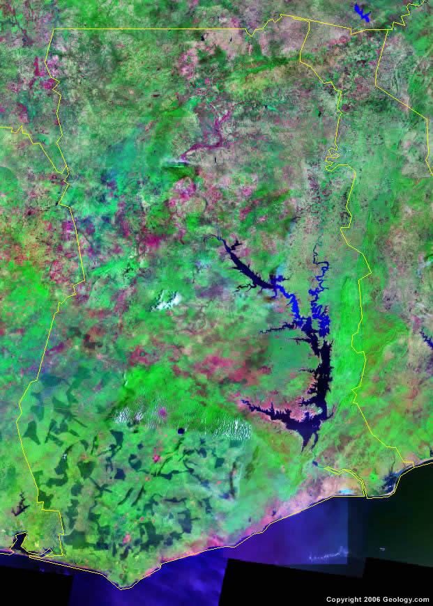
Ghana Map and Satellite Image
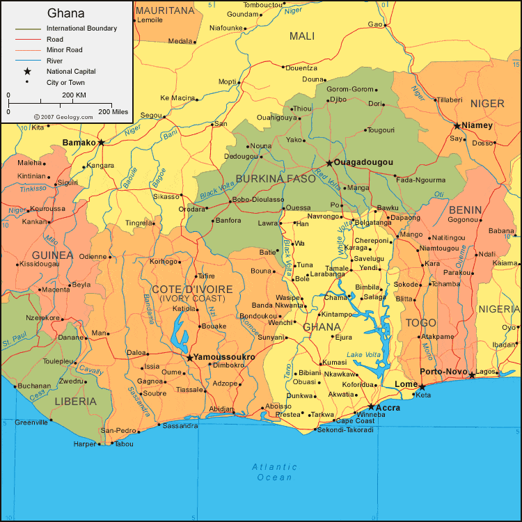
| Ghana is located in western Africa. Ghana is bordered by the Gulf of Guinea to the south, Cote d'Ivoire (Ivory Coast) to the west, Burkina Faso to the north, and Togo to the east. |
ADVERTISEMENT
Ghana Bordering Countries:
Burkina Faso, Cote d'Ivoire, TogoRegional Maps:
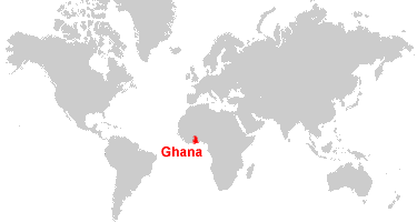
Map of Africa, World MapWhere is Ghana?
Ghana Satellite Image
ADVERTISEMENT

Explore Ghana Using Google Earth:
Google Earth is a free program from Google that allows you to explore satellite images showing the cities and landscapes of Ghana and all of Africa in fantastic detail. It works on your desktop computer, tablet, or mobile phone. The images in many areas are detailed enough that you can see houses, vehicles and even people on a city street. Google Earth is free and easy-to-use.
Ghana on a World Wall Map:
Ghana is one of nearly 200 countries illustrated on our Blue Ocean Laminated Map of the World. This map shows a combination of political and physical features. It includes country boundaries, major cities, major mountains in shaded relief, ocean depth in blue color gradient, along with many other features. This is a great map for students, schools, offices and anywhere that a nice map of the world is needed for education, display or decor.
Ghana On a Large Wall Map of Africa:
If you are interested in Ghana and the geography of Africa our large laminated map of Africa might be just what you need. It is a large political map of Africa that also shows many of the continent's physical features in color or shaded relief. Major lakes, rivers, cities, roads, country boundaries, coastlines and surrounding islands are all shown on the map.Ghana Cities:
Accra, Akwatia, Banda Nkwanta, Bawku, Bibiani, Bimbila, Bole, Bolgatanga, Cape Coast, Chama, Chereponi, Dunkwa, Ejura, Foso, Han, Ho, Kade, Karaga, Keta, Kintampo, Koforidua, Kumasi, Larabanga, Lawra, Navrongo, Nkawkaw, Nyakrom, Obuasi, Oda, Prestea, Salaga, Savelugu, Sekondi Takoradi, Sunyani, Swedru, Tamale, Tarkwa, Tema, Teshi, Tuna, Wa, Wasipe, Wenchi, Winneba and Yendi.Ghana Locations:
Black Volta River, Gulf of Guinea, Lake Bosumtwi, Lake Volta, Tano River and White Volta River.Ghana Natural Resources:
Ghana has a variety of natural resources some of which are: rubber, timber, hydropower, petroleum, salt, limestone, fish and industrial diamonds. The metallic resources of the country include gold, silver, bauxite and manganese.Ghana Natural Hazards:
For Ghana, the natural hazards include the dry, dusty, northeastern harmattan winds, which occur from January to March. In addition, the county is subject to droughts.Ghana Environmental Issues:
The country of Ghana has a number of environmental issues. Some of the issues are deforestation, overgrazing and erosion. The country has had recurrent drought in north, which severely affects the agricultural activities. There is water pollution and inadequate supplies of potable water. The destruction of habitat and poaching threatens their wildlife populations.
ADVERTISEMENT