Home » World Maps » Africa » Guinea-Bissau
Guinea-Bissau Map and Satellite Image
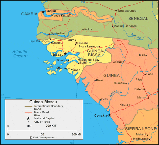
| Guinea-Bissau is located in western Africa. Guinea-Bissau is bordered by the Atlantic Ocean to the west, Senegal to the north, and Guinea to the southeast. |
ADVERTISEMENT
Guinea-Bissau Bordering Countries:
Guinea, SenegalRegional Maps:
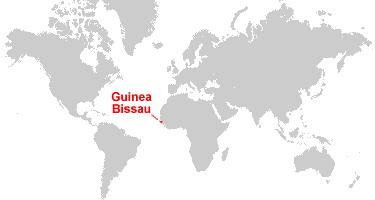
Map of Africa, World MapWhere is Guinea-Bissau?
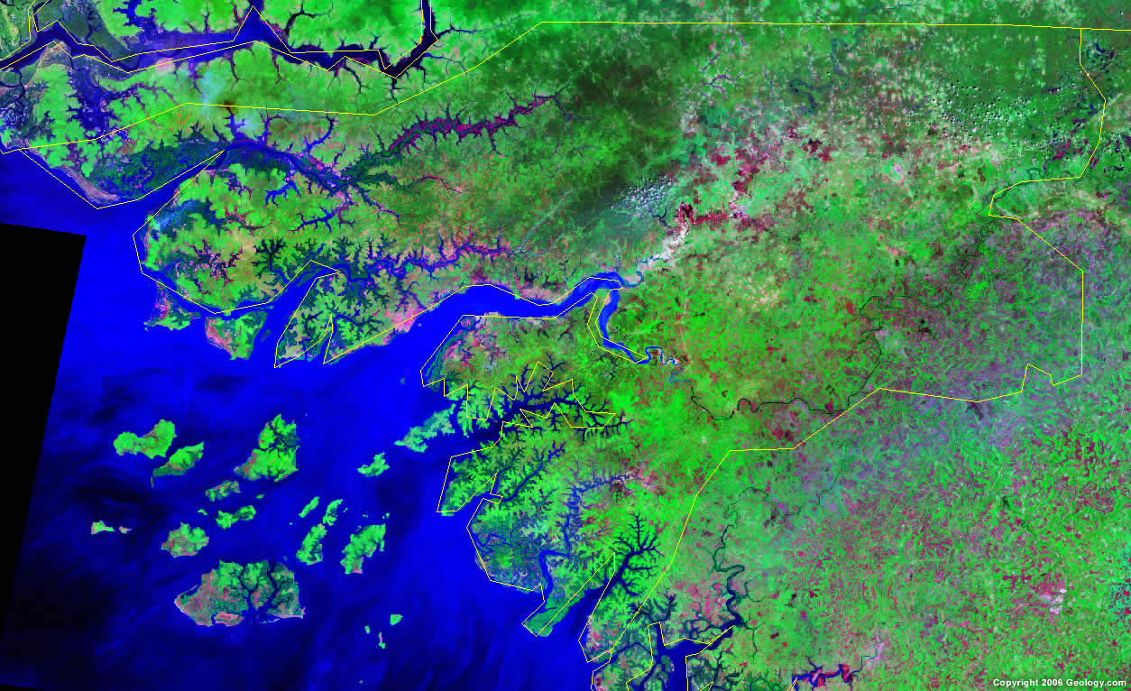
Guinea-Bissau Satellite Image
ADVERTISEMENT

Explore Guinea-Bissau Using Google Earth:
Google Earth is a free program from Google that allows you to explore satellite images showing the cities and landscapes of Guinea-Bissau and all of Africa in fantastic detail. It works on your desktop computer, tablet, or mobile phone. The images in many areas are detailed enough that you can see houses, vehicles and even people on a city street. Google Earth is free and easy-to-use.
Guinea-Bissau on a World Wall Map:
Guinea-Bissau is one of nearly 200 countries illustrated on our Blue Ocean Laminated Map of the World. This map shows a combination of political and physical features. It includes country boundaries, major cities, major mountains in shaded relief, ocean depth in blue color gradient, along with many other features. This is a great map for students, schools, offices and anywhere that a nice map of the world is needed for education, display or decor.
Guinea-Bissau On a Large Wall Map of Africa:
If you are interested in Guinea-Bissau and the geography of Africa our large laminated map of Africa might be just what you need. It is a large political map of Africa that also shows many of the continent's physical features in color or shaded relief. Major lakes, rivers, cities, roads, country boundaries, coastlines and surrounding islands are all shown on the map.Guinea-Bissau Cities:
Bafata, Bissau, Bolama, Buba, Bubaque, Cacheu, Cacine, Catio, Farim, Fulacunda, Madina do Boe, Mansaba, Nova Lamego, Sao Domingos and Sao Joao.Guinea-Bissau Locations:
Atlantic Ocean, Cacheu River and Geba River.Guinea-Bissau Natural Resources:
Guinea-Bissau has unexploited deposits of petroleum and commercial resources of phosphates present. Other natural resources for the country include fish, timber, bauxite, clay, granite, and limestone.Guinea-Bissau Natural Hazards:
Guinea-Bissau's natural hazards include brush fires, and a hot, dry, dusty harmattan haze that can reduce visibility during the dry season.Guinea-Bissau Environmental Issues:
The country of Guinea-Bissau has environmental issues which include deforestation and soil erosion. There is also overgrazing and overfishing.
ADVERTISEMENT