Home » World Maps » Asia » Jordan
Jordan Map and Satellite Image
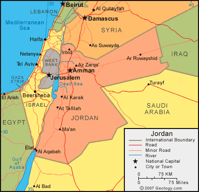
| Jordan is located in the Middle East. It is bordered by Israel and the West Bank to the west, Syria to the north, and Saudi Arabia and Iraq to the east. |
ADVERTISEMENT
Jordan Neighboring Countries:
Egypt, Iraq, Israel, Lebanon, Saudi Arabia, Syria, West BankRegional Maps:
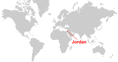
Asia, Middle East, WorldWhere is Jordan?
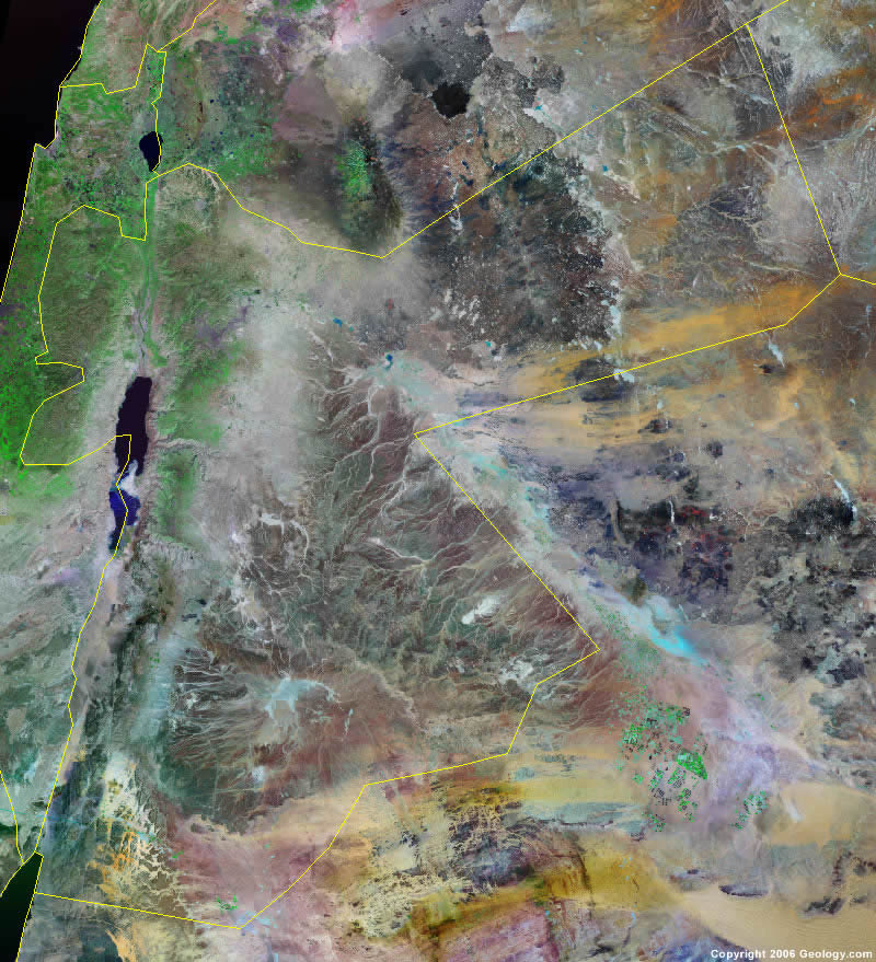
Jordan Satellite Image
ADVERTISEMENT

Explore Jordan Using Google Earth:
Google Earth is a free program from Google that allows you to explore satellite images showing the cities and landscapes of Jordan and all of Asia in fantastic detail. It works on your desktop computer, tablet, or mobile phone. The images in many areas are detailed enough that you can see houses, vehicles and even people on a city street. Google Earth is free and easy-to-use.
Jordan on a World Wall Map:
Jordan is one of nearly 200 countries illustrated on our Blue Ocean Laminated Map of the World. This map shows a combination of political and physical features. It includes country boundaries, major cities, major mountains in shaded relief, ocean depth in blue color gradient, along with many other features. This is a great map for students, schools, offices and anywhere that a nice map of the world is needed for education, display or decor.
Jordan On a Large Wall Map of Asia:
If you are interested in Jordan and the geography of Asia our large laminated map of Asia might be just what you need. It is a large political map of Asia that also shows many of the continent's physical features in color or shaded relief. Major lakes, rivers,cities, roads, country boundaries, coastlines and surrounding islands are all shown on the map.Jordan Cities:
Al Mazraah, Al Karak, Al Mafraq, Al Tafilah, Amman (Philadelphia), Aqaba, Ar Rabbah, Ar Ramtha, Ar Rusayfah, Ar Ruwayshid, As Salt, At Tayyibah, Az Zarqa, Azraq ash Shishan, Irbid (Arbela), Irbid, Madaba and Ma'an.Jordan Locations:
Dead Sea, Gulf of Aqaba, Jordan River, Mediterranean Sea, Qa Abu al Husayn, Qa al Hafirah, Qa al Jafr, Qa al Qataf, Qa al Wisad, Sea of Galilee, Syrian Desert, Wadi al Arabah River and Yarmul River.Jordan Natural Resources:
The country of Jordan has some natural resources such as phosphates, potash and shale oil.Jordan Natural Hazards:
Jordan has natural hazards which include droughts and periodic earthquakes.Jordan Environmental Issues:
Environmental issues for the country of Jordan include deforestation, overgrazing, soil erosion, and desertification. The country also has limited natural fresh water resources.
ADVERTISEMENT