Home » World Maps » Asia » Saudi Arabia
Saudi Arabia Map and Satellite Image
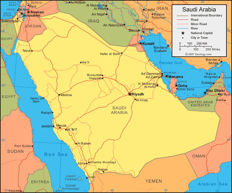
| Saudi Arabia is located in the Middle East. Saudi Arabia is bordered by the Red Sea to the west, Yemen and Oman to the south, the Persian Gulf, Qatar, and United Arab Emirates to the east, and Kuwait, Iraq, and Jordan to the north. |
ADVERTISEMENT
Saudi Arabia Neighboring Countries:
Egypt, Eritrea, Iraq, Israel, Jordan, Kuwait, Oman, Qatar, Sudan, UAE, YemenRegional Maps:
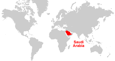
Africa, Asia, Middle East, WorldWhere is Saudi Arabia?
Saudi Arabia Satellite Image

ADVERTISEMENT

Explore Saudi Arabia Using Google Earth:
Google Earth is a free program from Google that allows you to explore satellite images showing the cities and landscapes of Saudi Arabia and all of Asia in fantastic detail. It works on your desktop computer, tablet, or mobile phone. The images in many areas are detailed enough that you can see houses, vehicles and even people on a city street. Google Earth is free and easy-to-use.
Saudi Arabia on a World Wall Map:
Saudi Arabia is one of nearly 200 countries illustrated on our Blue Ocean Laminated Map of the World. This map shows a combination of political and physical features. It includes country boundaries, major cities, major mountains in shaded relief, ocean depth in blue color gradient, along with many other features. This is a great map for students, schools, offices and anywhere that a nice map of the world is needed for education, display or decor.
Saudi Arabia On a Large Wall Map of Asia:
If you are interested in Saudi Arabia and the geography of Asia our large laminated map of Asia might be just what you need. It is a large political map of Asia that also shows many of the continent's physical features in color or shaded relief. Major lakes, rivers, cities, roads, country boundaries, coastlines and surrounding islands are all shown on the map.Saudi Arabia Cities:
Aba as Sa'ud, Abha, Ad Dammam, Al Bahah, Al Hillah (Hauta), Al Hufuf (Hofuf), Al Kharj, Al Khubar, Al Manamah (Manama), Al Mubarraz, Al Qunfudhah, Ar Riyad (Riyadh), At Ta'if, Az Zahran, Buraydah, Ha'il, Hafar al Batin, Jeddah, Jizan, Khamis Mushayt, Makkah (Mecca), Medina, Najran, Qal at Bishah, Rabigh, Tabuk, Unayzah, Wadi ad Dawasir and Yanbu'al Bahr.Saudi Arabia Locations:
Ad Dahna, Ad Dhana, Al Jafurah, An Nafud, Ar Rub' al Khali (Empty Quarter), Arabian Sea, Gulf of Aqaba, Gulf of Bahrain, Harrat al Buqum, Harrat Khaybar, Harrat Kishb, Harrat Nawasif, Harrat Rahat (Lava Fields), Harrat Uwayrid, Jabal Hijaz, Jabal Tuwayq, Persian Gulf (Arabian Gulf), Red Sea, Syrian Desert and Tihamat ash Sham.Saudi Arabia Natural Resources:
Saudi Arabia has substantial fossil fuel resources including petroleum and natural gas. The country also has metal resources, which include iron ore, gold and copper.Saudi Arabia Natural Hazards:
The natural hazards for Saudi Arabia include frequent dust and sand storms.Saudi Arabia Environmental Issues:
Environmental issues for Saudi Arabia are mostly water related. These issues include a depletion of the underground water resources. The lack of perennial rivers and permanent water bodies has prompted the development of extensive seawater desalination facilities. The coasts are polluted from oil spills. The country also has desertification.
ADVERTISEMENT