Home » World Maps » Africa » Kenya
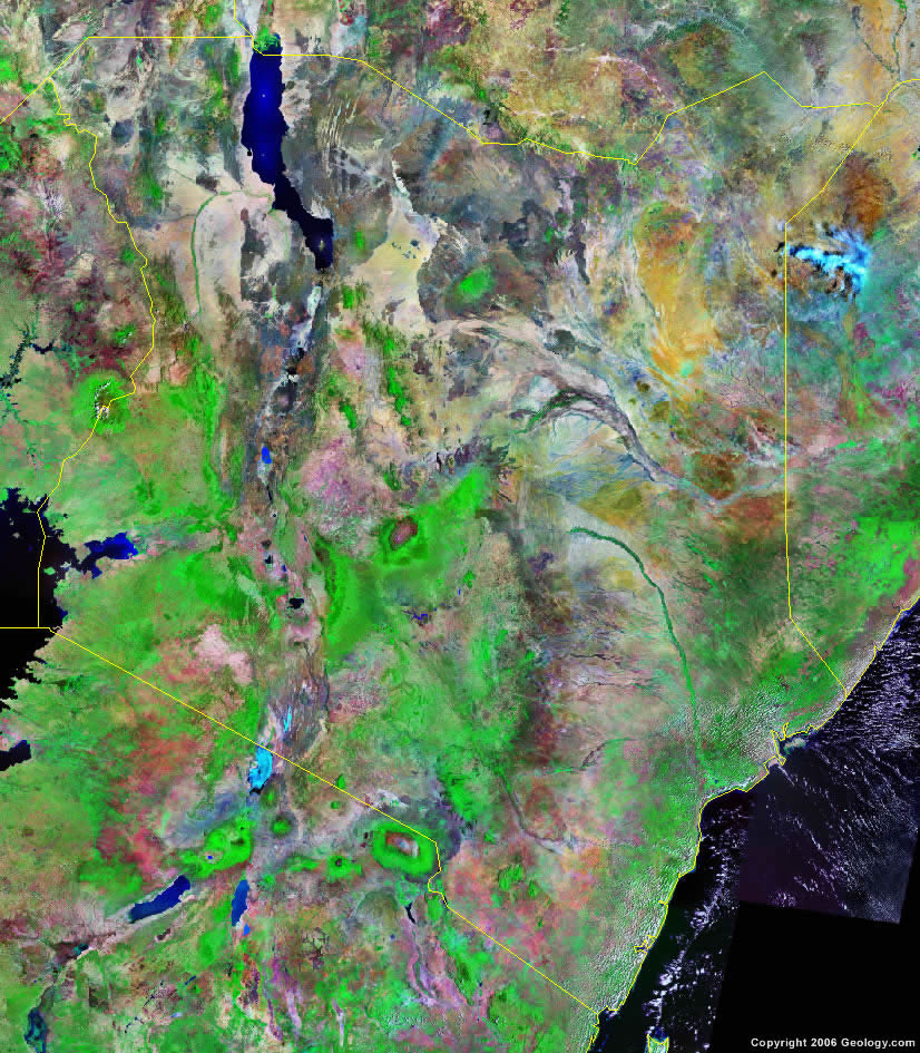
Kenya Map and Satellite Image
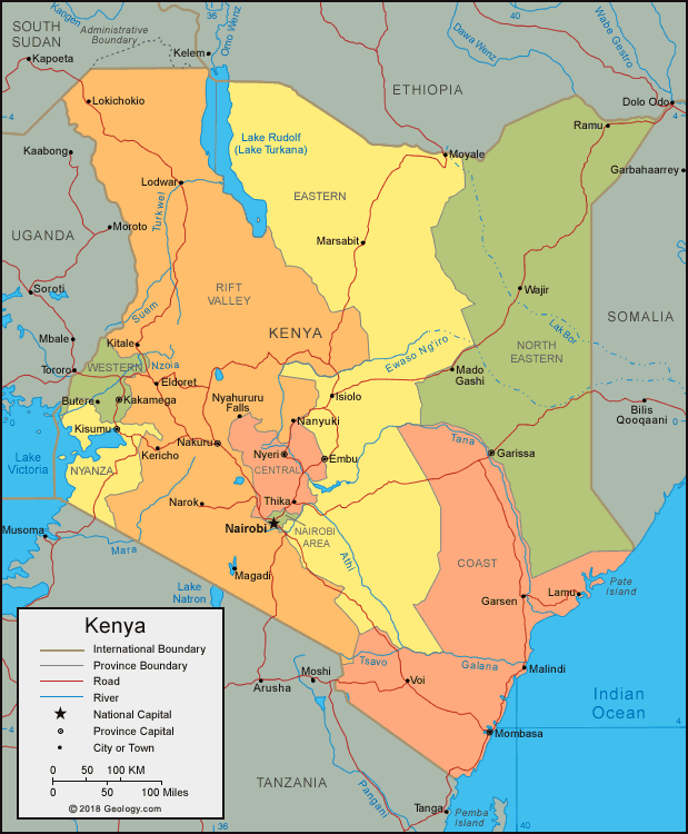
| Kenya is located in eastern Africa. Kenya is bordered by the Indian Ocean, Somalia to the east, Ethiopia to the north, South Sudan and Uganda to the west, and Tanzania to the south. |
ADVERTISEMENT
Kenya Bordering Countries:
Ethiopia, Somalia, South Sudan, Tanzania, UgandaRegional Maps:
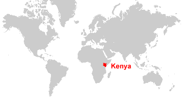
Map of Africa, World MapWhere is Kenya?
Kenya Satellite Image
ADVERTISEMENT

Explore Kenya Using Google Earth:
Google Earth is a free program from Google that allows you to explore satellite images showing the cities and landscapes of Kenya and all of Africa in fantastic detail. It works on your desktop computer, tablet, or mobile phone. The images in many areas are detailed enough that you can see houses, vehicles and even people on a city street. Google Earth is free and easy-to-use.
Kenya on a World Wall Map:
Kenya is one of nearly 200 countries illustrated on our Blue Ocean Laminated Map of the World. This map shows a combination of political and physical features. It includes country boundaries, major cities, major mountains in shaded relief, ocean depth in blue color gradient, along with many other features. This is a great map for students, schools, offices and anywhere that a nice map of the world is needed for education, display or decor.
Kenya On a Large Wall Map of Africa:
If you are interested in Kenya and the geography of Africa our large laminated map of Africa might be just what you need. It is a large political map of Africa that also shows many of the continent's physical features in color or shaded relief. Major lakes, rivers, cities, roads, country boundaries, coastlines and surrounding islands are all shown on the map.Kenya Cities:
Bungoma, Butera, Eldoret, Embu, Garissa, Isiolo, Kakamega, Karungu, Kericho, Kisii, Kisumu, Kitale, Kongelai, Kwale, Lamu, Lodwar, Lokichokio, Machakos, Mado Gashi, Magadi, Malindi, Maralal, Marsabit, Meru, Mombasa, Moyale, Nairobi, Nakuru, Nanyuki, Narok, Nyahururu Falls, Nyeri, Ramu, Sotik, Thika, Voi and Wajir.Kenya Locations:
Athi River, Chalbi Desert, Ewaso Ng'iro River, Galana River, Indian Ocean, Laga Bogal River, Laga Bor River, Lake Amboseli, Lake Nakuru, Lake Natron, Lake Turkana (Lake Rudolf), Lake Victoria, Lorian Swamp, Lotagipi Swamp, Mara River, Mount Kenya, Nzoia River, Pare Mountains, Suam River, Tana Lake, Tana River, Tsavo River, Turkwel River, Ungama Bay, Usambara Mountains and Yatta Plateau.Kenya Natural Resources:
Kenya's many mineral resources include fluorspar, gypsum, diatomite, soda ash, limestone and gemstones. The country has other exploitable resources which include zinc, salt, wildlife and hydropower.Kenya Natural Hazards:
The country of Kenya has natural hazards which include recurring droughts, but there is also flooding during rainy seasons.Kenya Environmental Issues:
Kenya's environmental issues which concern the land include deforestation, soil erosion and desertification. The country has water pollution from urban and industrial wastes and there is an overall degradation of water quality from the increased use of pesticides and fertilizers. Lake Victoria is affected by the invasive and noxious water hyacinth. Kenya's other environmental issues include poaching.
ADVERTISEMENT