Home » World Maps » Africa » Mozambique
Mozambique Map and Satellite Image
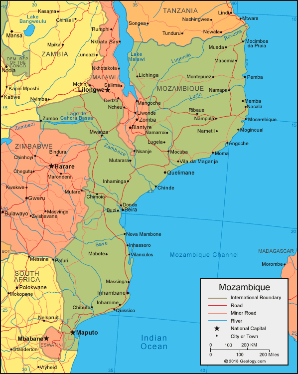
| Mozambique is located in southeastern Africa. Mozambique is bordered by the Indian Ocean to the east, Tanzania to the north, Malawi, Zambia, and Zimbabwe to the west, and South Africa and eSwatini (formerly Swaziland) to the southwest. |
ADVERTISEMENT
Mozambique Bordering Countries:
Malawi, South Africa, eSwatini (formerly Swaziland), Tanzania, Zambia, ZimbabweRegional Maps:
Map of Africa, World Map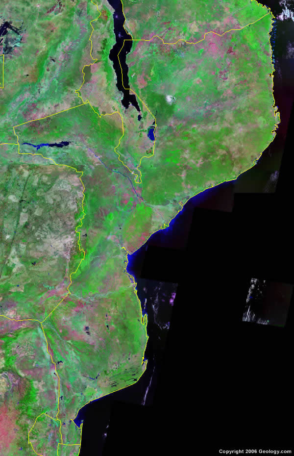
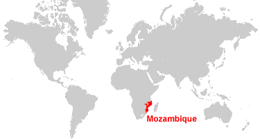
Where is Mozambique?

Explore Mozambique Using Google Earth:
Google Earth is a free program from Google that allows you to explore satellite images showing the cities and landscapes of Mozambique and all of Africa in fantastic detail. It works on your desktop computer, tablet, or mobile phone. The images in many areas are detailed enough that you can see houses, vehicles and even people on a city street. Google Earth is free and easy-to-use.
Mozambique on a World Wall Map:
Mozambique is one of nearly 200 countries illustrated on our Blue Ocean Laminated Map of the World. This map shows a combination of political and physical features. It includes country boundaries, major cities, major mountains in shaded relief, ocean depth in blue color gradient, along with many other features. This is a great map for students, schools, offices and anywhere that a nice map of the world is needed for education, display or decor.
Mozambique On a Large Wall Map of Africa:
If you are interested in Mozambique and the geography of Africa our large laminated map of Africa might be just what you need. It is a large political map of Africa that also shows many of the continent's physical features in color or shaded relief. Major lakes, rivers, cities, roads, country boundaries, coastlines and surrounding islands are all shown on the map.ADVERTISEMENT
Mozambique Cities:
Angoche, Beira, Buzi, Chibuto, Chimolo, Chinde, Divinhe, Dondo, Inhambane, Inhaminga, Inharrime, Inhassoro, Lichinga, Lugela, Mabote, Macomia, Manga, Manica, Maputo, Massinga, Memba, Mocambique, Mocimboa, Mocuba, Mogincual, Moma, Montepuez, Mueda, Mutarara, Mutare, Mwanza, Nacala, Namapa, Namarroi, Nametil, Nampula, Nangade, Negomano, Nova Mambone, Nova Sofala, Pafuri, Pemba, Quelimane, Quissico, Ribaue, Vila da Maganja, Vilanculos, Xai-Xai and Zumbo.Mozambique Locations:
Baia de Fernao Veloso, Baia de Pemba, Indian Ocean, Lago Chiuta, Lago de Cahora Bassa, Lake Chilwa, Lake Malawi, Lebombo Mountains, Limpopo River, Lugenda River, Lurio River, Rio Zambeze River, Rovuma River, Save River and Zambeze River.Mozambique Natural Resources:
Mozambique has several fuel resources including coal, natural gas and hydropower. Metal and mineral resources include titanium, tantalum and graphite.Mozambique Natural Hazards:
Mozambique is subject to devastating cyclones and floods in the central and southern provinces. There are other serious occurrences in this country, including severe droughts.Mozambique Environmental Issues:
Mozambique has had an increased migration of its population to the urban and coastal areas, because of recurrent droughts and a long civil war in the hinterlands. This has resulted in adverse environmental consequences. The coastal and surface waters are polluted. The country also has desertification. The elephant population is threatened by poaching for ivory.
ADVERTISEMENT