Home » World Maps » Europe » Switzerland
Switzerland Map and Satellite Image

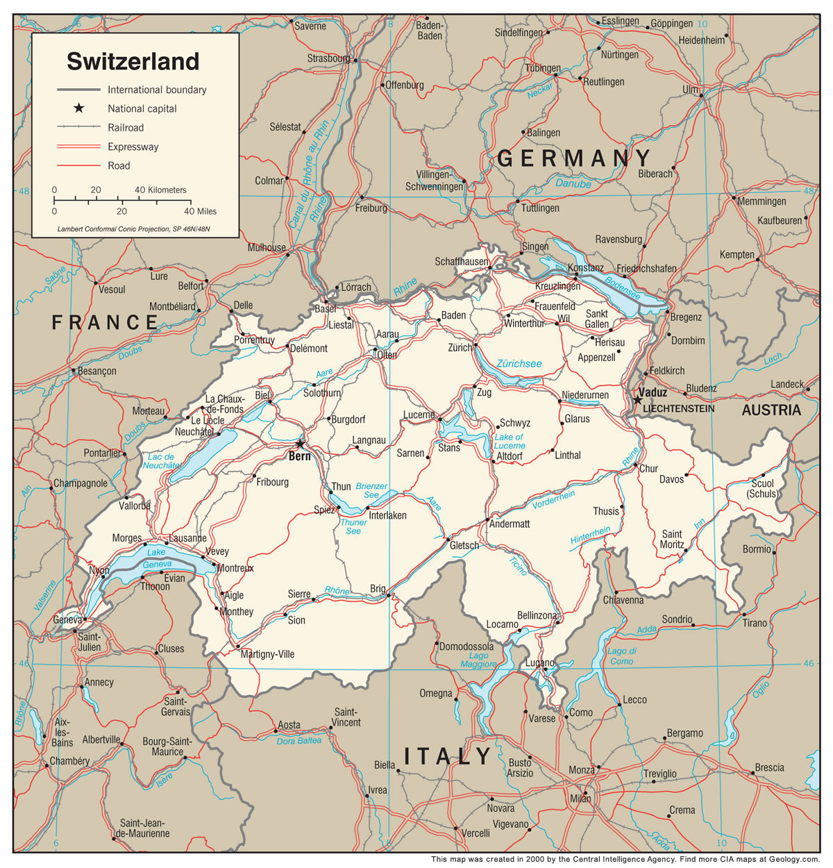
| Switzerland is located in central Europe. Switzerland is bordered by Germany to the north, France to the west, Liechtenstein and Austria to the east, and Italy to the south. |
ADVERTISEMENT
Switzerland Bordering Countries:
Austria, France, Germany, Italy, LiechtensteinRegional Maps:
Map of Europe, World Map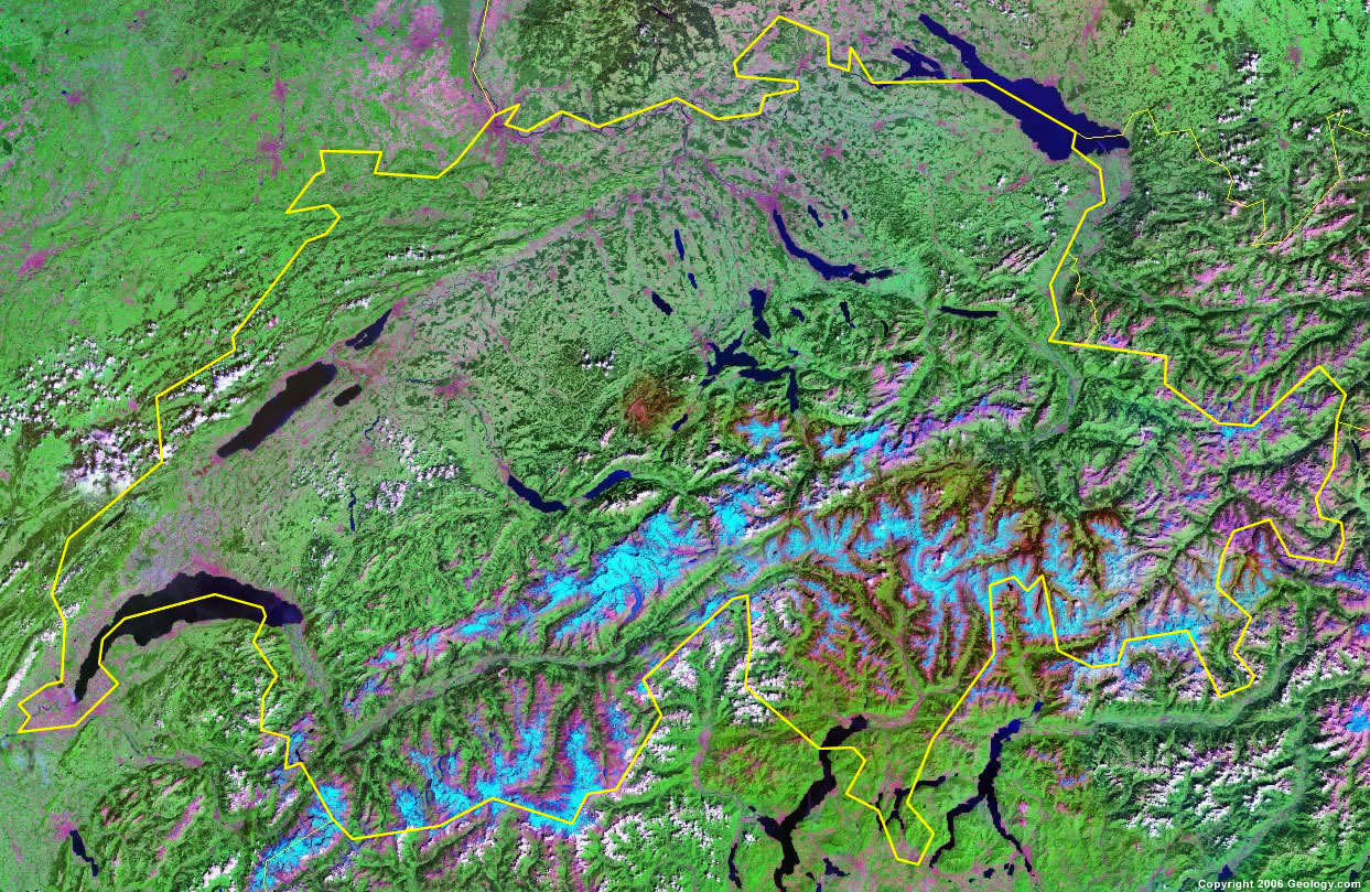
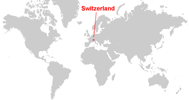
Where is Switzerland?
ADVERTISEMENT

Explore Switzerland Using Google Earth:
Google Earth is a free program from Google that allows you to explore satellite images showing the cities and landscapes of Switzerland and all of Europe in fantastic detail. It works on your desktop computer, tablet, or mobile phone. The images in many areas are detailed enough that you can see houses, vehicles and even people on a city street. Google Earth is free and easy-to-use.
Switzerland on a World Wall Map:
Switzerland is one of nearly 200 countries illustrated on our Blue Ocean Laminated Map of the World. This map shows a combination of political and physical features. It includes country boundaries, major cities, major mountains in shaded relief, ocean depth in blue color gradient, along with many other features. This is a great map for students, schools, offices and anywhere that a nice map of the world is needed for education, display or decor.
Switzerland On a Large Wall Map of Europe:
If you are interested in Switzerland and the geography of Europe our large laminated map of Europe might be just what you need. It is a large political map of Europe that also shows many of the continent's physical features in color or shaded relief. Major lakes, rivers,cities, roads, country boundaries, coastlines and surrounding islands are all shown on the map.Switzerland Cities:
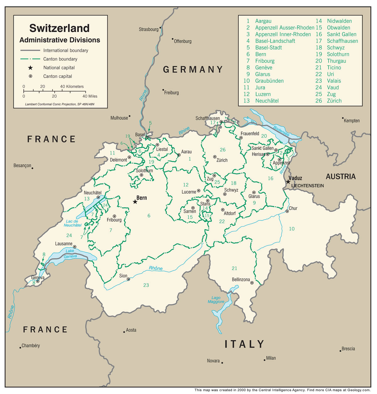
Aarau, Altdorf, Appenzell, Baar, Basel, Bellinzona, Bern, Bolligen, Burgdorf, Chur, Davos, Emmen, Frauenfeld, Fribourg, Geneva, Glarus, Grenchen, Herisau, Horw, Kriens, Langenthal, Lausanne, Liestal, Locarno, Lucerne, Martigny, Montreux, Neuchatel, Pratteln, Reinach, Rorschach, Samen, Sankt Gallen, Schaffhausen, Schwyz, Sion, Solothurn, Stans, Uster, Wadenswil, Zug and Zurich.Switzerland Locations:
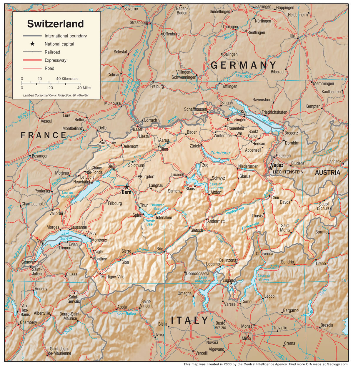
Aare River, Berner Alpen, Bieler See, Bodensee, Brienzer See, Doubs River, Glarner Alpen, Lac de la Gruyere, Lac de Neuchatel, Lac Leman, Lake Geneva, Lake of Lucerne, Lepontine Alps, Rhaetian Alps, Rhein River, Rhone River, Sarner See, Sempacher See, The Alps, Thuner See, Ural Mountains, Vierwaldstatter See, Walensee, Zuger See and Zurichsee.Switzerland Natural Resources:
Switzerland has lucrative natural resources which include timber, salt, and the potential for hydropower.Switzerland Natural Hazards:
The country of Switzerland has natural hazards which include occurrences of flash floods, landslides, and avalanches.Switzerland Environmental Issues:
Switzerland has air pollution, which results from vehicle emissions and open-air burning. The country has acid rain, and a loss of biodiversity. In addition, there is water pollution from the increased use of agricultural fertilizers.
ADVERTISEMENT