Home » US Maps » California » County Map
California County Map with County Seat Cities

ADVERTISEMENT
County Maps for Neighboring States:
Arizona Nevada Oregon


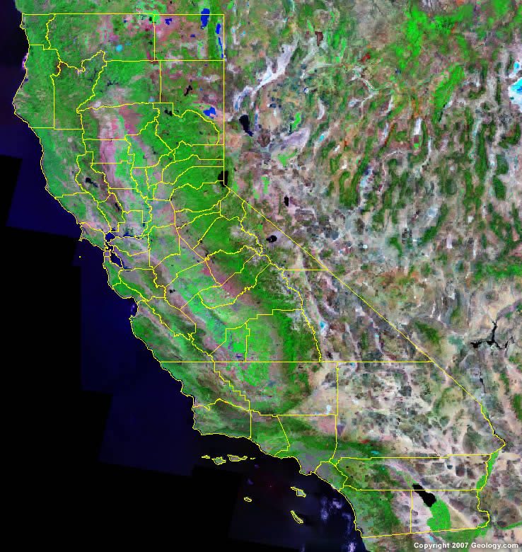
The map above is a Landsat satellite image of California with County boundaries superimposed. We have a more detailed satellite image of California without County boundaries.


ADVERTISEMENT
California Counties and County Seats |
|
|
Alameda County - Oakland Alpine County - Markleeville Amador County - Jackson Butte County - Oroville Calaveras County - San Andreas Colusa County - Colusa Contra Costa County - Martinez Del Norte County - Crescent City El Dorado County - Placerville Fresno County - Fresno Glenn County - Willows Humboldt County - Eureka Imperial County - El Centro Inyo County - Independence Kern County - Bakersfield Kings County - Hanford Lake County - Lakeport Lassen County - Susanville Los Angeles County - Los Angeles Madera County - Madera Marin County - San Rafael Mariposa County - Mariposa Mendocino County - Ukiah Merced County - Merced Modoc County - Alturas Mono County - Bridgeport Monterey County - Salinas Napa County - Napa Nevada County - Nevada City |
Orange County - Santa Ana Placer County - Auburn Plumas County - Quincy Riverside County - Riverside Sacramento County - Sacramento San Benito County - Hollister San Bernardino County - San Bernardino San Diego County - San Diego San Francisco County - San Francisco San Joaquin County - Stockton San Luis Obispo County - San Luis Obispo San Mateo County - Redwood City Santa Barbara County - Santa Barbara Santa Clara County - San Jose Santa Cruz County - Santa Cruz Shasta County - Redding Sierra County - Downieville Siskiyou County - Yreka Solano County - Fairfield Sonoma County - Santa Rosa Stanislaus County - Modesto Sutter County - Yuba City Tehama County - Red Bluff Trinity County - Weaverville Tulare County - Visalia Tuolumne County - Sonora Ventura County - Ventura Yolo County - Woodland Yuba County - Marysville |
