Home » World Maps » Africa » Mauritania
Mauritania Map and Satellite Image
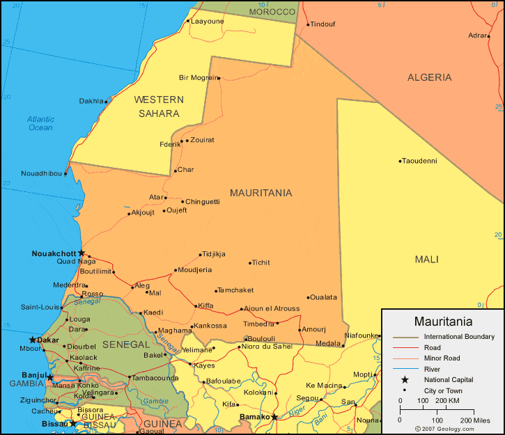
| Mauritania is located in northern Africa. Mauritania is bordered by the Atlantic Ocean to the west, Western Sahara and Algeria to the north, Mali to the east and south, and Senegal to the south. |
ADVERTISEMENT
Mauritania Bordering Countries:
Algeria, Mali, SenegalRegional Maps:
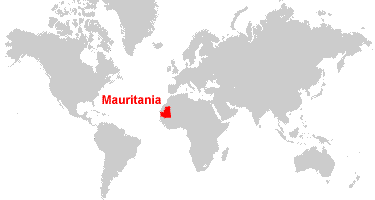
Western Sahara, Africa, World MapWhere is Mauritania?
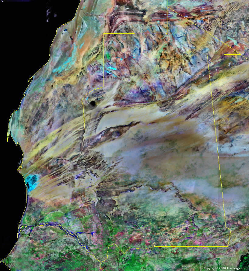
Mauritania Satellite Image
ADVERTISEMENT

Explore Mauritania Using Google Earth:
Google Earth is a free program from Google that allows you to explore satellite images showing the cities and landscapes of Mauritania and all of Africa in fantastic detail. It works on your desktop computer, tablet, or mobile phone. The images in many areas are detailed enough that you can see houses, vehicles and even people on a city street. Google Earth is free and easy-to-use.
Mauritania on a World Wall Map:
Mauritania is one of nearly 200 countries illustrated on our Blue Ocean Laminated Map of the World. This map shows a combination of political and physical features. It includes country boundaries, major cities, major mountains in shaded relief, ocean depth in blue color gradient, along with many other features. This is a great map for students, schools, offices and anywhere that a nice map of the world is needed for education, display or decor.
Mauritania On a Large Wall Map of Africa:
If you are interested in Mauritania and the geography of Africa our large laminated map of Africa might be just what you need. It is a large political map of Africa that also shows many of the continent's physical features in color or shaded relief. Major lakes, rivers, cities, roads, country boundaries, coastlines and surrounding islands are all shown on the map.Mauritania Cities:
Akjoujt, Aleg, Amourj, Atar, 'Ayounel el 'Atrous, Azlat, Bir Mogrein, Bogue, Boutilimit, Char, Chinguetti, Diade, Fderik, Kaedi, Kankossa, Kiffa, Koou, Legat, Maghama, Mal, Mbout, Medala, Mederdra, Moudjeria, Mouit, Nema, ouadhibou, Nouakchott, Oualata, Oujeft, Quad Naga, Rosso, Selibaby, Tamchaket, Tichit, Tidjikja, Tiguent, Timbedra and Zouirat.Mauritania Locations:
Atlantic Ocean, Baie du Levrier, Lac Rkiz, Sahara Sahel (Sahara Desert) and Senegal River.Mauritania Natural Resources:
Mauritania has metallic resources which include iron ore, gold and copper. A variety of other natural resources for this country include gypsum, phosphates, diamonds, oil and fish.Mauritania Natural Hazards:
Natural hazards for Mauritania include periodic droughts. In addition, the country experiences hot, dry, dust/sand-laden sirocco winds that blow primarily in March and April.Mauritania Environmental Issues:
The country of Mauritania, in northern Africa, has a number of environmental issues. Regarding the land, the issues include deforestation, overgrazing, and soil erosion, which is aggravated by drought. All of these issues contribute to desertification. In addition, there are locust infestations. Mauritania has very limited natural freshwater resources away from the Senegal, which is the only perennial river.
ADVERTISEMENT