Home » World Maps » Europe » Slovakia
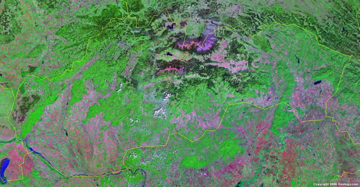
Slovakia Map and Satellite Image
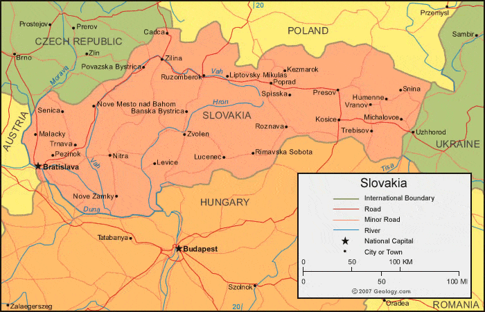
| Slovakia is located in central Europe. Slovakia is bordered by the Czech Republic and Poland to the north, Ukraine to the east, Hungary to the south, and Austria to the west. |
ADVERTISEMENT
Slovakia Bordering Countries:
Austria, Czech Republic, Hungary, Poland, UkraineRegional Maps:
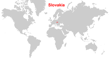
Map of Europe, World MapWhere is Slovakia?
Slovakia Satellite Image
ADVERTISEMENT

Explore Slovakia Using Google Earth:
Google Earth is a free program from Google that allows you to explore satellite images showing the cities and landscapes of Slovakia and all of Europe in fantastic detail. It works on your desktop computer, tablet, or mobile phone. The images in many areas are detailed enough that you can see houses, vehicles and even people on a city street. Google Earth is free and easy-to-use.
Slovakia on a World Wall Map:
Slovakia is one of nearly 200 countries illustrated on our Blue Ocean Laminated Map of the World. This map shows a combination of political and physical features. It includes country boundaries, major cities, major mountains in shaded relief, ocean depth in blue color gradient, along with many other features. This is a great map for students, schools, offices and anywhere that a nice map of the world is needed for education, display or decor.
Slovakia On a Large Wall Map of Europe:
If you are interested in Slovakia and the geography of Europe our large laminated map of Europe might be just what you need. It is a large political map of Europe that also shows many of the continent's physical features in color or shaded relief. Major lakes, rivers, cities, roads, country boundaries, coastlines and surrounding islands are all shown on the map.Slovakia Cities:
Banska Bystrica, Bardejov, Bratislava (Pressburg), Cadca, Detva, Dunajska Streda, Humenne, Kezmarok, Kolarovo, Komarno, Kosice, Levice, Liptovsky Mikulas, Lucenec, Malacky, Michalovce, Nitra, Nove Mesto nad Bahom, Nove Zamky, Pezinok, Poprad, Povazska Bystrica, Presov, Rimavska Sobota, Roznava, Ruzomberok, Senica, Sered, Snina, Spisska, Trebisov, Trnava, Vel'ky Krtis, Vranov, Zilina and Zvolen.Slovakia Locations:
Biele Karpaty, East Beskids, Hron River, Male Karpaty, Vah River and West Beskids Dunaje (Danube) River.Slovakia Natural Resources:
Slovakia has some fuel resources including brown coal and lignite. Small amounts of iron ore, manganese ore, and copper are some of the metallic resources. Other natural resources for this country include salt and arable land.Slovakia Natural Hazards:
Flooding is a natural hazard for the country of Slovakia.Slovakia Environmental Issues:
There are environmental issues pertaining to the air. These include air pollution from the metallurgical plants, which presents human health risks. The pollution results in acid rain that is damaging the forests.
ADVERTISEMENT