Home » World Maps » Canada » Northwest Territories
Northwest Territories Map - Northwest Territories Satellite Image

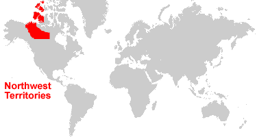
| Northwest Territories is located in northern Canada. Northwest Territories is bordered by the Arctic Ocean and the Beaufort Sea, Nunavut to the east, Yukon Territory to the west, and British Columbia, Alberta, and Saskatchewan to the south. |
ADVERTISEMENT
Northwest Territories Bordering Provinces/Territories:
Alberta, British Columbia, Manitoba, Nunavut, Saskatchewan, Yukon TerritoryRegional Maps:
Map of Canada, World MapWhere is Northwest Territories?
Northwest Territories Satellite Image
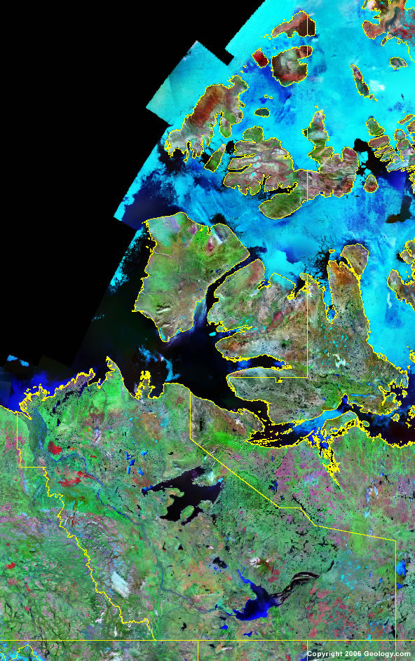
Click for high-resolution image.
ADVERTISEMENT

Explore Northwest Territories, Canada Using Google Earth
Google Earth is a free program from Google that allows you to explore satellite images showing the cities and landscapes of Northwest Territories and all of North America in fantastic detail. It works on your desktop computer, tablet, or mobile phone. The images in many areas are detailed enough that you can see houses, vehicles and even people on a city street. Google Earth is free and easy-to-use.
Canada Topo Maps
Get a custom printed large-format Canadian Topographic Map on waterproof, laminated or glossy paper. You can center the map anywhere in Canada that you want and adjust the scale with easy-to-use tools on the MyTopo website. They will then print and ship your map rolled in a tube or folded neatly in an envelope - your choice.
Northwest Territories, Canada on a World Wall Map
Canada is one of nearly 200 countries illustrated on our Blue Ocean Laminated Map of the World. The Canadian province and territory boundaries are shown on the map along with other political and physical features. It displays symbols for major cities. Major mountains are shown in shaded relief. Ocean depths are indicated with a blue color gradient. This is a great map for students, schools, offices and anywhere that a nice map of the world is needed for education, display or decor.
Northwest Territories, Canada On a Large Wall Map of North America
If you are interested in Northwest Territories and the geography of Canada, our large laminated map of North America might be just what you need. It is a large political map of North America that also shows many of the continent's physical features in color and shaded relief. Major lakes, rivers, cities, roads, country/province/territory boundaries, coastlines and surrounding islands are all shown on the map.Northwest Territories Cities:
Aklavik, Cunningham Landing, Discovery, Echo Bay, Enterprise, Fort Good Hope, Fort Liard, Fort McPherson, Fort Providence, Fort Resolution, Fort Simpson, Fort Smith, Hay River, Inuvik, Kakisa, Lutselk'e, Norman Wells, Pine Point, Rae-Edzo, Reliance, Sawmill Bay, Trout Lake, Tsiigehtchic, Tulita, and Yellowknife.Northwest Territories Lakes, Rivers and Locations:
Amundsen Gulf, Arctic Ocean, Aubry Lake, Beaufort Sea, Colville Lake, Darnley Bay, Franklin Bay, Franklin Mountains, Great Bear Lake, Great Slave Lake, Hill Island Lake, Horton Lake, Hottah Lake, Howard Lake, Keele River, Kugmallit Bay, Lac Belot, Lac Des Bois, Lac Maunoir, Liard River, Liverpool Bay, MacKay Lake, Mackenzie Bay, Mackenzie Mountains, Mackenzie River, McKinley Bay, Mills Lake, Peel River, Point Lake, Russell Inlet, Scott Lake, South Nahanni, Tathlina Lake, Thelon River, Trout Lake, Whitefish Lake, and Willow Lake.