geology

Home » US Maps » Arizona Maps » Arizona County Map

Arizona County Map with Administrative Cities


Map of Arizona Counties

Maps for Neighboring States

: California   Colorado   Nevada   New Mexico   Utah

Arizona DeLorme Atlas Arizona
Road Atlas
Detailed road maps, including back roads, for an entire state in a single convenient book. Get one for your next trip!
  Arizona wall map
Arizona
Wall Map
 
Terrain Navigator mapping software Arizona
3D Topo Software
View, annotate and print detailed topographic maps for the entire state of Arizona. Terrain Navigator is the perfect tool for hikers, hunters and those who work in the field.

Arizona County Map
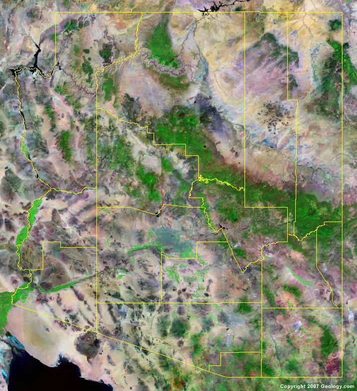
The map above is a Landsat satellite image of Arizona with County boundaries superimposed. We have another satellite image of Arizona without County boundaries and a Landsat tutorial that can help you learn how to read these images.

City Satellite Images
City satellite images

Arizona Counties and County Seats

Apache County - St. Johns
Cochise County - Bisbee
Coconino County - Flagstaff
Gila County - Globe
Graham County - Safford
Greenlee County - Clifton
La Paz County - Parker
Maricopa County - Phoenix
Mohave County - Kingman
Navajo County - Holbrook
Pima County - Tucson
Pinal County - Florence
Santa Cruz County - Nogales
Yavapai County - Prescott
Yuma County - Yuma

Copyright information: The maps on this page were composed by Brad Cole of Geology.com. If you want to share these maps with others please link to this page. These maps are property of Geology.com and may not be used beyond our websites. They were created using data licensed from and copyright by Map Resources.
© 2005-2012 Geology.com. All Rights Reserved.
Images, code and content of this website are property of Geology.com. Use without permission is prohibited. Pages on this site are protected by Copyscape.