Home » US Maps » Nevada » County Map
Nevada County Map with County Seat Cities

ADVERTISEMENT
County Maps for Neighboring States:
Arizona California Idaho Oregon Utah


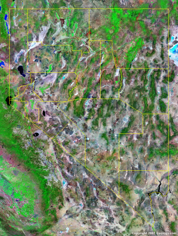
The map above is a Landsat satellite image of Nevada with County boundaries superimposed. We have a more detailed satellite image of Nevada without County boundaries.


ADVERTISEMENT
Nevada Counties and County Seats |
|
|
Churchill County - Fallon Clark County - Las Vegas Douglas County - Minden Elko County - Elko Esmeralda County - Goldfield Eureka County - Eureka Humboldt County - Winnemucca Lander County - Battle Mountain |
Lincoln County - Pioche Lyon County - Yerington Mineral County - Hawthorne Nye County - Tonopah Pershing County - Lovelock Storey County - Virginia City Washoe County - Reno White Pine County - Ely |
