Home » US Maps » Oklahoma » County Map
Oklahoma County Map with County Seat Cities

ADVERTISEMENT
County Maps for Neighboring States:
Arkansas Colorado Kansas Missouri New Mexico Texas
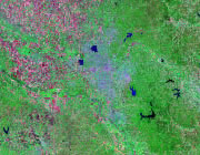


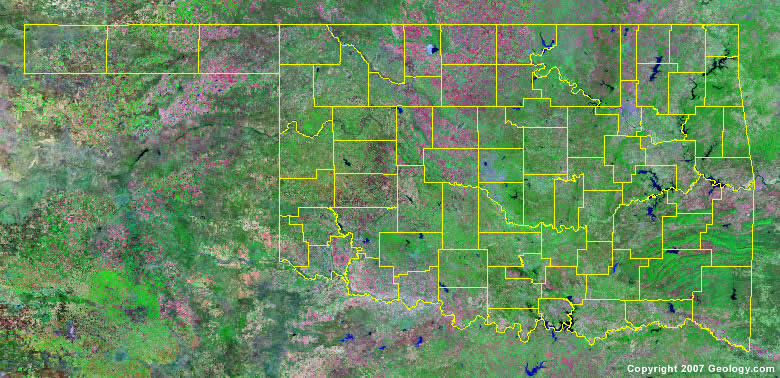
The map above is a Landsat satellite image of Oklahoma with County boundaries superimposed. We have a more detailed satellite image of Oklahoma without County boundaries.


ADVERTISEMENT
Oklahoma Counties and County Seats |
|
|
Adair County - Stilwell Alfalfa County - Cherokee Atoka County - Atoka Beaver County - Beaver Beckham County - Sayre Blaine County - Watonga Bryan County - Durant Caddo County - Anadarko Canadian County - El Reno Carter County - Ardmore Cherokee County - Tahlequah Choctaw County - Hugo Cimarron County - Boise City Cleveland County - Norman Coal County - Coalgate Comanche County - Lawton Cotton County - Walters Craig County - Vinita Creek County - Sapulpa Custer County - Arapaho Delaware County - Jay Dewey County - Taloga Ellis County - Arnett Garfield County - Enid Garvin County - Pauls Valley Grady County - Chickasha Grant County - Medford Greer County - Mangum Harmon County - Hollis Harper County - Buffalo Haskell County - Stigler Hughes County - Holdenville Jackson County - Altus Jefferson County - Waurika Johnston County - Tishomingo Kay County - Newkirk Kingfisher County - Kingfisher Kiowa County - Hobart Latimer County - Wilburton |
Le Flore County - Poteau Lincoln County - Chandler Logan County - Guthrie Love County - Marietta Major County - Fairview Marshall County - Madill Mayes County - Pryor McClain County - Purcell McCurtain County - Idabel McIntosh County - Eufaula Murray County - Sulphur Muskogee County - Muskogee Noble County - Perry Nowata County - Nowata Okfuskee County - Okemah Oklahoma County - Oklahoma City Okmulgee County - Okmulgee Osage County - Pawhuska Ottawa County - Miami Pawnee County - Pawnee Payne County - Stillwater Pittsburg County - McAlester Pontotoc County - Ada Pottawatomie County - Shawnee Pushmataha County - Antlers Roger Mills County - Cheyenne Rogers County - Claremore Seminole County - Wewoka Sequoyah County - Sallisaw Stephens County - Duncan Texas County - Guymon Tillman County - Frederick Tulsa County - Tulsa Wagoner County - Wagoner Washington County - Bartlesville Washita County - Cordell Woods County - Alva Woodward County - Woodward |
