Home » US Maps » Massachusetts » Lakes and Rivers
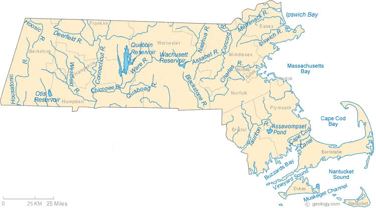
Massachusetts Lakes, Rivers and Water Resources
ADVERTISEMENT
Massachusetts Rivers Shown on the Map: Assabet River, Blackstone River, Cape Cod Canal, Charles River, Chicopee River, Concord River, Connecticut River, Deerfield River, Hoosic River, Housatonic River, Ipswich River, Merrimack River, Nashua River, Quaboag River, Taunton River, Ware River and Westfield River.
Massachusetts Lakes Shown on the Map: Assawompset Pond, Otis Reservoir, Quabbin Reservoir and Wachusett Reservoir.
| Massachusetts Stream and River Levels |
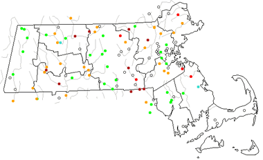 The United States Geological Survey has a number of stream gages located throughout Massachusetts. These estimate stream levels, discharges and record them over time. This data is published on the web and many stations allow users to plot custom graphs. Get updated Massachusetts river and stream levels from USGS here.
| Massachusetts Stream and River Level Alerts |
 The United States Geological Survey has a system that will send you an email message when flood levels are reached on any stream with USGS gaging equipment that you have selected. Sign up here to receive Massachusetts stream and river level alerts.

| Massachusetts Drought Map |
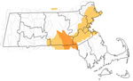 The United States Geological Survey publishes updated drought maps on their website. There you can view a map that shows where below normal 7-day average stream flow conditions were recently recorded. The maps are updated daily. Get a current Massachusetts drought map here.
| Massachusetts Water Publications |
 The United States Geological Survey has a number of publications related to water use and water resources in Massachusetts. Visit the New England Water Science Center here.
| Massachusetts Elevation Map |
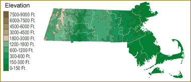 The topography of an area determines the direction of stream flow and often is a primary influence on the geographic distribution of precipitation. View a detailed Massachusetts elevation map.


Find Other Topics on Geology.com:

|

| ||

|

| ||

|

| ||

|

|