Home » Satellite Images » US States » Virginia
Satellite Image of Virginia
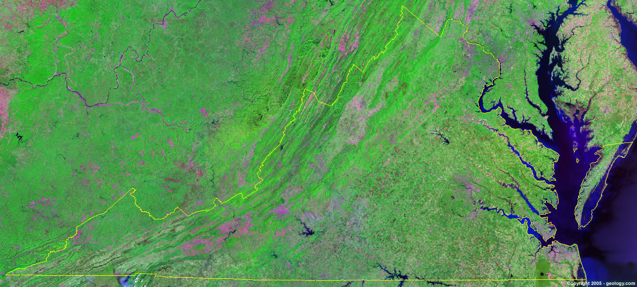
Virginia Satellite Image - View Cities, Rivers, Lakes & Environment
Satellite Images for Neighboring States:
Kentucky Maryland North Carolina Tennessee West VirginiaThis is a Landsat GeoCover 2000 satellite image map of Virginia. Cities, rivers, lakes, mountains and other features shown in this image include:
Virginia Cities:
Alexandria, VA
Arlington, VA
Blacksburg, VA
Charlottesville, VA
Chesapeake, VA
Danville, VA
Fredericksburg, VA
Front Royal, VA
Hampton, VA
Harrisonburg, VA
Leesburg, VA
Lynchburg, VA
Newport News, VA
Norfolk, VA
Petersburg, VA
Portsmouth, VA
Richmond, VA
Roanoke, VA
Virginia Beach, VA
Williamsburg, VA
Winchester, VA
Virginia Rivers, Lakes, Water Features:
Blackwater River
Chickahominy River
Claytor Lake
Gathright Dam
James River
John H. Kerr Reservoir
John W. Flannagan Reservoir
Lake Anna
Lake Chesdin
Mattaponi River
New River
Pamunkey River
Philpott Lake
Potomac River
Pound Lake
Rappahannock River
Shenandoah River
Smith Mountain Lake
South Holston Lake
Swift Creek Reservoir
York River
Other Prominent Virginia Features:
Allegheny Mountains
Appalachian Mountains
Blue Ridge
Chesapeake Bay
Shenandoah Mountain
Virginia farm land
ADVERTISEMENT
More Satellite Images
 State Satellite Images: Color Landsat views of all 50 states. Spectacular images.
 Use Google Earth for FREE: Browse seamless worldwide satellite images. Free.
 Earth from Space at Night: Composite images show worldwide patterns of night light and heat.
 Oil & Gas Fields from Space at Night: Drill pad lighting and flaring make them stand out at night.
 Country Satellite Images: Satellite images for over 170 countries from Landsat GeoCover data.
  Satellite Views of US Cities: Images of 120 cities and their surrounding environment.
 Land Below Sea Level: The top ten locations where land is below the level of the ocean.
  Satellite Views of 64 World Cities: Spectacular images showing the city and surrounding environment.
Copyright information: The images on this page were composed by Angela King and are copyright by Geology.com. These images are not available for use beyond our websites. If you would like to share them with others, please link to this page. The satellite image was produced using Landsat data from NASA.