Home » Satellite Images » US States » Wyoming
Satellite Image of Wyoming
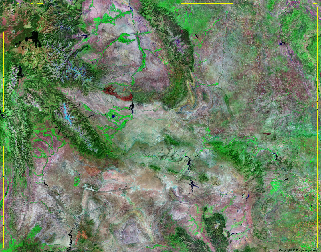
Wyoming Satellite Image - View Cities, Rivers, Lakes & Environment
Satellite Images for Neighboring States:
Colorado Idaho Montana Nebraska South Dakota UtahThis is a Landsat GeoCover 2000 satellite image map of Wyoming. Cities, rivers, lakes, mountains and other features shown in this image include:
Wyoming Cities:
Casper, WY
Cheyenne, WY
Gillette, WY
Green River, WY
Jackson, WY
Laramie, WY
Rock Springs, WY
Sheridan, WY
Wyoming Rivers, Lakes, Water Features:
Alcova Reservoir
Badwater Creek
Belle Fourche River
Bighorn Lake
Bighorn River
Boysen Reservoir
Buffalo Bill Reservoir
Cheyenne River
Flaming Gorge Reservoir
Fontenelle Creek
Glendo Reservoir
Gray Rocks Reservoir
Green River
Jackson Lake
Keyhole Reservoir
Lake De Smet
Lewis Lake
North Platte River
Ocean Lake
Pathfinder Reservoir
Powder River
Seminoe Reservoir
Shoshone Lake
Yellowstone Lake
Other Prominent Wyoming Features:
Absaroka Range
Bighorn Mountains
Carter Mountain
Ferris Mountains
Gros Ventre Range
Laramie Mountains
Medicine Bow Mountains
Rocky Mountains
Salt River Range
Shirley Mountains
Sierra Madre
Teton Range
Wind River Range
Wyoming Range
ADVERTISEMENT
More Satellite Images
 State Satellite Images: Color Landsat views of all 50 states. Spectacular images.
 Use Google Earth for FREE: Browse seamless worldwide satellite images. Free.
 Earth from Space at Night: Composite images show worldwide patterns of night light and heat.
 Oil & Gas Fields from Space at Night: Drill pad lighting and flaring make them stand out at night.
 Country Satellite Images: Satellite images for over 170 countries from Landsat GeoCover data.
  Satellite Views of US Cities: Images of 120 cities and their surrounding environment.
 Land Below Sea Level: The top ten locations where land is below the level of the ocean.
  Satellite Views of 64 World Cities: Spectacular images showing the city and surrounding environment.
Copyright information: The images on this page were composed by Angela King and are copyright by Geology.com. These images are not available for use beyond our websites. If you would like to share them with others, please link to this page. The satellite image was produced using Landsat data from NASA.