Home » World Maps » Africa » Cameroon
Cameroon Map and Satellite Image
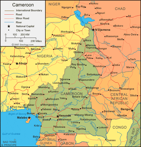
| Cameroon is located in western Africa. Cameroon is bordered by the Bight of Bonny and the Gulf of New Guinea to the west, Nigeria to the North, Chad and Central African Republic to the east, Republic of the Congo to the southeast, and Gabon and Equatorial Guinea to the south. |
ADVERTISEMENT
Cameroon Bordering Countries:
Central African Republic, Chad, Equatorial Guinea, Gabon, Nigeria, Republic of the CongoRegional Maps:
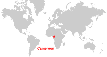
Map of Africa, World MapWhere is Cameroon?
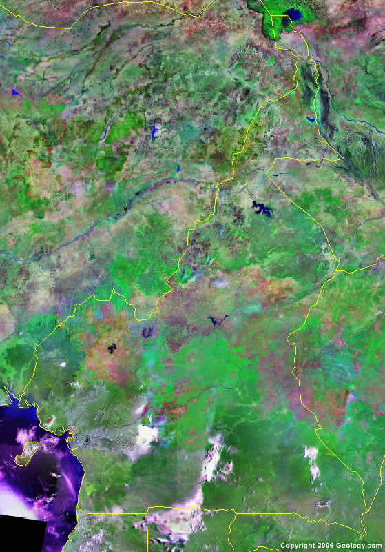
Cameroon Satellite Image
ADVERTISEMENT

Explore Cameroon Using Google Earth:
Google Earth is a free program from Google that allows you to explore satellite images showing the cities and landscapes of Cameroon and all of Africa in fantastic detail. It works on your desktop computer, tablet, or mobile phone. The images in many areas are detailed enough that you can see houses, vehicles and even people on a city street. Google Earth is free and easy-to-use.
Cameroon on a World Wall Map:
Cameroon is one of nearly 200 countries illustrated on our Blue Ocean Laminated Map of the World. This map shows a combination of political and physical features. It includes country boundaries, major cities, major mountains in shaded relief, ocean depth in blue color gradient, along with many other features. This is a great map for students, schools, offices and anywhere that a nice map of the world is needed for education, display or decor.
Cameroon On a Large Wall Map of Africa:
If you are interested in Cameroon and the geography of Africa our large laminated map of Africa might be just what you need. It is a large political map of Africa that also shows many of the continent's physical features in color or shaded relief. Major lakes, rivers,cities, roads, country boundaries, coastlines and surrounding islands are all shown on the map.Cameroon Cities:
Abong Mband, Bafang, Bafousam, Bamenda, Bertoua, Betare Oya, Buea, Douala, Dschang, Ebolowa, Edea, Eseka, Garoua, Guider, Kribi, Kumbo, Laedegoulda, Limbe, Lokomo, Lomie, Mamfe, Maroua, Meiganga, Minta, Mora, Ndop, Ngaoundere, Ngoila, Nkambe, Nkongsamba, Ntui, Poli, Rey Bouba, Tignere, Tiko, Yabassi, Yagoua, Yaounde, Yen, Yokadouma and Yoko.Cameroon Locations:
Bight of Bonny, Boumba River, Dja River, Gulf of New Guinea, Lac de Bamendjing, Lagdo Reservoir, Lake Chad (Lake Tchad), Mandara Mountains, Mbakaou Reservoir, Ntem River, Sanaga River and Vina River.Cameroon Natural Resources:
Cameroon's natural resources include timber, iron ore, petroleum, bauxite and potential hydropower.Cameroon Natural Hazards:
A natural hazard for Cameroon is the volcanic activity, with periodic releases of poisonous gases, from the Lake Nyos and Lake Monoun volcanoes.Cameroon Environmental Issues:
The country of Cameroon, in western Africa, has environmental issues pertaining to overgrazing, deforestation and desertification. There is incidence of both poaching and overfishing. Waterborne diseases are prevalent in Cameroon.
ADVERTISEMENT