Home » World Maps » Africa » Liberia
Liberia Map and Satellite Image
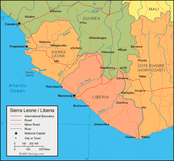
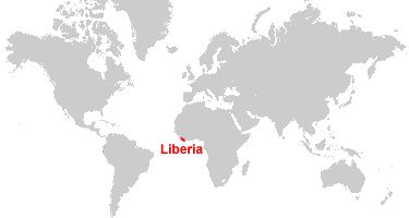
| Liberia is located in western Africa. Liberia is bordered by the Atlantic Ocean, Sierra Leone and Guinea to the north, and Cote d'Ivoire (Ivory Coast) to the east. |
ADVERTISEMENT
Liberia Bordering Countries:
Guinea, Cote d'Ivoire, Sierra LeoneRegional Maps:
Map of Africa, World MapWhere is Liberia?
Liberia Satellite Image

ADVERTISEMENT

Explore Liberia Using Google Earth:
Google Earth is a free program from Google that allows you to explore satellite images showing the cities and landscapes of Liberia and all of Africa in fantastic detail. It works on your desktop computer, tablet, or mobile phone. The images in many areas are detailed enough that you can see houses, vehicles and even people on a city street. Google Earth is free and easy-to-use.
Liberia on a World Wall Map:
Liberia is one of nearly 200 countries illustrated on our Blue Ocean Laminated Map of the World. This map shows a combination of political and physical features. It includes country boundaries, major cities, major mountains in shaded relief, ocean depth in blue color gradient, along with many other features. This is a great map for students, schools, offices and anywhere that a nice map of the world is needed for education, display or decor.
Liberia On a Large Wall Map of Africa:
If you are interested in Liberia and the geography of Africa our large laminated map of Africa might be just what you need. It is a large political map of Africa that also shows many of the continent's physical features in color or shaded relief. Major lakes, rivers, cities, roads, country boundaries, coastlines and surrounding islands are all shown on the map.Liberia Cities:
Belle Yella, Brewerville, Buchanan, Cape Palmas, Edina, Garawe, Gbarnga, Grand Cess, Greenville, Harper, Kle, Marshall, Monrovia, Nana Kru, Pelokehn, River Cess, Robertsport, Sasstown, Sehnkwehn, Suehn, Tapeta, Timbo, Tubmanburg, Zorzor and Zwedru.Liberia Locations:
Atlantic Ocean, Cavalla River, Cess River, Lake Piso, Loffa River, Mano River, Moro River, Nimba Mountains, Sinoe Bay, St. John River and St. Paul River.Liberia Natural Resources:
Liberia has commercial resources which include iron ore, diamonds and gold. Other natural resources are timber and hydropower.Liberia Natural Hazards:
One of the natural hazards in Liberia is the dust-laden harmattan winds, which blow in from the Sahara, from December to March.Liberia Environmental Issues:
Environmental issues for Liberia include deforestation of their tropical rain forests and the loss of biodiversity. The country also has soil erosion, and its coastal waters are polluted from oil residue and raw sewage.
ADVERTISEMENT