Home » World Maps » Africa » Niger
Niger Map and Satellite Image
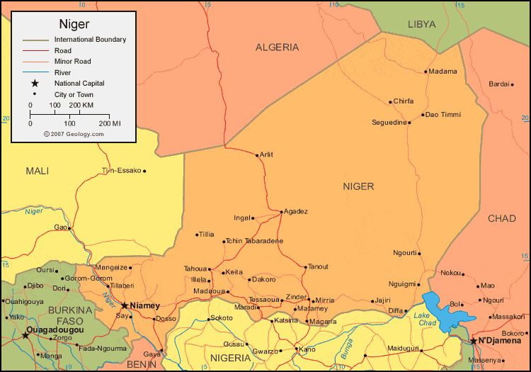
| Niger is located in northern Africa. Niger is bordered by Algeria and Libya to the north, Chad to the east, Nigeria and Benin to the south, and Mali and Burkina Faso to the west. |
ADVERTISEMENT
Niger Bordering Countries:
Algeria, Benin, Burkina Faso, Chad, Libya, Mali, NigeriaRegional Maps:
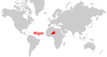
Map of Africa, World MapWhere is Niger?
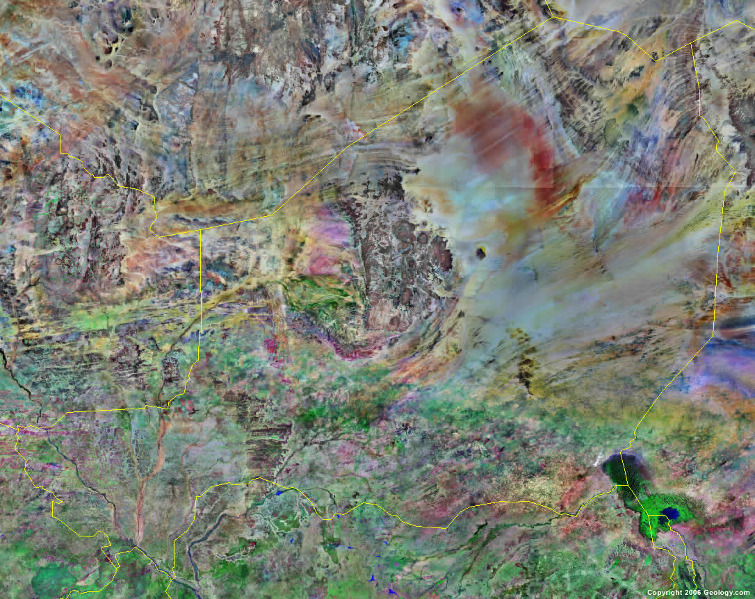
Niger Satellite Image
ADVERTISEMENT

Explore Niger Using Google Earth:
Google Earth is a free program from Google that allows you to explore satellite images showing the cities and landscapes of Niger and all of Africa in fantastic detail. It works on your desktop computer, tablet, or mobile phone. The images in many areas are detailed enough that you can see houses, vehicles and even people on a city street. Google Earth is free and easy-to-use.
Niger on a World Wall Map:
Niger is one of nearly 200 countries illustrated on our Blue Ocean Laminated Map of the World. This map shows a combination of political and physical features. It includes country boundaries, major cities, major mountains in shaded relief, ocean depth in blue color gradient, along with many other features. This is a great map for students, schools, offices and anywhere that a nice map of the world is needed for education, display or decor.
Niger On a Large Wall Map of Africa:
If you are interested in Niger and the geography of Africa our large laminated map of Africa might be just what you need. It is a large political map of Africa that also shows many of the continent's physical features in color or shaded relief. Major lakes, rivers,cities, roads, country boundaries, coastlines and surrounding islands are all shown on the map.Niger Cities:
Abalek, Arlit, Ayorou, Bankilare, Bayzo, Boboye, Bosse Bangou, Chirfa, Dakoro, Dao Timmi, Dargol, Diffa, Dosso, Gaya, Illela, Ingal, Jajiri, Keita, Kolo, Kore Mayroua, Lido, Loga, Madama, Madaoua, Magaria, Mangaize, Maradi, Matamey, Mirria, Ngourti, Nguigmi, Niamey, Say, Seguedine, Sinder, Tahoua, Tanout, Tchin Tabaradene, Tera, Tessaoua, Tibiri, Tillaberi, Tillia, Torodi, Yeni and Zinder.Niger Locations:
Lake Chad (Lake Tchad), Niger River and Sahara Sahel (Sahara Desert).Niger Natural Resources:
Niger has fossil fuels which includes deposits of petroleum and coal. The metallic resources include gold, tin, uranium, iron ore and molybdenum. Some of the other natural resources are gypsum, salt and phosphates.Niger Natural Hazards:
There are some natural hazards in the country of Niger, one of which is the recurring occurrences of drought.Niger Environmental Issues:
Environmental issues for Niger are mostly land related. These include: overgrazing; soil erosion; deforestation; desertification. The country's wildlife populations (such as the giraffe, hippopotamus, elephant, and lion) are threatened because of habitat destruction and poaching.
ADVERTISEMENT