Home » World Maps » Asia » Oman
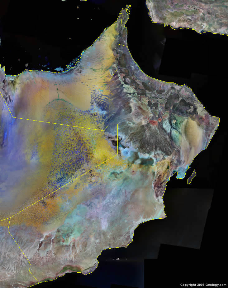
Oman Map and Satellite Image
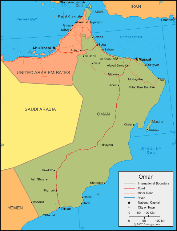
| Oman is located in the Middle East. Oman is bordered by the Gulf of Oman to the north, the Arabian Sea to the southeast, and Saudi Arabia, United Arab Emirates, and Yemen to the west. |
ADVERTISEMENT
Oman Neighboring Countries:
Iran, Saudi Arabia, United Arab Emirates, YemenRegional Maps:
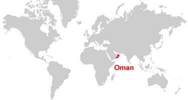
Asia, Middle East, WorldWhere is Oman?
Oman Satellite Image
ADVERTISEMENT

Explore Oman Using Google Earth:
Google Earth is a free program from Google that allows you to explore satellite images showing the cities and landscapes of Oman and all of Asia in fantastic detail. It works on your desktop computer, tablet, or mobile phone. The images in many areas are detailed enough that you can see houses, vehicles and even people on a city street. Google Earth is free and easy-to-use.
Oman on a World Wall Map:
Oman is one of nearly 200 countries illustrated on our Blue Ocean Laminated Map of the World. This map shows a combination of political and physical features. It includes country boundaries, major cities, major mountains in shaded relief, ocean depth in blue color gradient, along with many other features. This is a great map for students, schools, offices and anywhere that a nice map of the world is needed for education, display or decor.
Oman On a Large Wall Map of Asia:
If you are interested in Oman and the geography of Asia our large laminated map of Asia might be just what you need. It is a large political map of Asia that also shows many of the continent's physical features in color or shaded relief. Major lakes, rivers,cities, roads, country boundaries, coastlines and surrounding islands are all shown on the map.Oman Cities:
Adam, Al Khaburah, Al Qabil, Alayat Sama'il, Ash Shisar, Barka, Bidbid, Bilad Bani Bu 'Ali, Dank, Dawkah, Duqm, Habarut, Hasik, Hayma, Ibra, Kalban, Kharfat, Khluf, Masqat (Muscat), Matrah, Mirbat, Mudayrib, Nizwa, Qurayyat, Rakhyut, Raysut, Sadh, Saham, Salalah, Sharbatat, Shinas, Suhar, Sur, Taqah and Thamarit.Oman Locations:
Arabian Sea, Ghubbat Sawqirah, Gulf of Oman, Khalij Masira, Persian Gulf (Arabian Gulf), Tur'at Masirah, Wadi Aswad and Wadi Musallim.Oman Natural Resources:
The mineral resources for Oman include copper, asbestos, chromium, gypsum, limestone and some marble. The fuel resources in this country include the fossil fuels of petroleum and natural gas.Oman Natural Hazards:
There are periodic droughts in Oman. Other natural hazards include the summer winds, which will often raise large sandstorms and dust storms in the country's interior.Oman Environmental Issues:
The country of Oman has very limited natural freshwater resources. Other environmental issues are that the soil has a measured rise of salinity, and there is pollution on the country's beaches from oil spills.
ADVERTISEMENT