Home » World Maps » Asia » Qatar
Qatar Map and Satellite Image
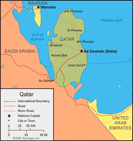
| Qatar is located in the Middle East. Qatar is bordered by the Gulf of Bahrain to the west, the Persian Gulf to the east, and Saudi Arabia to the south. |
ADVERTISEMENT
Qatar Neighboring Countries:
Bahrain, Iran, Saudi Arabia, United Arab EmiratesRegional Maps:
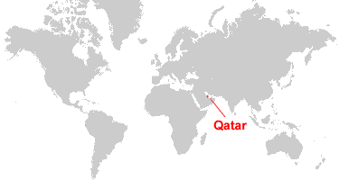
Asia, Middle East, WorldWhere is Qatar?
Qatar Satellite Image

ADVERTISEMENT

Explore Qatar Using Google Earth:
Google Earth is a free program from Google that allows you to explore satellite images showing the cities and landscapes of Qatar and all of Asia in fantastic detail. It works on your desktop computer, tablet, or mobile phone. The images in many areas are detailed enough that you can see houses, vehicles and even people on a city street. Google Earth is free and easy-to-use.
Qatar on a World Wall Map:
Qatar is one of nearly 200 countries illustrated on our Blue Ocean Laminated Map of the World. This map shows a combination of political and physical features. It includes country boundaries, major cities, major mountains in shaded relief, ocean depth in blue color gradient, along with many other features. This is a great map for students, schools, offices and anywhere that a nice map of the world is needed for education, display or decor.
Qatar On a Large Wall Map of Asia:
If you are interested in Qatar and the geography of Asia our large laminated map of Asia might be just what you need. It is a large political map of Asia that also shows many of the continent's physical features in color or shaded relief. Major lakes, rivers, cities, roads, country boundaries, coastlines and surrounding islands are all shown on the map.Qatar Cities:
Ad Dawhah (Doha), Al Khawr, Al Khuwayr, Al Wakrah, Ar Ruways, Dukhan, Jumayliyah, Limm Sa'id, Umm Bab and Umm Sa'id.Qatar Locations:
Gulf of Bahrain and Persian Gulf (Arabian Gulf).Qatar Natural Resources:
Qatar has fossil fuel deposits of petroleum, and natural gas. Fish is also a natural resource for this country.Qatar Natural Hazards:
For the country of Qatar some common natural hazards include dust storms, sandstorms, and haze.Qatar Environmental Issues:
An environmental issue for Qatar is its limited natural fresh water resources. The country is experiencing an increased dependence on large-scale desalination facilities.
ADVERTISEMENT