Home » US Maps » Michigan » Lakes and Rivers
Michigan Lakes, Rivers and Water Resources

ADVERTISEMENT
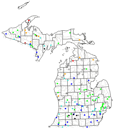
Michigan Rivers Shown on the Map: Au Sable River, Black River, Cass River, Escanaba River, Ford River, Grand River, Huron River, Kalamazoo River, Manistee River, Maple River, Menominee River, Muskegon River, Ontonagon River, Raisin River, Shiawassee River, St. Joseph River and Tittabawassee River.
Michigan Lakes Shown on the Map: Houghton Lake, Indian Lake, Lake Erie, Lake Gogebic, Lake Huron, Lake Michigan, Lake Superior, Manistique Lake and Mullet Lake.
| Michigan Stream and River Levels |
 The United States Geological Survey has a number of stream gages located throughout Michigan. These estimate stream levels, discharges and record them over time. This data is published on the web and many stations allow users to plot custom graphs. Get updated Michigan river and stream levels from USGS here.
| Michigan Stream and River Level Alerts |
 The United States Geological Survey has a system that will send you an email message when flood levels are reached on any stream with USGS gaging equipment that you have selected. Sign up here to receive Michigan stream and river level alerts.
| Michigan Water Publications |
 The United States Geological Survey has a number of publications related to water use and water resources in Michigan. Visit the Upper Midwest Water Science Center here.

| Michigan Waterfall: Bond Falls |
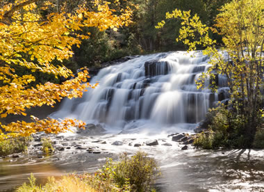 Bond Falls is located near the city of Paulding in Ontonagon County, on Michigan's Upper Peninsula. This cascade waterfall is on the Ontonagon River and has a height of about 50 feet. Image copyright by iStockphoto / csterken.
| Michigan Drought Map |
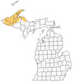 The United States Geological Survey publishes updated drought maps on their website. There you can view a map that shows where below normal 7-day average stream flow conditions were recently recorded. The maps are updated daily. Get a current Michigan drought map here.
| Michigan Elevation Map |
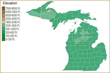 The topography of an area determines the direction of stream flow and often is a primary influence on the geographic distribution of precipitation. View a detailed Michigan elevation map.


Find Other Topics on Geology.com:

|

| ||

|

| ||

|

| ||

|

|