Home » Articles » Where is the Arctic?
Where is the Arctic? What is its Boundary?
Article by: Hobart M. King, PhD
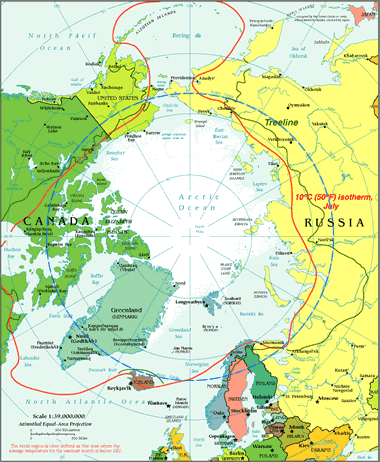
Boundaries of the Arctic: This map shows the three boundaries commonly used to define the southern geographic extent of the Arctic: 1) the Arctic Circle (shown as a dashed blue line); 2) the area where the average temperature of the warmest month is less than ten degrees Celsius (shown as a solid red line); and, 3) the arctic treeline (shown as a solid green line). Public domain image from the CIA Factbook, treeline added by the National Snow and Ice Data Center [2]. Click to enlarge.
What Is "The Arctic"?
The Arctic is the polar region of Earth that surrounds the North Pole. It includes the Arctic Ocean, numerous islands, and the northernmost portions of several countries. These include: Canada, Finland, Greenland, Norway, Russia, Sweden, and the United States. Most people can agree with that statement. However, there are some scientific disagreements over how far south the Arctic extends and what marks its southern boundary.
Here are three southernmost boundaries of the Arctic that have been used by many people.
 areas north of the Arctic Circle where July temperatures average below 10°C areas north of the Arctic treeline areas north of the Arctic Circle where July temperatures average below 10°C areas north of the Arctic treeline |
In the paragraphs below we will explore what defines these boundaries.
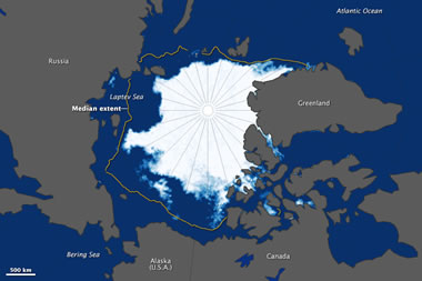
Arctic Ice Extent Map: This image shows the extent of Arctic ice on September 11, 2015. NASA Earth Observatory images by Jesse Allen, using data from the Advanced Microwave Scanning Radiometer 2 (AMSR2) sensor on the Global Change Observation Mission 1st-Water (GCOM-W1) satellite. [1] Click to enlarge.
What Is the Arctic Circle?
The Arctic Circle is a line of latitude that circles the Earth at approximately 66° 33' 47.2" north of the Equator. How was that strange number determined? The position of the Arctic Circle is at the latitude above which the sun does not set on the summer solstice and does not rise on the winter solstice.
This is what causes the Arctic to have a very long continuous night each year and a very long continuous day. The length of these long continuous days and nights are six months each at the North Pole. Their length decreases with distance from the North Pole.
The approximate location of the Arctic Circle is plotted on the map at the top of this page as a dashed blue line.
The latitude of the Arctic Circle is slowly drifting northward at a speed of about 15 meters per year. On July 2, 2018 it was at approximately 66° 33' 47.2" north of the Equator. This drift has nothing to do with climate change. Instead, the drift occurs because the Earth wobbles on its axis of rotation in a 40,000 year cycle in response to the gravitational attraction of the moon.
To most of the general public, using the Arctic Circle as the defining southern boundary for "the Arctic" is easy and makes total sense. However, some researchers believe that there are better ways to draw a map of the Arctic.
Average July Temperature Below 10°C
The full explanation for this boundary is "the area where the average temperature for the warmest month of the year is below 10°C (or approximately 50°F)". The warmest month of the year is almost always July. This boundary can be plotted on a map as a line of equal temperature known as the 10°C isotherm or the 50°F isotherm.
The approximate location of the 10°C isotherm is plotted on the map at the top of this page as a solid red line.
Some researchers prefer using the 10°C isotherm to define the southern limit of the arctic rather than using the Arctic Circle. Many of them prefer the 10°C isotherm because it is a boundary of "equal temperature conditions" rather than a latitude line. The 10°C isotherm can also be plotted over bodies of water, and that is where it has its greatest variability.
Climate change is pushing Earth’s climate zones northward. The 10°C isotherm provides a constant temperature condition used to define the arctic at a time when its extent is shrinking.
| Arctic Information |
|
[1] Arctic Sea Ice Reaches Annual Low: Article on NASA's Earth Observatory website, September 16, 2015.
[2] Map of the Arctic Treeline: Map from the National Snow & Ice Data Center website, now hosted on the Internet Archive. |
What Is the Arctic Treeline?
The arctic treeline is the northern geographic limit of tree survival. North of the treeline, temperatures are so cold that trees are killed when their inner sap freezes in winter. North of the treeline, trees are unable to easily grow root systems deep into the frozen soil. This deprives them of the nutrients and structural support that they need for survival. Many other types of plant life are limited by these conditions, and the fauna that depend upon the plants are also limited.
Some researches like to use the treeline as a southern limit of the arctic because it is a visible change in the landscape and a severe change in lifeforms. Some researchers believe that it is a logical southern boundary for the arctic.
The approximate location of the treeline is plotted on the map at the top of this page as a solid green line.
Just as the 10°C isotherm will migrate north with shifting climate zones, the treeline is also expected to move northward over time. However, the movement of the arctic treeline is likely to be much slower than the movement of the 10°C isotherm because the trees take longer to respond.
| More Maps |
 |
Gifts That Rock |
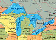 |
Great Lakes |
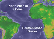 |
Map of the Oceans |
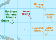 |
U.S. Territories |
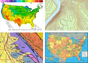 |
Types of Maps |
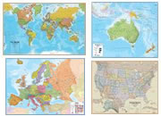 |
Wall Maps |
 |
Map of the Ten Largest Deserts |
 |
What Is An Archipelago? |

Find Other Topics on Geology.com:

|

| ||

|

| ||

|

| ||

|

|