Home » Volcanoes » Kilauea Volcano
Kilauea Volcano: Photos of the 2018 Eruption
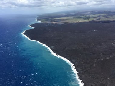
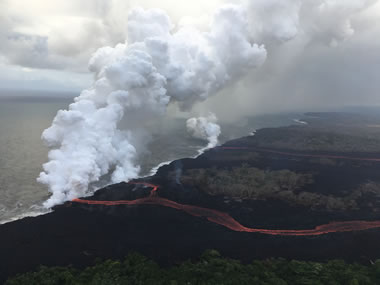
New Lava Delta: Lava flows from the Lower East Rift Zone have been entering the ocean along the easternmost coast of the island. Since the beginning of the current eruption cycle in early May, 2018, approximately 875 acres of lava deltas have been built where lava distributary channels fall into the ocean. Image by the United States Geological Survey.
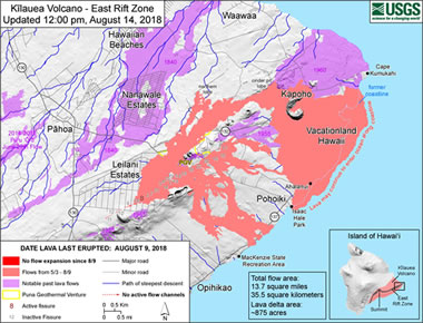
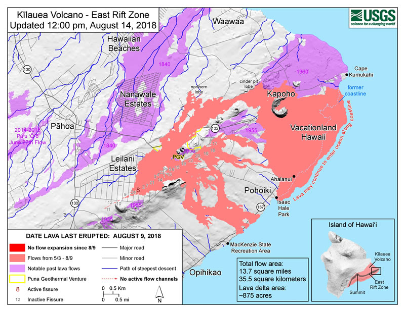
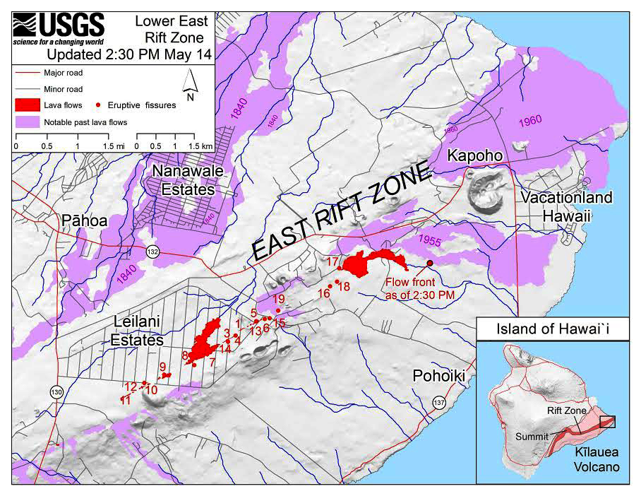
Lava Flow Map: An updated lava flow map of the East Rift Zone area, showing fissure eruption locations and recent lava flows. Note the location of the former coastline and how the island has been enlarged by lava deltas. Map by USGS. Click to enlarge.
East Rift Zone Eruptions
In late April 2018, small earthquakes began shaking the East Rift Zone of Kilauea Volcano, located along the southeastern side of the Island of Hawaii. Soon, hundreds of earthquakes had been recorded, fissure eruptions were fountaining lava, and basalt flows forced people in the Leilani Estates community to abandon their homes.
In the weeks that followed, numerous fissures were producing lava and poisonous sulfur dioxide gas. The lava flows destroyed dozens of homes, damaged roads, downed power lines and covered thousands of acres with igneous rock.
Daily earthquake activity persisted through the weeks. The largest earthquake was a 6.9 magnitude event. It damaged many buildings on the island of Hawaii, and triggered numerous landslides. It was one of the most powerful earthquakes ever felt in the Hawaiian Islands chain.
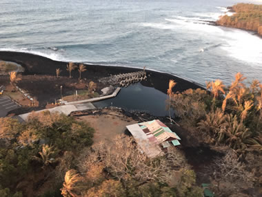
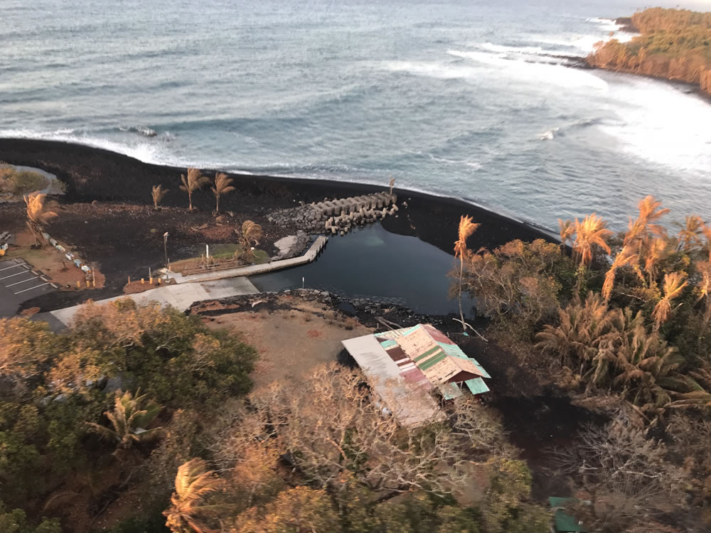
Black Sand Creation at Kilauea: As molten lava enters the ocean, the rapid temperature drop causes it to solidify and then immediately shatter into small glassy fragments. This is the origin of the black basalt sand that is well-known in Hawaii. The black sand is transported along the coast by longshore currents. The sand deposits can enlarge beaches, create sand bars, and close inlets. In the photo above, the shoreline has been extended seaward by a thick deposit of black sand. The sand has surrounded a boat ramp, making it unusable until waves and currents remove the sand, or until humans intervene, or until more black sand is delivered to make the black beach wider. Image by the United States Geological Survey. Click to enlarge.
Nothing New for the Hawaiian Island Chain
What we are seeing today is not unusual for the Hawaiian islands. The islands were formed because they are travelling on the Pacific plate over the Hawaiian Hot Spot. In fact, Lö'ihi Seamount, an active submarine volcano growing off the Island of Hawaii's southern coast, will likely be the next island of the Hawaiian island chain.
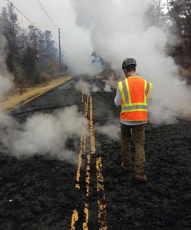
| Monitoring Pavement Fractures |
Monitoring Pavement Fractures: Scientists often mark and monitor pavement fractures for signs of extension, compression or displacement. These can be indicators of magma movement below or reactivation of a nearby fissure. Image by the United States Geological Survey. Click to enlarge.
Rumors of a Collapse and Tsunami?
Numerous websites have stories speculating that the south flank of Kilauea volcano might be unstable as a result of recent earthquake and volcanic activity. The stories speculate that the south flank might be detached along a subsurface fault and is ready to slide into the ocean, producing a basin-wide tsunami.
The United States Geological Survey responds that these stories are total speculation.
"There is no geologic evidence for past catastrophic collapses of Kīlauea Volcano that would lead to a major Pacific tsunami, and such an event is extremely unlikely in the future based on monitoring of surface deformation."
Strong earthquakes along the shoreline of Hawaii have produced localized tsunamis in the past. Earthquakes in 1868 (~M8) and in 1975 (M7.7) did produce small tsunamis that caused local deaths and injuries. However, neither of these events were catastrophic or caused a basin-wide impact.
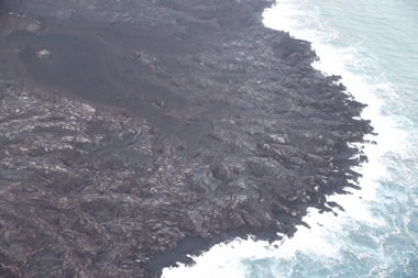
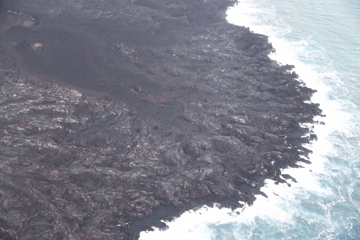
Unstable Lava Deltas: Cracks parallel to the shoreline clearly illustrate the instability of this lava delta near Kapoho and Vacation Lots. Photo by the United States Geological Survey. Click to enlarge.
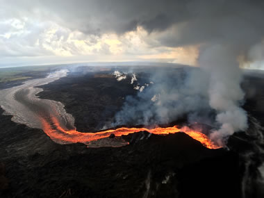
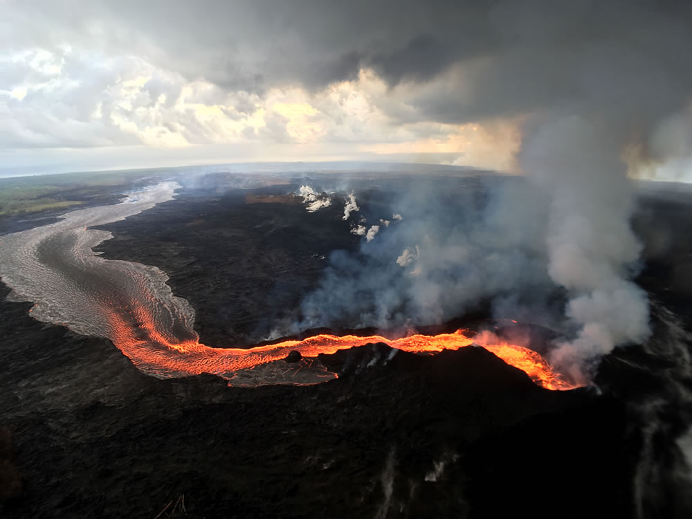
Incandescent Lava flows from Fissure 8 in the East Rift Zone. The lava begins its way to the coast in a perched channel built up from basalt that has solidified around the fissure. It then flows to the coast, where it plunges into the ocean to produce the plume of laze seen the distance. Photo by the United States Geological Survey. Click to enlarge.
| Ocean Entry Through Steam and Rain |
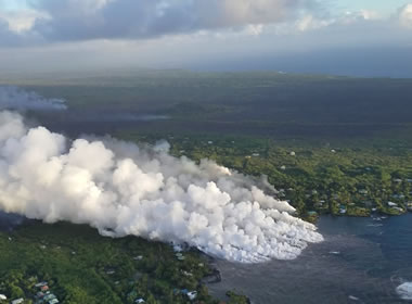
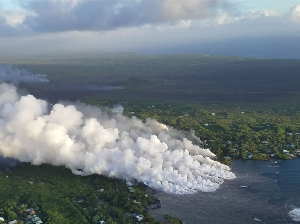
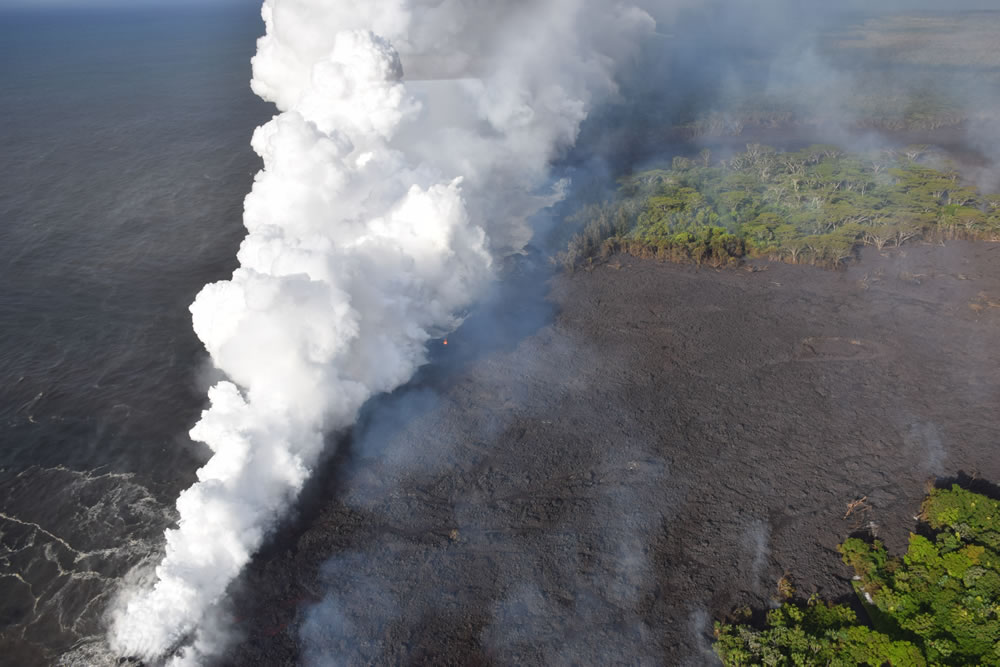
Ocean Entry Through Steam and Rain: Braided streams of lava produce a wide ocean entry along the southeast coast of Hawaii. The "foggy" view is caused by steam rising from the ocean entry and rain falling through the morning sky. Photo by the United States Geological Survey.
Lava Hits Kapoho Bay: Lava originating from Fissure 8 traveled down stream valleys and entered Kapoho Bay on June 3, producing clouds of steam that were carried across the island by wind. Photo by the United States Geological Survey. Click to enlarge.
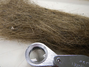
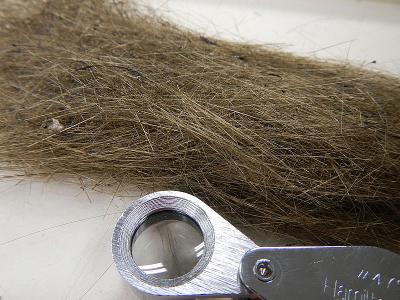
Pele's Hair is the name used for hair-like strands of volcanic glass that sometimes form in areas where lava fountaining, lava cascades and vigorous lava activity occur. They are less than 1/2 millimeter in width, but can be up to two meters in length. They resemble golden-brown human hair in their size, shape and color. They are a mineraloid formed from basaltic lava. Creative Commons photograph by Cm3826. Click to enlarge.
| Ash Plume at Kilauea Summit |
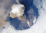
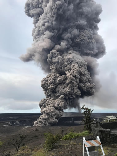
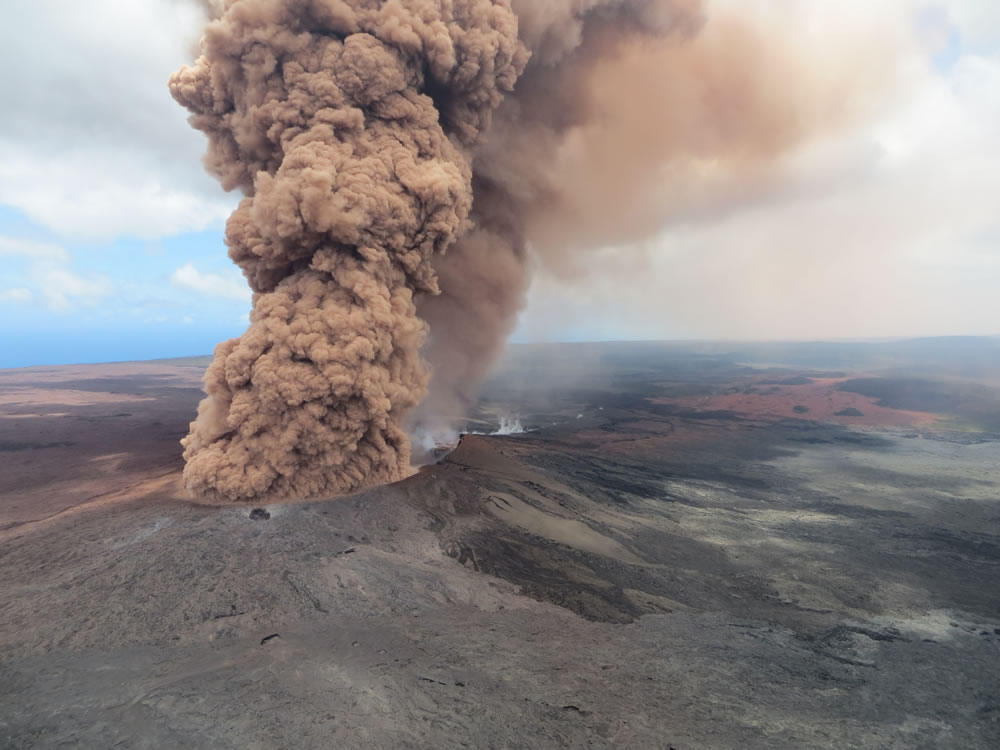
Ash Plume at Kilauea Summit: Falling lava levels in the Halema'uma'u crater at the summit of Kilauea have facilitated several small explosions. The lower lava levels allow groundwater to interact with the magma, causing explosions that launch large rocks and produce ash columns that rise high into the atmosphere. The photo above shows an ash plume produced on May 24 that rose to a height of 10,000 feet and produced light ashfalls downwind. Photo by the United States Geological Survey. Click to enlarge.
Tephra: The photo above shows a portion of Leilani Street, in the Leilani Estates subdivision, where tephra from high lava fountains at fissure 8 has been carried downwind. The tephra is vesicular basalt. Image by the United States Geological Survey. Click to enlarge.

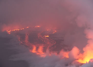
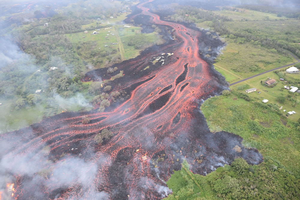
Channelized Lava Flow: Aerial view of channelized lava flowing from a fissure eruption in the East Rift Zone of Kilauea on May 19, 2018. Photo by the United States Geological Survey. Click to enlarge.

Lava Fountaining: This photograph shows lava fountaining and ramparts built from the spatter at Fissure 22 on May 21. To appreciate how high the lava is fountaining, look at the size of the trees in front of the lava flow. Photograph by the United States Geological Survey. Click to enlarge.
| First-Ever Ashfall Advisory |
First-Ever Ashfall Advisory: The National Weather Service issued the first ashfall advisory for Hawaii on May 17, after ash plumes were released from Kilauea Volcano and rose to elevations of 30,000 feet. Photo by the United States Geological Survey. Click to enlarge.
Three Ocean Entries: On May 24 lava was pouring into the Pacific Ocean at three locations, and Fissures 6, 13 and 22 were still erupting. Photo by the United States Geological Survey. Click to enlarge.
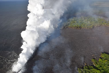
Sulfur Dioxide Plumes: This photo is a view from a plane flying parallel to the trend of fissure eruptions in the East Rift Zone. The white plumes rising through calm air are escaping from fissure eruptions. They are rich in sulfur dioxide gas. Public domain photo by the United States Geological Survey. Click to enlarge.
Kilauea Lava Reaches the Ocean: On May 20th, lava from Fissure 20 had flowed all the way to the edge of the island and was falling into the ocean. The white plume rising from the ocean entry is known as "laze" - a contraction of "lava haze". Laze is produced when hot lava causes sea water to boil. That produces chemical and physical reactions that cause the plume to contain a mixture of condensed seawater steam, hydrochloric acid gas, and tiny shards of volcanic glass. It is a health hazard for people in the immediate area or downwind. Photo by the United States Geological Survey. Click to enlarge.
Fissure 17: This is a photo of Fissure Eruption #17 from May 13. On that date it was producing intermittent lava jets that threw spatter and lava bombs up to 500 feet above the ground. A total of 18 fissures had opened as of the date of this photo. Image by the United States Geological Survey. Click to enlarge.
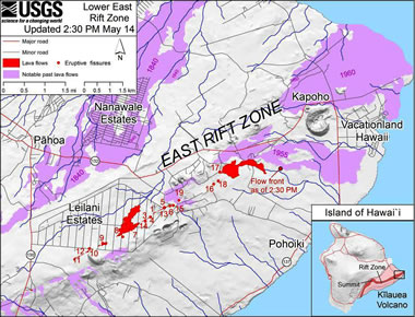
East Rift Zone Map: An updated map of the East Rift Zone showing the location of the 18 recent fissure eruptions, recent lava flows, and historic lava flows. Public domain map by the United States Geological Survey. Click to enlarge.
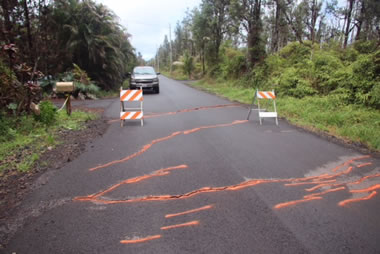
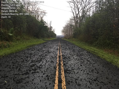
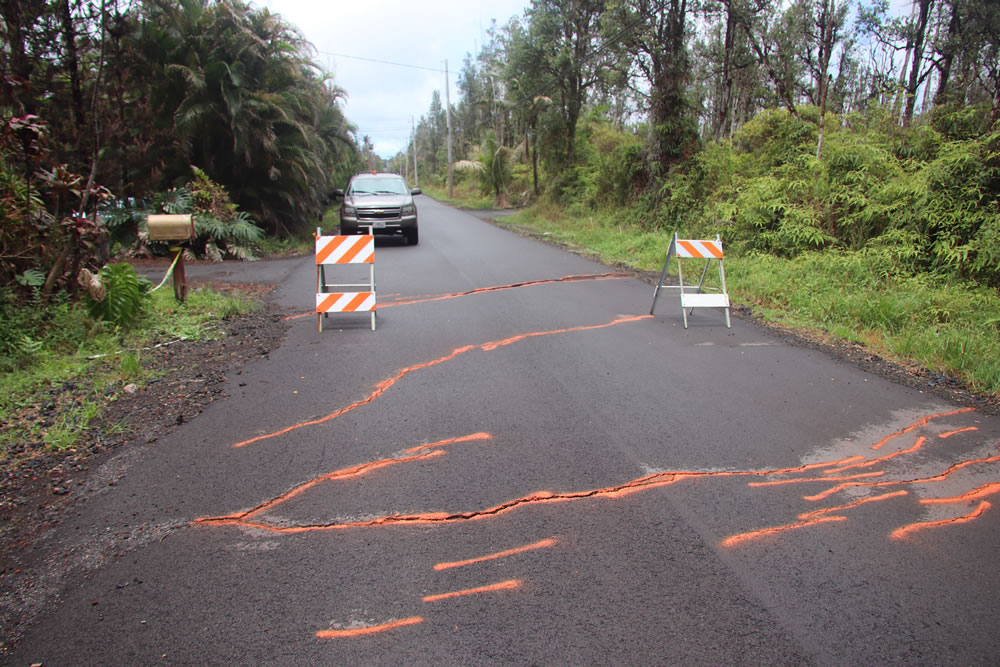
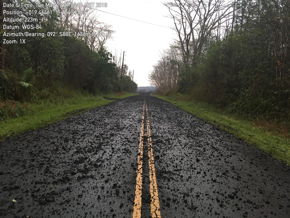
Road Displacement: Ground deformation in the East Rift Zone has produced fissures venting steam and fissures fountaining lava. In this photo road displacement is made especially obvious where it cuts the yellow line on the pavement. Image by the United States Geological Survey. Click to enlarge.
| Ash Column at Overlook Crater |
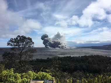
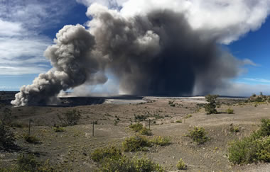
Ash Column at Overlook Crater: A rockfall from the steep walls of Overlook Crater triggered an explosion from the lava lake below, which produced a large ash cloud that took about an hour to clear. Image by the United States Geological Survey. Click to enlarge.
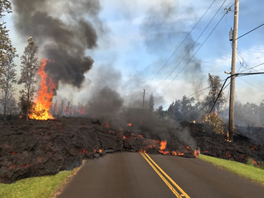
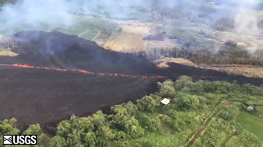
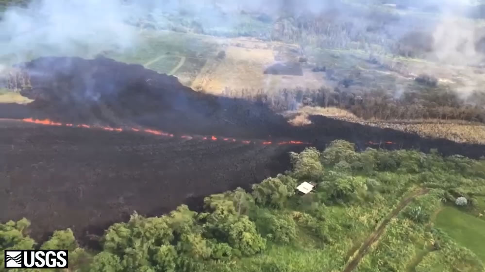
Lava Flow Crossing Road: This photo from Hookapu Street in Leilani Estates shows a lava flow crossing a road and damaging power transmission equipment. Flames shooting out of the flow are flammable gases produced by burning wood and organic debris that has been overrun by the flow. Public domain image by the United States Geological Survey. Click to enlarge.
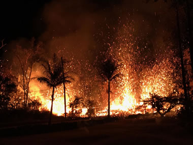
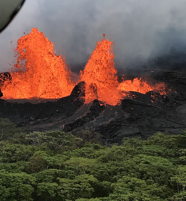
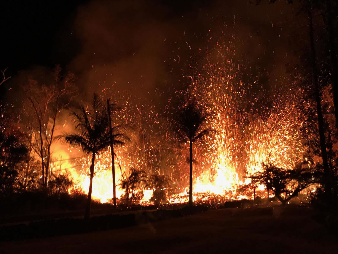
Fountaining Lava: This fissure eruption in the East Rift Zone of Kilauea Volcano began with the emission of steam, then a small sputtering of lava from a newly-opened fracture in the ground. The same day, roaring lava jets produced 200-foot-high fountains of lava. This night photograph shows incandescent lava erupting from several jets along the fissure. Public domain photo by the United States Geological Survey. Click to enlarge image.

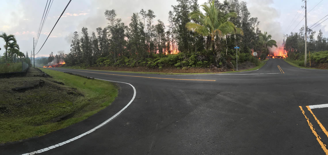
Fissure Eruption: This panoramic photo shows a long fissure eruption in the Leilani Estates community that cut through a small wooded area and closed two streets near the intersection of Leilani and Makamae Streets. Public domain photo by the United States Geological Survey. Click to enlarge image.
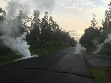
Steam Emissions: The first visible signs of potential volcanic eruptions were surface fractures and steam vents. These were convincing evidence that an eruption was about to occur. The steam was produced as molten rock below vaporized groundwater and caused it to begin hissing from the first fractures that developed at the surface. Public domain photo by the United States Geological Survey. Click to enlarge.
| Red Ash Plume at Pu'u'ō'ō |

Red Ash Plume at Pu'u'ō'ō: A column of robust, reddish-brown ash was released from Pu'u'ō'ō crater after a magnitude 6.9 earthquake occured on the South Flank of Kilauea and shook the entire island chain. Public domain photo by the United States Geological Survey. Click to enlarge.
| Satellite Image of Kilauea |
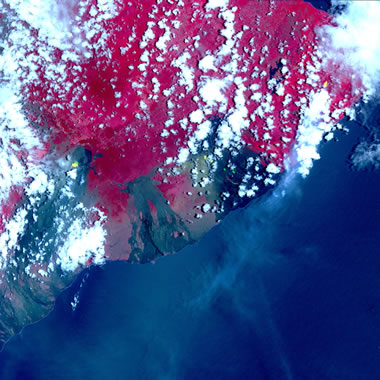
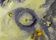
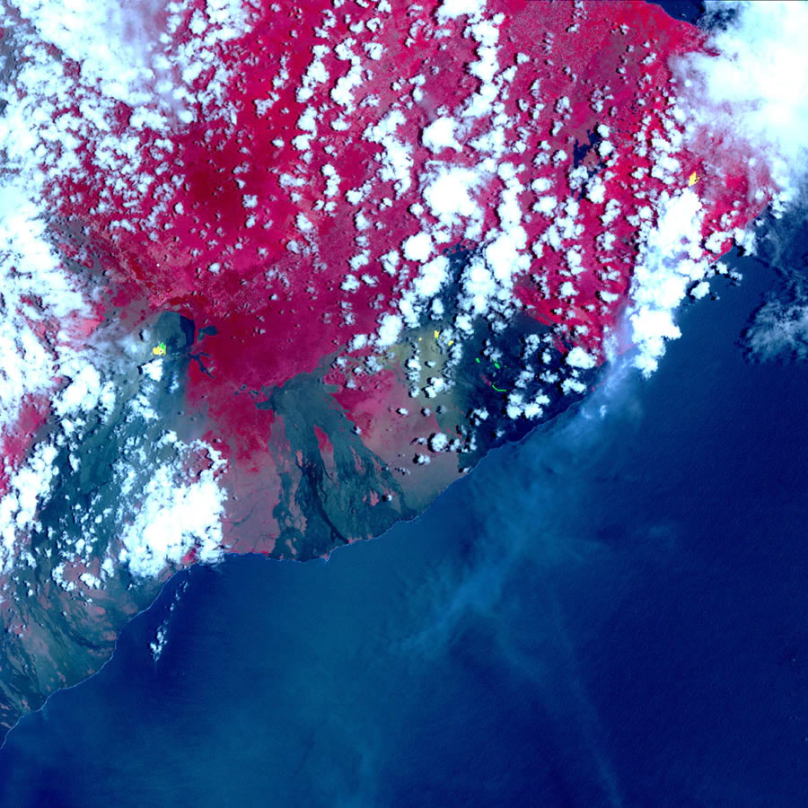
Satellite Image of Kilauea: This image from NASA's Terra spacecraft shows recent eruption features of Kilauea Volcano. Colors on the image represent different land features. Areas covered in vegetation are red, old lava flows are black and gray, the ocean is shades of blue. Yellow and greenish colors are hotspots that include erupting fissures, lava flows, lava lakes and recent ashfall areas. Hotspots in the middle of the image are the Pu'u O'o crater and lava flows descending the southeast flank of the volcano. The westernmost hotspots are the crater and lava lake on Kilauea's summit. The easternmost hot spots are erupting fissures and lava flowing to the northwest. The greenish areas southwest of Pu'u O'o are covered in fresh ashfall. Image by NASA. Click to enlarge.
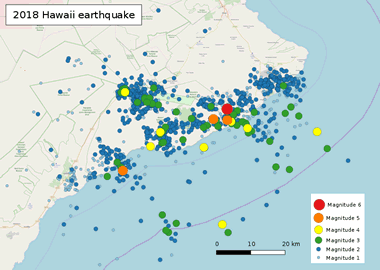
Earthquake Epicenter Map: This map shows the location of earthquakes that occured between January 1 and May 5, 2018, the date of the magnitude 6.9 event. It shows activity concentrated around the summit crater and across the East Rift Zone. Creative Commons map shared by Phoenix7777. Click to enlarge.
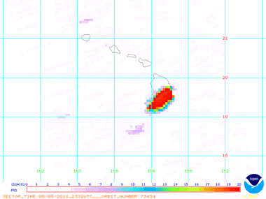
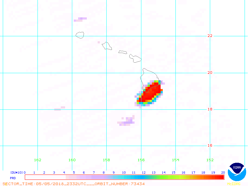
Sulfur Dioxide Plume: This map shows the geographic extent of the sulfur dioxide plume produced by the the eruptions on May 5, 2018. The plume was being carried towards the southwest along the southern edge of the island. Public domain map prepared by the National Oceanic and Atmospheric Administration. Click to enlarge.
Find Other Topics on Geology.com:
 | Rocks: Galleries of igneous, sedimentary and metamorphic rock photos with descriptions. |
|
 | Minerals: Information about ore minerals, gem materials and rock-forming minerals. |
|
 | Volcanoes: Articles about volcanoes, volcanic hazards and eruptions past and present. |
|
 | Gemstones: Colorful images and articles about diamonds and colored stones. |
|
 | General Geology: Articles about geysers, maars, deltas, rifts, salt domes, water, and much more! |
|
 | Geology Store: Hammers, field bags, hand lenses, maps, books, hardness picks, gold pans. |
|

|
 | Diamonds: Learn about the properties of diamond, its many uses, and diamond discoveries.
|
|