Home » World Maps » Australia » Bougainville
Bougainville Map and Satellite Image
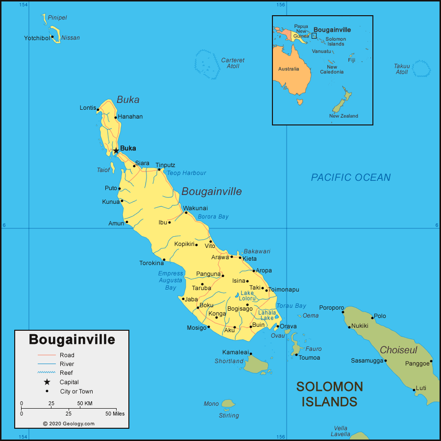
| The Autonomous Region of Bougainville is a group of islands and atolls located in the South Pacific Ocean. Bougainville is east of Papua New Guinea and northwest of the Solomon Islands.
In late 2019, a non-binding independence referendum was held in Bougainville, and over 98% of the people voted in favor of independence from Papua New Guinea. However, it might take years for negotiations and the process of Bougainvillean independence to be completed. The tentative agreement, negotiated in 2021, is that Bougainville will become independent by 2027 if the agreement is ratified by the parliament of Papua New Guinea. |
ADVERTISEMENT
Bougainville Neighboring Countries and Islands:
Papua New Guinea, Solomon Islands, Vanuatu, New CaledoniaRegional Maps:
Map of Indonesia, Map of Australia, Map of the Oceans, Map of the World
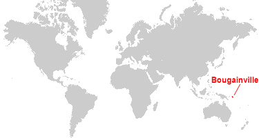
Where is Bougainville?

Explore Bougainville Using Google Earth:
Google Earth is a free program from Google that allows you to explore satellite images showing the cities and landscapes of Bougainville and all of Oceania in fantastic detail. It works on your desktop computer, tablet, or mobile phone. The images in many areas are detailed enough that you can see houses, vehicles and even people on a city street. Google Earth is free and easy-to-use.
Bougainville on a World Wall Map:
Bougainville is included on our Blue Ocean Laminated Map of the World. This map shows a combination of political and physical features. It includes country boundaries, major cities, major mountains in shaded relief, ocean depth in blue color gradient, along with many other features. This is a great map for students, schools, offices and anywhere that a nice map of the world is needed for education, display or decor.
Bougainville On a Large Wall Map of Australia:
If you are interested in Bougainville and the geography of Australia, our large laminated map of Australia might be just what you need. It is a large political map of Australia that also shows many of the continent's physical features in color or shaded relief. Major lakes, rivers, cities, roads, country boundaries, coastlines and surrounding islands are all shown on the map.ADVERTISEMENT
Bougainville Cities:
Aku, Amun, Arawa, Aropa, Bogisago, Boku, Buin, Buka, Hanahan, Ibu, Isina, Jaba, Kieta, Konga, Kopikiri, Kunua, Lontis, Mosigo, Orava, Panguna, Puto, Siara, Taki, Taruba, Tinputz, Toimonapu, Torokina, Vito, Wakunai, and Yotchibol.Islands of Bougainville:
Anusagari, Arigua Reef, Arovo, Bakawari, Bougainville, Buka, Carteret Atoll, Gog, Hatsigan, Hetau, Hon, Kuruki Island and Kuruki Reef, Magine Islands, Mabiri Reef, Madehas, Manus, Matsungan, Nissan, Otua Islet, Pachem, Petats, Pinipel, Pororan, Rantan, Saposa Islands, Sirot, Sohano, Taiof, Takanupe, Takuu Atoll, Tanwoa, Tautsina, Teop, Yame, and Zeune Islands. Not shown on the map: Nuguria Islands (also known as Abgarris or Fead Islands) and Nukumanu Islands (formerly Tasman Islands).Bougainville Locations:
Borora Bay, Buka Passage, Empress Augusta Bay, Lahala Lake, Lake Loloru, Panguna mine, Teop Harbour, and Torau Bay.Bougainville Natural Resources:
The Panguna mine in Bougainville has deposits of copper ore, gold, and silver. The mine was closed in 1989 due to environmental concerns and civil conflict.Bougainville Natural Hazards:
Bagana is a historically active volcano on the main island of Bougainville.Bougainville Environmental Issues:
The Jaba River was polluted with sediment and heavy metals that were dumped from the Panguna copper mine.
ADVERTISEMENT