Home » World Maps » Australia » Vanuatu
Vanuatu Map and Satellite Image
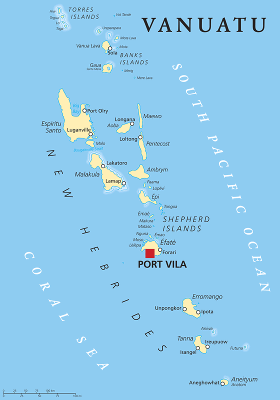
| The Republic of Vanuatu is an island country and a volcanic archipelago (shaped like the letter "Y") in the South Pacific Ocean, about 1100 miles (1770 kilometers) east of Australia. France and the United Kingdom claimed parts of the archipelago between the 1880s and the late 1900s. At that time the archipelago was known as The New Hebrides. The Republic of Vanuatu was founded in 1980.
Today the capital city of Vanuatu is Port Vila. The islands have an estimated population of about 307,815 (2020), with over 98% of the population being natives of Vanuatu. The official languages are Bislama, English, and French. The economy is mostly based upon fishing, agriculture, tourism, raising cattle, and offshore financial services. Map by Peter Hermes Furian / iStockphoto. Click for a larger view. |
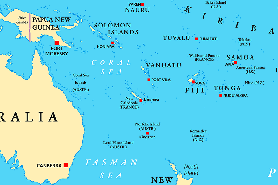
| This map shows a view of the South Pacific Ocean and Coral Sea islands that surround Vanuatu. Capital city locations are shown by red squares. Map by Peter Hermes Furian and Alamy. |
ADVERTISEMENT
Vanuatu Neighboring Island Groups:
New Caledonia, Solomon Islands, Fiji, Wallis and Futuna, Tuvalu, Tonga, Niue, Samoa, American SamoaRegional Maps:
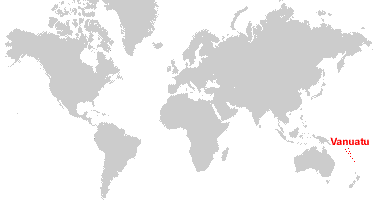
Map of Papua New Guinea, Map of Australia, Map of New Zealand, Map of the Oceans, Map of the WorldWhere is Vanuatu?
Vanuatu Satellite Image
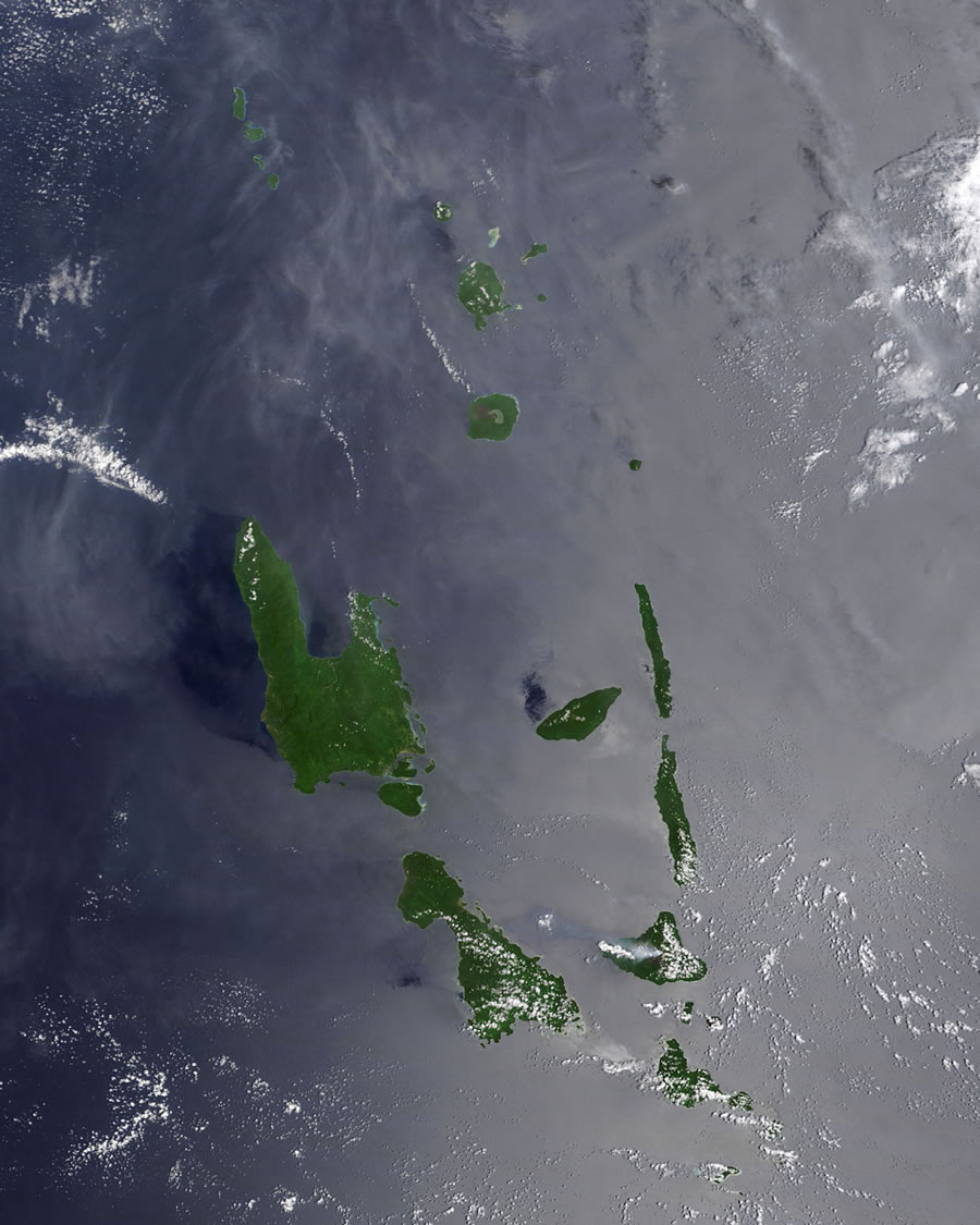
| This satellite image shows the northern islands of Vanuatu. If you click the image to enlarge it, then (on desktop computers) click again, you will see this image at a higher resolution. If you look closely you will be able to see calderas of several volcanoes, and a plume of volcanic ash streaming from Ambrym Volcano on Ambrym island. Data for the satellite image above was acquired by the Moderate Resolution Imaging Spectroradiometer (MODIS) aboard NASA's Terra satellite in 2009. The image was created by Jeff Schmaltz, Goddard Space Flight Center. Click for a larger view. |
ADVERTISEMENT

Explore Vanuatu Using Google Earth:
Google Earth is a free program from Google that allows you to explore satellite images showing the cities and landscapes of Vanuatu and all of Oceania in fantastic detail. It works on your desktop computer, tablet, or mobile phone. The images in many areas are detailed enough that you can see houses, vehicles and even people on a city street. Google Earth is free and easy-to-use.
Vanuatu on a World Wall Map:
Vanuatu is one of nearly 200 countries illustrated on our Blue Ocean Laminated Map of the World. This map shows a combination of political and physical features. It includes country boundaries, major cities, major mountains in shaded relief, ocean depth in blue color gradient, along with many other features. This is a great map for students, schools, offices and anywhere that a nice map of the world is needed for education, display or decor.Vanuatu's Islands:
Vanuatu is an archipelago of over 80 islands, with 65 of the islands being inhabited. The fourteen largest islands (with a surface area of at least 100 square kilometers) are, from largest to smallest: Espiritu Santo, Malakula, Efate, Erromango, Ambrym, Tanna, Pentecost, Epi, Ambae (or Aoba), Gaua, Vanua Lava, Maewo, Malo, and Aneityum (or Anatom). Over half of the population lives on Espiritu Santo, Malakula, and Efate.Smaller islands and islets in Vanuatu include: the Torres Islands (Hiw, Tegua, Lo, and Toga), Vot Tande, Ureparapara, Mota Lava, Mota, Merig, Mere Lava, Paama, Lopevi, Tongoa, Emae, Makura, Mataso, Nguna, Emao, Moso, Lelepa, Aniwa, and Futuna.
Vanuatu's Towns:
Over 70% of the population lives in two towns: Port Vila (the capital city) on the island of Efate, and Luganville on the island of Espiritu Santo. Other towns in Vanuatu include: Aneghowhat, Forari, Ipota, Ireupuow, Isangel, Lakatoro, Lamap, Loltong, Longana, Port Olry, Sola, and Unpongkor.Vanuatu Natural Resources:
The important export commodities of Vanuatu are fish and fish products, perfume plants, mollusks, and cocoa beans. Wood is an important natural resource that has been developed only for domestic use. Most of the country's electricity is generated from imported fossil fuels. However, the use of solar and wind power is growing through small projects initiated by communities, businesses, and households.Vanuatu Natural Hazards:
Vanuatu is often hit by tropical cyclones, with the peak season being from January through April. There are also frequent volcanic eruptions. Yasur is one of the world's most active volcanoes. Other active volcanoes in Vanuatu include: Aoba, Ambrym, Epi, Gaua, Kuwae, Lopevi, Suretamatai, and Traitor's Head. Additionally, the islands are occasionally affected by earthquakes and tsunamis.Vanuatu Environmental Issues:
Many people of Vanuatu do not have a reliable supply of potable water. Water supply problems are worst in rural areas and in small communities that are not served by public water distribution and where proper sewage disposal practices are not followed. As a result, many streams and much of the groundwater resource has been contaminated. These adverse effects on the islands' water resources are accelerated by population growth and deforestation.
ADVERTISEMENT