Home » World Maps » Australia » Fiji
Fiji Map and Satellite Image
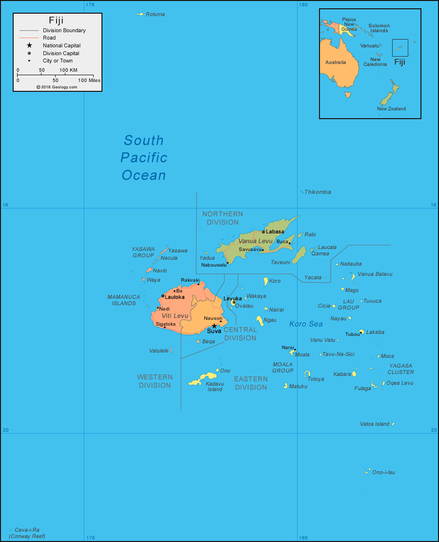
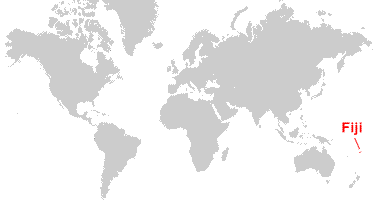
| Fiji is a group of islands located in the South Pacific Ocean. Fiji is north of New Zealand and east of Australia. |
ADVERTISEMENT
Fiji Neighboring Island Groups:
American Samoa, New Caledonia, Niue, Samoa, Solomon Islands, Tonga, Tuvalu, Vanuatu, Wallis and FutunaRegional Maps:
Map of New Zealand, Map of Australia, Map of the Oceans, Map of the WorldWhere is Fiji?
Fiji Satellite Image

| Data for the satellite image above was acquired by the Moderate Resolution Imaging Spectroradiometer (MODIS) instrument on NASA's Aqua satellite in 2010. The image was created by Norman Kuring, NASA Ocean Color. Click for a larger view. |
ADVERTISEMENT

Explore Fiji Using Google Earth:
Google Earth is a free program from Google that allows you to explore satellite images showing the cities and landscapes of Fiji and all of Oceania in fantastic detail. It works on your desktop computer, tablet, or mobile phone. The images in many areas are detailed enough that you can see houses, vehicles and even people on a city street. Google Earth is free and easy-to-use.
Fiji on a World Wall Map:
Fiji is one of nearly 200 countries illustrated on our Blue Ocean Laminated Map of the World. This map shows a combination of political and physical features. It includes country boundaries, major cities, major mountains in shaded relief, ocean depth in blue color gradient, along with many other features. This is a great map for students, schools, offices and anywhere that a nice map of the world is needed for education, display or decor.Fiji Cities:
Nadi, Lautoka, Sigatoka, Ba, Rakiraki, Suva, Nausori, Nabouwalu, Levuka, Savusavu, Labasa, Buca, Naroi, Tubou.Fiji Named Islands:
Rotuma, Thikombia, Vanua Levu, Rabi, Laucala, Qamea, Taveuni, Yadua, Yacata, Yasawa, Nacula, Naviti, Waya, Viti Levu, Vatulele, Beqa, Kadavu Island, Ono, Ovalau, Wakaya, Koro, Nairai, Ngau, Moala, Totoya, Matuku, Tavu-Na-Sici, Vanu Vatu, Naitauba, Vanua Balavu, Mago, Tuvuca, Cicia, Nayau, Lakeba, Moce, Kabara, Fulaga, Oqea Levu, Vatoa Island, Ono-i-lau, and Ceva-i-Ra (Conway Reef).Fiji Locations:
South Pacific Ocean, Koro Sea. Island groups include the Kadavu Group, Lau Islands, Lomaiviti Islands, Mamanuca Islands, Rotuma Group, Vanua Levu Group, Viti Levu Group, and Yasawa Islands.Fiji Natural Resources:
The fuel resources for Fiji include hydropower and offshore oil potential. Metal resources include gold and copper. Other resources include fish and timber.Fiji Natural Hazards:
Fiji is prone to cyclones, especially from November to January.Fiji Environmental Issues:
The environmental issues in Fiji include deforestation and soil erosion.
ADVERTISEMENT