Home » US Maps » Minnesota » County Map
Minnesota County Map with County Seat Cities

ADVERTISEMENT
County Maps for Neighboring States:
Iowa North Dakota South Dakota Wisconsin


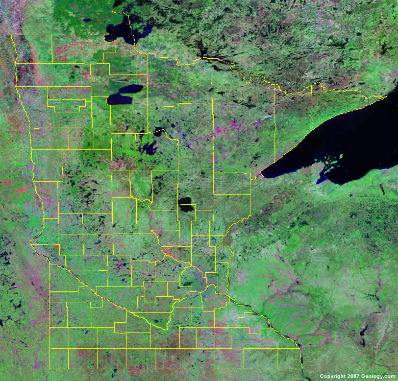
The map above is a Landsat satellite image of Minnesota with County boundaries superimposed. We have a more detailed satellite image of Minnesota without County boundaries.


ADVERTISEMENT
Minnesota Counties and County Seats |
|
|
Aitkin County - Aitkin Anoka County - Anoka Becker County - Detroit Lakes Beltrami County - Bemidji Benton County - Foley Big Stone County - Ortonville Blue Earth County - Mankato Brown County - New Ulm Carlton County - Carlton Carver County - Chaska Cass County - Walker Chippewa County - Montevideo Chisago County - Center City Clay County - Moorhead Clearwater County - Bagley Cook County - Grand Marais Cottonwood County - Windom Crow Wing County - Brainerd Dakota County - Hastings Dodge County - Mantorville Douglas County - Alexandria Faribault County - Blue Earth Fillmore County - Preston Freeborn County - Albert Lea Goodhue County - Red Wing Grant County - Elbow Lake Hennepin County - Minneapolis Houston County - Caledonia Hubbard County - Park Rapids Isanti County - Cambridge Itasca County - Grand Rapids Jackson County - Jackson Kanabec County - Mora Kandiyohi County - Willmar Kittson County - Hallock Koochiching County - International Falls Lac qui Parle County - Madison Lake County - Two Harbors Lake of the Woods County - Baudette Le Sueur County - Le Center Lincoln County - Ivanhoe Lyon County - Marshall McLeod County - Glencoe Mahnomen County - Mahnomen |
Marshall County - Warren Martin County - Fairmont Meeker County - Litchfield Mille Lacs County - Milaca Morrison County - Little Falls Mower County - Austin Murray County - Slayton Nicollet County - St. Peter Nobles County - Worthington Norman County - Ada Olmsted County - Rochester Otter Tail County - Fergus Falls Pennington County - Thief River Falls Pine County - Pine City Pipestone County - Pipestone Polk County - Crookston Pope County - Glenwood Ramsey County - St. Paul Red Lake County - Red Lake Falls Redwood County - Redwood Falls Renville County - Olivia Rice County - Faribault Rock County - Luverne Roseau County - Roseau St. Louis County - Duluth Scott County - Shakopee Sherburne County - Elk River Sibley County - Gaylord Stearns County - St. Cloud Steele County - Owatonna Stevens County - Morris Swift County - Benson Todd County - Long Prairie Traverse County - Wheaton Wabasha County - Wabasha Wadena County - Wadena Waseca County - Waseca Washington County - Stillwater Watonwan County - St. James Wilkin County - Breckenridge Winona County - Winona Wright County - Buffalo Yellow Medicine County - Granite Falls |
