Home » Satellite Images
Satellite Images of Countries, States, U.S. Cities and World Cities
Google Earth Free Download

Satellite, Low Altitude & Topos
World at Night

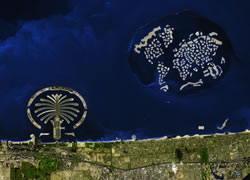
Artificial Islands of Dubai
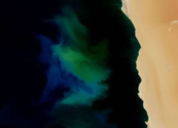
Phytoplankton Blooms
US State Satellite Images

US City Satellite Images

World City Satellite Images

Oil Fields from Space

Land Below Sea Level

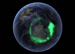
Aurora Australis
Country Satellite Images

Selenga Delta Satellite View
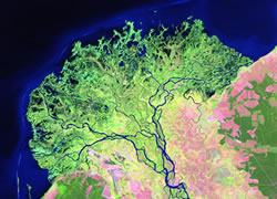
Copyright information: Data used to produce the Landsat images above was provided by NASA's Earth Science Enterprise Scientific Data Purchase Program and produced, under NASA contract, by Earth Satellite Corporation. Thank you to those agencies for use of the data. The Landsat images above were composed by Angela King and are property of Geology.com. Use of any Geology.com image without written permission is prohibited.