Home » US Maps » Iowa » County Map
Iowa County Map with County Seat Cities

ADVERTISEMENT
County Maps for Neighboring States:
Illinois Minnesota Nebraska South Dakota Wisconsin
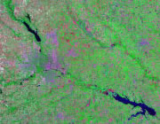


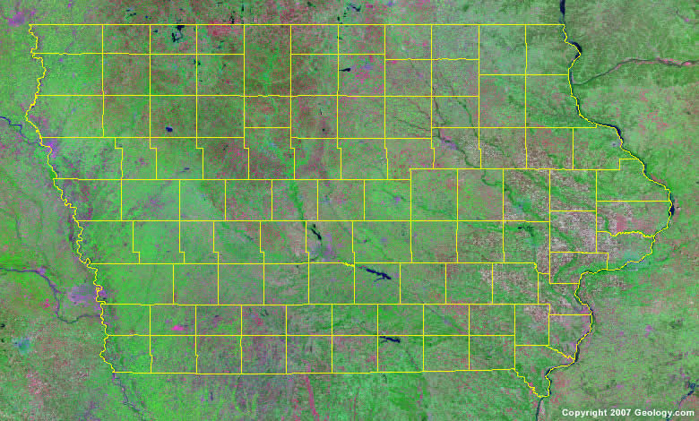
The map above is a Landsat satellite image of Iowa with County boundaries superimposed. We have a more detailed satellite image of Iowa without County boundaries.


ADVERTISEMENT
Iowa Counties and County Seats |
|
|
Adair County - Greenfield Adams County - Corning Allamakee County - Waukon Appanoose County - Centerville Audubon County - Audubon Benton County - Vinton Black Hawk County - Waterloo Boone County - Boone Bremer County - Waverly Buchanan County - Independence Buena Vista County - Storm Lake Butler County - Allison Calhoun County - Rockwell Carroll County - Carroll Cass County - Atlantic Cedar County - Tipton Cerro Gordo County - Mason City Cherokee County - Cherokee Chickasaw County - New Hampton Clarke County - Osceola Clay County - Spencer Clayton County - Elkader Clinton County - Clinton Crawford County - Denison Dallas County - Adel Davis County - Bloomfield Decatur County - Leon Delaware County - Manchester Des Moines County - Burlington Dickinson County - Spirit Lake Dubuque County - Dubuque Emmet County - Estherville Fayette County - West Union Floyd County - Charles City Franklin County - Hampton Fremont County - Sidney Greene County - Jefferson Grundy County - Grundy Center Guthrie County - Guthrie Center Hamilton County - Webster City Hancock County - Garner Hardin County - Eldora Harrison County - Logan Henry County - Mount Pleasant Howard County - Cresco Humboldt County - Dakota City Ida County - Ida Grove Iowa County - Marengo Jackson County - Maquoketa Jasper County - Newton |
Jefferson County - Fairfield Johnson County - Iowa City Jones County - Anamosa Keokuk County - Sigourney Kossuth County - Algona Lee County - Fort Madison Linn County - Cedar Rapids Louisa County - Wapello Lucas County - Chariton Lyon County - Rock Rapids Madison County - Winterset Mahaska County - Oskaloosa Marion County - Knoxville Marshall County - Marshalltown Mills County - Glenwood Mitchell County - Osage Monona County - Onawa Monroe County - Albia Montgomery County - Red Oak Muscatine County - Muscatine O'Brien County - Primghar Osceola County - Sibley Page County - Clarinda Palo Alto County - Emmetsburg Plymouth County - Le Mars Pocahontas County - Pocahontas Polk County - Des Moines Pottawattamie County - Council Bluffs Poweshiek County - Montezuma Ringgold County - Mount Ayr Sac County - Sac City Scott County - Davenport Shelby County - Harlan Sioux County - Orange City Story County - Nevada Tama County - Toledo Taylor County - Bedford Union County - Creston Van Buren County - Keosauqua Wapello County - Ottumwa Warren County - Indianola Washington County - Washington Wayne County - Corydon Webster County - Fort Dodge Winnebago County - Forest City Winneshiek County - Decorah Woodbury County - Sioux City Worth County - Northwood Wright County - Clarion |
