Home » US Maps » Tennessee » County Map
Tennessee County Map with County Seat Cities

ADVERTISEMENT
County Maps for Neighboring States:
Alabama Arkansas Georgia Kentucky Mississippi Missouri North Carolina Virginia
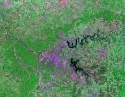


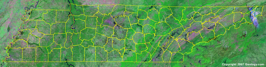
The map above is a Landsat satellite image of Tennessee with County boundaries superimposed. We have a more detailed satellite image of Tennessee without County boundaries.


ADVERTISEMENT
Tennessee Counties and County Seats |
|
| Anderson County - Clinton Bedford County - Shelbyville Benton County - Camden Bledsoe County - Pikeville Blount County - Maryville Bradley County - Cleveland Campbell County - Jacksboro Cannon County - Woodbury Carroll County - Huntingdon Carter County - Elizabethton Cheatham County - Ashland City Chester County - Henderson Claiborne County - Tazewell Clay County - Celina Cocke County - Newport Coffee County - Manchester Crockett County - Alamo Cumberland County - Crossville Davidson County - Nashville DeKalb County - Smithville Decatur County - Decaturville Dickson County - Charlotte Dyer County - Dyersburg Fayette County - Somerville Fentress County - Jamestown Franklin County - Winchester Gibson County - Trenton Giles County - Pulaski Grainger County - Rutledge Greene County - Greeneville Grundy County - Altamont Hamblen County - Morristown Hamilton County - Chattanooga Hancock County - Sneedville Hardeman County - Bolivar Hardin County - Savannah Hawkins County - Rogersville Haywood County - Brownsville Henderson County - Lexington Henry County - Paris Hickman County - Centerville Houston County - Erin Humphreys County - Waverly Jackson County - Gainesboro Jefferson County - Dandridge Johnson County - Mountain City Knox County - Knoxville Lake County - Tiptonville |
Lauderdale County - Ripley Lawrence County - Lawrenceburg Lewis County - Hohenwald Lincoln County - Fayetteville Loudon County - Loudon Macon County - Lafayette Madison County - Jackson Marion County - Jasper Marshall County - Lewisburg Maury County - Columbia McMinn County - Athens McNairy County - Selmer Meigs County - Decatur Monroe County - Madisonville Montgomery County - Clarksville Moore County - Lynchburg Morgan County - Wartburg Obion County - Union City Overton County - Livingston Perry County - Linden Pickett County - Byrdstown Polk County - Benton Putnam County - Cookeville Rhea County - Dayton Roane County - Kingston Robertson County - Springfield Rutherford County - Murfreesboro Scott County - Huntsville Sequatchie County - Dunlap Sevier County - Sevierville Shelby County - Memphis Smith County - Carthage Stewart County - Dover Sullivan County - Blountville Sumner County - Gallatin Tipton County - Covington Trousdale County - Hartsville Unicoi County - Erwin Union County - Maynardville Van Buren County - Spencer Warren County - McMinnville Washington County - Jonesboro Wayne County - Waynesboro Weakley County - Dresden White County - Sparta Williamson County - Franklin Wilson County - Lebanon |
