Home » US Maps » West Virginia » County Map
West Virginia County Map with County Seat Cities

ADVERTISEMENT
County Maps for Neighboring States:
Kentucky Maryland Ohio Pennsylvania Virginia


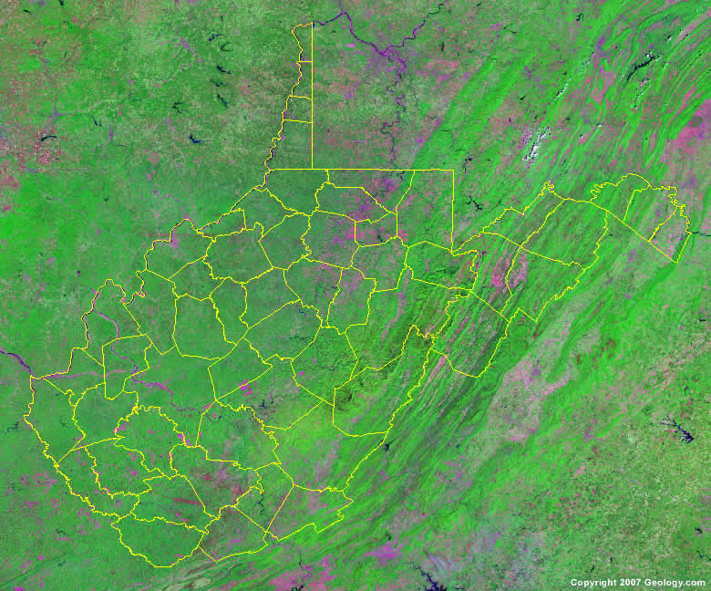
The map above is a Landsat satellite image of West Virginia with County boundaries superimposed. We have a more detailed satellite image of West Virginia without County boundaries.


ADVERTISEMENT
West Virginia Counties and County Seats |
|
|
Barbour County - Philippi Berkeley County - Martinsburg Boone County - Madison Braxton County - Sutton Brooke County - Wellsburg Cabell County - Huntington Calhoun County - Grantsville Clay County - Clay Doddridge County - West Union Fayette County - Fayetteville Gilmer County - Glenville Grant County - Petersburg Greenbrier County - Lewisburg Hampshire County - Romney Hancock County - New Cumberland Hardy County - Moorefield Harrison County - Clarksburg Jackson County - Ripley Jefferson County - Charles Town Kanawha County - Charleston Lewis County - Weston Lincoln County- Hamlin Logan County - Logan Marion County - Fairmont Marshall County - Moundsville Mason County - Point Pleasant McDowell County - Welch Mercer County - Princeton |
Mineral County - Keyser Mingo County - Williamson Monongalia County - Morgantown Monroe County - Union Morgan County - Berkeley Springs Nicholas County - Summersville Ohio County - Wheeling Pendleton County - Franklin Pleasants County - St. Marys Pocahontas County - Marlinton Preston County - Kingwood Putnam County - Winfield Raleigh County - Beckley Randolph County - Elkins Ritchie County - Harrisville Roane County - Spencer Summers County - Hinton Taylor County - Grafton Tucker County - Parsons Tyler County - Middlebourne Upshur County - Buckhannon Wayne County - Wayne Webster County - Webster Springs Wetzel County - New Martinsville Wirt County - Elizabeth Wood County - Parkersburg Wyoming County - Pineville |
