Home » Rocks » Oil Shale » United States
United States Oil-Shale Deposits
Reprint of: United States Geological Survey Scientific Investigations Report 2005-5294 by John R. Dyni
| United States of America Oil Shale |
U.S. oil shale: Map of areas underlain by the Green River Formation in Colorado, Utah, and Wyoming, United States (after Dyni, 2005) and major areas of surface minable Devonian oil shale in the eastern United States (after Matthews and others 1980). Click to enlarge map.
Numerous deposits of oil shale, ranging from Precambrian to Tertiary age, are present in the United States. The two most important deposits are in the Eocene Green River Formation in Colorado, Wyoming, and Utah and in the Devonian-Mississippian black shales in the eastern United States. Oil shale associated with coal deposits of Pennsylvanian age is also in the eastern United States. Other deposits are known to be in Nevada, Montana, Alaska, Kansas, and elsewhere, but these are either too small, too low grade, or have not yet been well enough explored (Russell, 1990, p. 82-157) to be considered as resources for the purposes of this report. Because of their size and grade, most investigations have focused on the Green River and the Devonian-Mississippian deposits.
| Oil Shale - Country Menu |
Green River Formation:
-Geology
Lacustrine sediments of the Green River Formation were deposited in two large lakes that occupied 65,000 km2 in several sedimentary-structural basins in Colorado, Wyoming, and Utah during early through middle Eocene time. The Uinta Mountain uplift and its eastward extension, the Axial Basin anticline, separate these basins. The Green River lake system was in existence for more than 10 million years during a time of a warm temperate to subtropical climate. During parts of their history, the lake basins were closed, and the waters became highly saline.
Fluctuations in the amount of inflowing stream waters caused large expansions and contractions of the lakes as evidenced by widespread intertonguing of marly lacustrine strata with beds of land-derived sandstone and siltstone. During arid times, the lakes contracted, and the waters became increasingly saline and alkaline. The lake-water content of soluble sodium carbonates and chloride increased, whereas the less soluble divalent Ca+Mg+Fe carbonates were precipitated with organic-rich sediments. During the driest periods, the lake waters reached salinities sufficient to precipitate beds of nahcolite, halite, and trona. The sediment pore waters were sufficiently saline to precipitate disseminated crystals of nahcolite, shortite, and dawsonite along with a host of other authigenic carbonate and silicate minerals (Milton, 1977).
A noteworthy aspect of the mineralogy is the complete lack of authigenic sulfate minerals. Although sulfate was probably a major anion in the stream waters entering the lakes, the sulfate ion was presumably totally consumed by sulfate-reducing bacteria in the lake and sediment waters according to the following generalized oxidation-reduction reaction:
2CH2O + SO4-2 ? 2HCO3-1 + H2S
Note that two moles of bicarbonate are formed for each mole of sulfate that is reduced. The resulting hydrogen sulfide could either react with available Fe++ to precipitate as iron sulfide minerals or escape from the sediments as a gas (Dyni, 1998). Other major sources of carbonate include calcium carbonate-secreting algae, hydrolysis of silicate minerals, and direct input from inflowing streams.
The warm alkaline lake waters of the Eocene Green River lakes provided excellent conditions for the abundant growth of blue-green algae (cyanobacteria) that are thought to be the major precursor of the organic matter in the oil shale. During times of freshening waters, the lakes hosted a variety of fishes, rays, bivalves, gastropods, ostracodes, and other aquatic fauna. Areas peripheral to the lakes supported a large and varied assemblage of land plants, insects, amphibians, turtles, lizards, snakes, crocodiles, birds, and numerous mammalian animals (McKenna, 1960; MacGinitie, 1969; and Grande, 1984).
-Historical Developments
The occurrence of oil shale in the Green River Formation in Colorado, Utah, and Wyoming has been known for many years. During the early 1900s, it was clearly established that the Green River deposits were a major resource of shale oil (Woodruff and Day, 1914; Winchester, 1916; Gavin, 1924). During this early period, the Green River and other deposits were investigated, including oil shale of the marine Phosphoria Formation of Permian age in Montana (Bowen, 1917; Condit, 1919) and oil shale in Tertiary lake beds near Elko, Nevada (Winchester, 1923).
In 1967, the U.S. Department of Interior began an extensive program to investigate the commercialization of the Green River oil-shale deposits. The dramatic increases in petroleum prices resulting from the OPEC oil embargo of 1973-74 triggered another resurgence of oil-shale activities during the 1970s and into the early 1980s. In 1974 several parcels of public oil-shale lands in Colorado, Utah, and Wyoming were put up for competitive bid under the Federal Prototype Oil Shale Leasing Program. Two tracts were leased in Colorado (C-a and C-b) and two in Utah (U-a and U-b) to oil companies.
Large underground mining facilities, including vertical shafts, room-and-pillar entries, and modified in-situ retorts, were constructed on Tracts C-a and C-b, but little or no shale oil was produced. During this time, Unocal Oil Company was developing its oil-shale facilities on privately owned land on the south side of the Piceance Creek Basin. The facilities included a room-and-pillar mine with a surface entry, a 10,000 barrel/day (1,460 ton/day) retort, and an upgrading plant. A few miles north of the Unocal property, Exxon Corporation opened a room-and-pillar mine with a surface entry, haulage roads, waste-rock dumpsite, and a water-storage reservoir and dam.
In 1977-78 the U.S. Bureau of Mines opened an experimental mine that included a 723-m-deep shaft with several room-and-pillar entries in the northern part of the Piceance Creek Basin to conduct research on the deeper deposits of oil shale, which are commingled with nahcolite and dawsonite. The site was closed in the late 1980s.
About $80 million were spent on the U-a/U-b tracts in Utah by three energy companies to sink a 313-m-deep vertical shaft and inclined haulage way to a high-grade zone of oil shale and to open several small entries. Other facilities included a mine services building, water- and sewage-treatment plants, and a water-retention dam.
The Seep Ridge project sited south of the U-a/U-b tracts, funded by Geokinetics, Inc. and the U.S. Department of Energy, produced shale oil by a shallow in-situ retorting method. Several thousand barrels of shale oil were produced.
The Unocal oil-shale plant was the last major project to produce shale oil from the Green River Formation. Plant construction began in 1980, and capital investment for constructing the mine, retort, upgrading plant, and other facilities was $650 million. Unocal produced 657,000 tons (about 4.4 million bbls) of shale oil, which were shipped to Chicago for refining into transportation fuels and other products under a program partly subsidized by the U.S. Government. The average rate of production in the last months of operation was about 875 tons (about 5,900 barrels) of shale oil per day; the facility was closed in 1991.
In the past few years, Shell Oil Company began an experimental field project to recover shale oil by a proprietary in-situ technique. Some details about the project have been publicly announced, and the results to date (2006) appear to favor continued research.
-Shale-Oil Resources
As the Green River oil-shale deposits in Colorado became better known, estimates of the resource increased from about 20 billion barrels in 1916, to 900 billion barrels in 1961, and to 1.0 trillion barrels (~147 billion tons) in 1989 (Winchester, 1916, p. 140; Donnell, 1961; Pitman and others, 1989). A lithologic section and a summary of the resources by oil-shale zones in the Piceance Creek Basin are shown in figure 17.
The Green River oil-shale resources in Utah and Wyoming are not as well known as those in Colorado. Trudell and others (1983, p. 57) calculated the measured and estimated resources of shale oil in an area of about 5,200 km2 in eastern Uinta Basin, Utah, to be 214 billion barrels (31 billion tons) of which about one-third is in the rich Mahogany oil-shale zone. Culbertson and others (1980, p. 17) estimated the oil-shale resources in the Green River Formation in the Green River Basin in southwest Wyoming to be 244 billion barrels (~35 billion tons) of shale oil.
Additional resources are also in the Washakie Basin east of the Green River Basin in southwest Wyoming. Trudell and others (1973) reported that several members of the Green River Formation on Kinney Rim on the west side of the Washakie Basin contain sequences of low to moderate grades of oil shale in three core holes. Two sequences of oil shale in the Laney Member, 11 and 42 m thick, average 63 l/t and represent as much as 8.7 million tons of in-situ shale oil per square kilometer. A total estimate of the resource in the Washakie Basin was not reported for lack of subsurface data.
-Other Mineral Resources
In addition to fossil energy, the Green River oil-shale deposits in Colorado contain valuable resources of sodium carbonate minerals including nahcolite (NaHCO3) and dawsonite [NaAl(OH)2CO3]. Both minerals are commingled with high-grade oil shale in the deep northern part of the basin. Dyni (1974) estimated the total nahcolite resource at 29 billion tons. Beard and others (1974) estimated nearly the same amount of nahcolite and 17 billion tons of dawsonite. Both minerals have value for soda ash (Na2CO3) and dawsonite also has potential value for its alumina (Al2O3) content. The latter mineral is most likely to be recovered as a byproduct of an oil-shale operation. One company is solution mining nahcolite for the manufacture of sodium bicarbonate in the northern part of the Piceance Creek Basin at depths of about 600 m (Day, 1998). Another company stopped solution mining nahcolite in 2004, but now processes soda ash obtained from the Wyoming trona deposits to manufacture sodium bicarbonate.
The Wilkins Peak Member of the Green River Formation in the Green River Basin in southwestern Wyoming contains not only oil shale but also the world's largest known resource of natural sodium carbonate as trona (Na2CO3.NaHCO3.2H2O). The trona resource is estimated at more than 115 billion tons in 22 beds ranging from 1.2 to 9.8 m in thickness (Wiig and others, 1995). In 1997, trona production from five mines was 16.5 million tons (Harris, 1997). Trona is refined into soda ash (Na2CO3) used in the manufacture of bottle and flat glass, baking soda, soap and detergents, waste treatment chemicals, and many other industrial chemicals. One ton of soda ash is obtained from about two tons of trona ore. Wyoming trona supplies about 90 percent of U.S. soda ash needs; in addition, about one-third of the total Wyoming soda ash produced is exported.
In the deeper part of the Piceance Creek Basin, the Green River oil shale contains a potential resource of natural gas, but its economic recovery is questionable (Cole and Daub, 1991). Natural gas is also present in the Green River oil-shale deposits in southwest Wyoming, and probably in the oil shale in Utah, but in unknown quantities. A summary of the oil shale and mineral resources of the Green River Formation in Colorado, Wyoming, and Utah is given in table 8.
Eastern Devonian-Mississippian Oil Shale:
-Depositional Environment
Black organic-rich marine shale and associated sediments of Late Devonian and Early Mississippian age underlie about 725,000 km2 in the eastern United States. These shales have been exploited for many years as a resource of natural gas, but have also been considered as a potential low-grade resource of shale oil and uranium (Roen and Kepferle, 1993; Conant and Swanson, 1961).
Over the years, geologists have applied many local names to these shales and associated rocks, including the Chattanooga, New Albany, Ohio, Sunbury, Antrim, and others. A group of papers detailing the stratigraphy, structure, and gas potential of these rocks in eastern United States have been published by the U.S. Geological Survey (Roen and Kepferle, 1993).
The black shales were deposited during Late Devonian and Early Mississippian time in a large epeiric sea that covered much of middle and eastern United States east of the Mississippi River. The area included the broad, shallow, interior Platform on the west that grades eastward into the Appalachian Basin. The depth to the base of the Devonian-Mississippian black shales ranges from surface exposures on the Interior Platform to more than 2,700 m along the depositional axis of the Appalachian Basin (de Witt and others, 1993, their pl. 1).
The Late Devonian sea was relatively shallow with minimal current and wave action, much like the environment in which the Alum Shale of Sweden was deposited in Europe. A large part of the organic matter in the black shale is amorphous bituminite, although a few structured fossil organisms such as Tasmanites, Botryococcus, Foerstia, and others have been recognized. Conodonts and linguloid brachiopods are sparingly distributed through some beds. Although much of the organic matter is amorphous and of uncertain origin, it is generally believed that much of it was derived from planktonic algae.
In the distal parts of the Devonian sea, the organic matter accumulated very slowly along with very fine-grained clayey sediments in poorly oxygenated waters free of burrowing organisms. Conant and Swanson (1961, p. 54) estimated that 30 cm of the upper part of the Chattanooga Shale deposited on the Interior Platform in Tennessee could represent as much as 150,000 years of sedimentation.
The black shales thicken eastward into the Appalachian Basin owing to increasing amounts of clastic sediments that were shed into the Devonian sea from the Appalachian highland lying to the east of the basin. Pyrite and marcasite are abundant authigenic minerals, but carbonate minerals are only a minor fraction of the mineral matter.
-Resources
The oil-shale resource is in that part of the Interior Platform where the black shales are the richest and closest to the surface. Although long known to produce oil upon retorting, the organic matter in the Devonian-Mississippian black shale yields only about half as much as the organic matter of the Green River oil shale, which is thought to be attributable to differences in the type of organic matter (or type of organic carbon) in each of the oil shales. The Devonian-Mississippian oil shale has a higher ratio of aromatic to aliphatic organic carbon than Green River oil shale, and is shown by material balance Fischer assays to yield much less shale oil and a higher percentage of carbon residue (Miknis, 1990).
Hydroretorting Devonian-Mississippian oil shale can increase the oil yield by more than 200 percent of the value determined by Fischer assay. In contrast, the conversion of organic matter to oil by hydroretorting is much less for Green River oil shale, about 130 to 140 percent of the Fischer assay value. Other marine oil shales also respond favorably to hydroretorting, with yields as much as, or more than, 300 percent of the Fischer assay (Dyni, and others, 1990).
Matthews and others (1980) evaluated the Devonian-Mississippian oil shales in areas of the Interior Platform where the shales are rich enough in organic matter and close enough to the surface to be mineable by open pit. Results of investigations in Alabama, Illinois, Indiana, Kentucky, Ohio, Michigan, eastern Missouri, Tennessee, and West Virginia indicated that 98 percent of the near-surface mineable resources are in Kentucky, Ohio, Indiana, and Tennessee (Matthews, 1983).
The criteria for the evaluation of the Devonian-Mississippian oil-shale resource used by Matthews and others (1980) were:
- Organic carbon content: =10 weight percent
- Overburden: =200 m
- Stripping ratio: =2.5:1
- Thickness of shale bed: =3 m
- Open-pit mining and hydroretorting
On the basis of these criteria, the total Devonian- Mississippian shale oil resources were estimated to be 423 billion barrels (61 billion tons).
| More Rocks |
 |
Tumbled Stones |
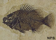 |
Fossils |
 |
Geodes |
 |
The Rock Used to Make Beer |
 |
Topo Maps |
 |
Difficult Rocks |
 |
Fluorescent Minerals |
 |
Sliding Rocks on Racetrack Playa |

Find Other Topics on Geology.com:

|

| ||

|

| ||

|

| ||

|

|