Home » World Maps » Africa » Mali
Mali Map and Satellite Image
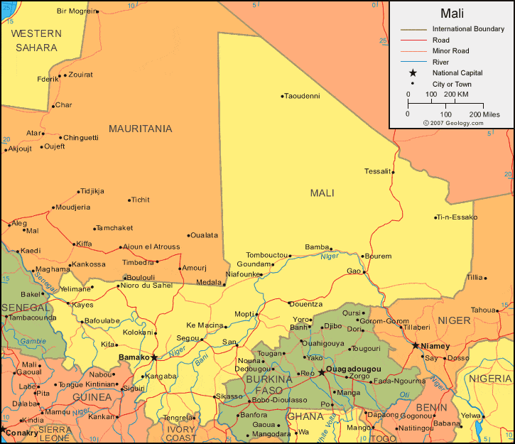
| Mali is located in western Africa. Mali is bordered by Senegal and Mauritania to the west, Algeria to the north, Niger to the east, and Burkina Faso, Guinea, and Cote d'Ivoire (Ivory Coast) to the south. |
ADVERTISEMENT
Mali Bordering Countries:
Algeria, Burkina Faso, Guinea, Cote d'Ivoire, Mauritania, Niger, SenegalRegional Maps:
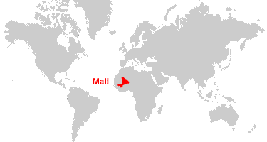
Map of Africa, World MapWhere is Mali?
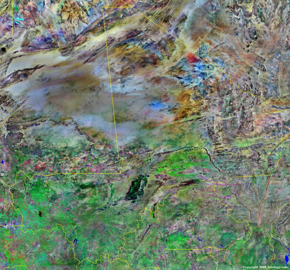
Mali Satellite Image
ADVERTISEMENT

Explore Mali Using Google Earth:
Google Earth is a free program from Google that allows you to explore satellite images showing the cities and landscapes of Mali and all of Africa in fantastic detail. It works on your desktop computer, tablet, or mobile phone. The images in many areas are detailed enough that you can see houses, vehicles and even people on a city street. Google Earth is free and easy-to-use.
Mali on a World Wall Map:
Mali is one of nearly 200 countries illustrated on our Blue Ocean Laminated Map of the World. This map shows a combination of political and physical features. It includes country boundaries, major cities, major mountains in shaded relief, ocean depth in blue color gradient, along with many other features. This is a great map for students, schools, offices and anywhere that a nice map of the world is needed for education, display or decor.
Mali On a Large Wall Map of Africa:
If you are interested in Mali and the geography of Africa our large laminated map of Africa might be just what you need. It is a large political map of Africa that also shows many of the continent's physical features in color or shaded relief. Major lakes, rivers, cities, roads, country boundaries, coastlines and surrounding islands are all shown on the map.Mali Cities:
Badogo, Bafoulabe, Bakmo, Baleya, Bamako, Bamba, Boro, Boulouli, Bourem, Danfina, Denso, Diala, Douentza, Falea, Famana, Fari, Gale, Gao, Goundam, Kalana, Kangaba, Kassaro, Kati, Kayes, Ke Macina, Kifa, Kito, Kole, Kolokani, Koutiali, Mopti, Niafounke, Nioro du Sahel, San, Segou, Sero, Siby, Sido, Sikasso, Taoudenni, Tessalit, Ti-n-Essako, Tombouctou, Yelimane and Yoro.Mali Locations:
Bani River, Baoule River, Lac Faguibine, Lac Garou, Lac do, Lac Niangay, Lac Aougoundou, Lac Korarou, Lac De'bo, Niger River, Sahara Sahel (Sahara Desert) and Senegal River.Mali Natural Resources:
Mali has unexploited deposits of bauxite, iron ore, manganese, tin, and copper. The exploited metals and minerals of Mali include gold, uranium, kaolin, gypsum and limestone. Other resources for this country include phosphates, salt, granite and hydropower.Mali Natural Hazards:
Although the country of Mali has recurring droughts, there is occasional Niger River flooding. Other natural hazards include the hot, dust-laden harmattan haze, which is common during dry seasons.Mali Environmental Issues:
Environmental issues for Mali concerning the land include deforestation, soil erosion and desertification. The country has inadequate supplies of potable water. In addition, poaching threatens the wildlife populations.
ADVERTISEMENT