Home » US Maps » Michigan » County Map
Michigan County Map with County Seat Cities

ADVERTISEMENT
County Maps for Neighboring States:
Indiana Ohio Wisconsin


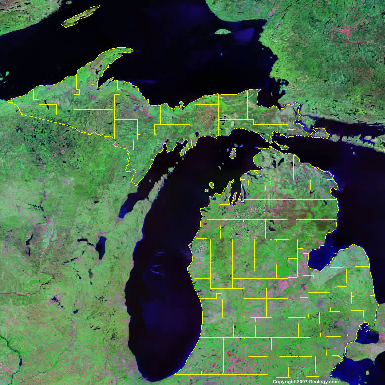
The map above is a Landsat satellite image of Michigan with County boundaries superimposed. We have a more detailed satellite image of Michigan without County boundaries.


ADVERTISEMENT
Michigan Counties and County Seats |
|
|
Alcona County - Harrisville Alger County - Munising Allegan County - Allegan Alpena County - Alpena Antrim County - Bellaire Arenac County - Standish Baraga County - L'Anse Barry County - Hastings Bay County - Bay City Benzie County - Beulah Berrien County - St. Joseph Branch County - Coldwater Calhoun County - Marshall Cass County - Cassopolis Charlevoix County - Charlevoix Cheboygan County - Cheboygan Chippewa County - Sault Ste. Marie Clare County - Harrison Clinton County - St. Johns Crawford County - Grayling Delta County - Escanaba Dickinson County - Iron Mountain Eaton County - Charlotte Emmet County - Petoskey Genesee County - Flint Gladwin County - Gladwin Gogebic County - Bessemer Grand Traverse County - Traverse City Gratiot County - Ithaca Hillsdale County - Hillsdale Houghton County - Houghton Huron County - Bad Axe Ingham County - Mason Ionia County - Ionia Iosco County - Tawas City Iron County - Crystal Falls Isabella County - Mt. Pleasant Jackson County - Jackson Kalamazoo County - Kalamazoo Kalkaska County - Kalkaska Kent County - Grand Rapids Keweenaw County - Eagle River |
Lake County - Baldwin Lapeer County - Lapeer Leelanau County - Leland Lenawee County - Adrian Livingston County - Howell Luce County - Newberry Mackinac County - St. Ignace Macomb County - Mount Clemens Manistee County - Manistee Marquette County - Marquette Mason County - Ludington Mecosta County - Big Rapids Menominee County - Menominee Midland County - Midland Missaukee County - Lake City Monroe County - Monroe Montcalm County - Stanton Montmorency County - Atlanta Muskegon County - Muskegon Newaygo County - White Cloud Oakland County - Pontiac Oceana County - Hart Ogemaw County - West Branch Ontonagon County - Ontonagon Osceola County - Reed City Oscoda County - Mio Otsego County - Gaylord Ottawa County - Grand Haven Presque Isle County - Rogers City Roscommon County - Roscommon Saginaw County - Saginaw Sanilac County - Sandusky Schoolcraft County - Manistique Shiawassee County - Corunna St. Clair County - Port Huron St. Joseph County - Centreville Tuscola County - Caro Van Buren County - Paw Paw Washtenaw County - Ann Arbor Wayne County - Detroit Wexford County - Cadillac |
