Home » US Map Collections
US Map Collections
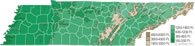
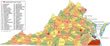
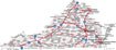
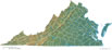
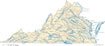
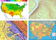
County, Cities, Physical, Elevation, and River Maps
Click on any State to View Map Collection


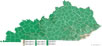
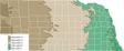
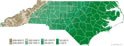
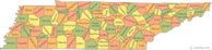
County Map
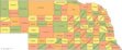
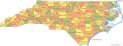
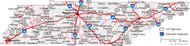
Cities Map
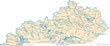
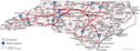
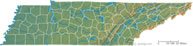
Physical Map
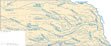
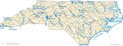
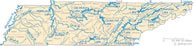
River Map
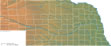
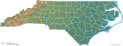
Elevation Map

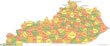
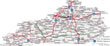
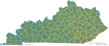
County

Cities

Physical

Rivers

Elevation

Borough

Cities

Physical

Rivers

Elevation

County

Cities

Physical

Rivers

Elevation

County

Cities

Physical

Rivers

Elevation

County

Cities

Physical

Rivers

Elevation

County

Cities

Physical

Rivers

Elevation

County

Cities

Physical

Rivers

Elevation

County

Cities

Physical

Rivers

Elevation

County

Cities

Physical

Rivers

Elevation

County

Cities

Physical

Rivers

Elevation

County

Cities

Physical

Rivers

Elevation

County

Cities

Physical

Rivers

Elevation

County

Cities

Physical

Rivers

Elevation

County

Cities

Physical

Rivers

Elevation

County

Cities

Physical

Rivers

Elevation

County

Cities

Physical

Rivers

Elevation
County
Cities
Physical
Rivers
Elevation

Parish

Cities

Physical

Rivers

Elevation

County

Cities

Physical

Rivers

Elevation

County

Cities

Physical

Rivers

Elevation

County

Cities

Physical

Rivers

Elevation

County

Cities

Physical

Rivers

Elevation

County

Cities

Physical

Rivers

Elevation

County

Cities

Physical

Rivers

Elevation

County

Cities

Physical

Rivers

Elevation

County

Cities

Physical

Rivers

Elevation
County
Cities
Physical
Rivers
Elevation

County

Cities

Physical

Rivers

Elevation

County

Cities

Physical

Rivers

Elevation

County

Cities

Physical

Rivers

Elevation

County

Cities

Physical

Rivers

Elevation

County

Cities

Physical

Rivers

Elevation
County
Cities
Physical
Rivers
Elevation

County

Cities

Physical

Rivers

Elevation

County

Cities

Physical

Rivers

Elevation

County

Cities

Physical

Rivers

Elevation

County

Cities

Physical

Rivers

Elevation

County

Cities

Physical

Rivers

Elevation

County

Cities

Physical

Rivers

Elevation

County

Cities

Physical

Rivers

Elevation

County

Cities

Physical

Rivers

Elevation
County
Cities
Physical
Rivers
Elevation

County

Cities

Physical

Rivers

Elevation

County

Cities

Physical

Rivers

Elevation

County

Cities

Physical

Rivers

Elevation
County
Cities
Physical
Rivers

Elevation

County

Cities

Physical

Rivers

Elevation

County

Cities

Physical

Rivers

Elevation

County

Cities

Physical

Rivers

Elevation

County

Cities

Physical

Rivers

Elevation
| More Geology Topics |
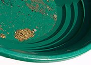 |
Gold |
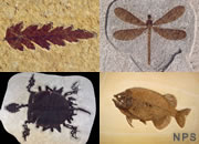 |
Fossils |
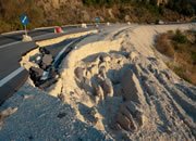 |
Landslides |
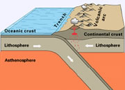 |
Plate Tectonics |
 |
Topo Maps |
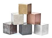 |
Metals |
 |
Gifts That Rock |
 |
General Geology |

Map of the Oceans
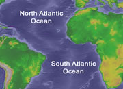
Map of the Oceans - showing the Atlantic, Pacific, Indian, Arctic, and Southern Oceans.
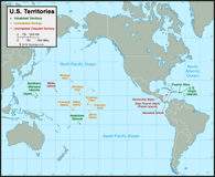
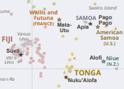
U.S. Territories Map
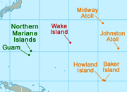
U.S. Territories - A map of the 16 United States territories in the Caribbean and Pacific.
Wall Maps
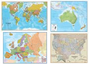
Wall Maps - Large and colorful wall maps of the world, the United States, and individual continents.
Ten Largest Deserts
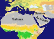
Map of the Ten Largest Deserts - The Sahara is huge, but two polar deserts are larger.
Archipelago
What Is An Archipelago? It is a closely scattered cluster of islands. Hawaii is an archipelago.
Diamond Producers Map
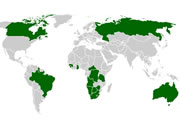
Top Ten Diamond Producers Map - Leaders include: Botswana, Russia, Angola and Canada.
Arctic Ocean Seafloor
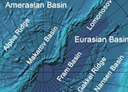
Arctic Ocean Seafloor Map - The ridges, basins, shelves and rifts defining the Arctic seafloor.
DeLorme Atlas
DeLorme Atlas Get a complete state of topo maps with back roads in one convenient book.
Northwest Passage
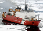
The Northwest Passage is a route connecting the Atlantic to the Pacific through the Arctic.
Deepest Ocean Trench
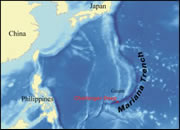
Deepest Part of the Ocean - The Mariana Trench is the deepest point in the ocean.
Where Is The Arctic?
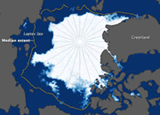
Where Is the Arctic? It surrounds the North Pole, but what is its southern boundary?
Lowest Land Points
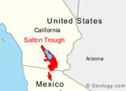
Land Below Sea Level - Several places on earth are over 100 meters below sea level!