Geology and Earth Science News and Information
Categories

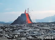
Underwater Volcano
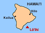
Hawaii*s Next Island could be growing in the Pacific Ocean right now. Its name is Lo*ihi.
Hawaiian Hot Spot
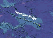
How did the Hawaiian Islands Form? The power of a moving plate over a stationary hot spot.
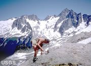
Tallest Mountain

Tallest Mountain - Everest has rivals in tallness, altitude and distance to the center of Earth.
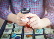
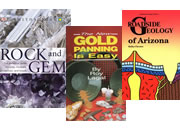
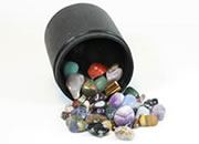
Rock and Mineral Kits
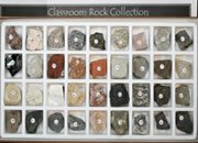
Rock & Mineral Kits The best way to learn about rocks and minerals is with specimens!
Largest Volcanoes
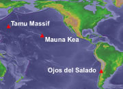
Largest Volcano - That title is shared by Tamu Massif, Mauna Kea and Ojos del Salado.
Geology News
Geology News including: Earth science, mining, gemology, maps, metals, archaeology, and more.
Google Earth - Free

Free Google Earth software allows you to browse seamless world satellite images. Free.
Fluorescent Minerals
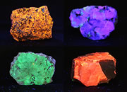
Fluorescent Minerals and rocks glow with spectacular colors under ultraviolet light.
Mineral Hardness
Mohs Hardness Scale is a set of reference minerals used for classroom hardness testing.
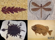
Fossils
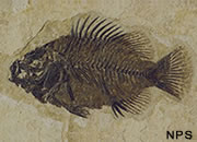
Fossils are remains, traces or imprints of ancient life. They reveal Earth's biological history.
Don*t Go To Jail
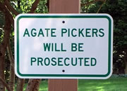
Know the Rules before removing rocks, fossils or minerals from public or private property.
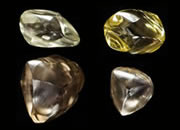
Largest Diamonds
World*s Largest Diamonds Records for the largest rough, faceted and carbonado diamond.
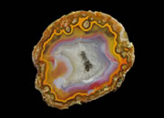
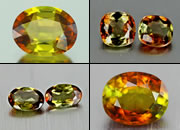
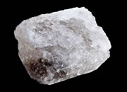
Grape Agate
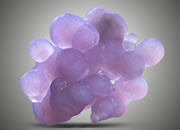
Grape Agate is a popular mineral specimen with the color and the shape of a bunch of grapes.
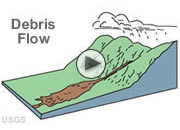
Horizontal Drilling
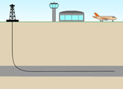
Horizontal Drilling has opened new resources and significantly improved productivity.
Birthstones
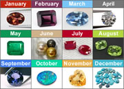
Birthstones are gems assigned to the month of a person*s birth. They are popular gifts in the U.S.
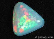
Fire Opal
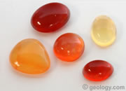
Fire Opal is a transparent to translucent opal with a yellow, orange or red background color.
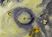
Darvaza Gas Crater
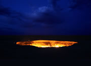
The Doorway to Hell is a flaming sinkhole seeping natural gas that has been burning for decades.

Coal Close Up
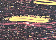
Coal Through a Microscope - Coal is more than a black rock. It is THE most interesting rock.
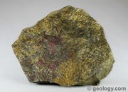
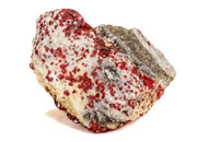
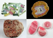
Rhodochrosite
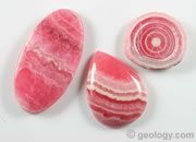
Rhodochrosite - a manganese mineral used as an ore, a pink gem and an ornamental stone.
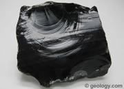
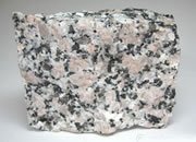
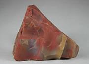
Rhyolite
Rhyolite An extrusive igneous rock with a high silica content, produced from granitic magma.
Lab-Grown Diamonds
Lab-Grown Diamonds? What are they? Can people really make diamonds? Are they real?
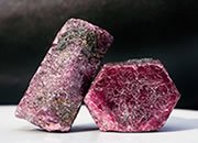
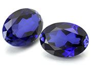
Ruby and Sapphire
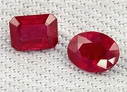
Ruby and Sapphire are the 2nd and 3rd most popular colored stones in the United States.
The Brewery Rock ?
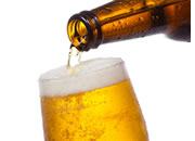
The Rock Used to Make Beer - Geologists are beer experts and should know about this rock.
Fool*s Gold
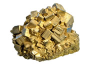
Fool*s Gold is a name used for pyrite when its brassy color fools people looking for gold.
Cave of the Hands
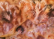
Cave of the Hands is a cave where ancient people painted hands about 9000 years ago.

Strawberry Quartz
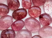
Strawberry Quartz is a red to pink quartz with inclusions that look like strawberry seeds.
Hand Lens
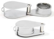
Hand Lens A 10-power folding magnifier in a metal case. A frequently used lab and field tool.
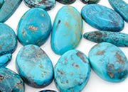
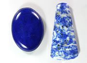
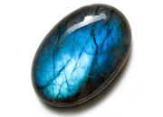
Gem Silica
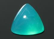
Gem Silica is a blue chalcedony colored by copper. It is the rarest and most valuable chalcedony.
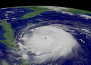
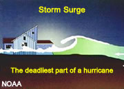
Largest Hurricanes
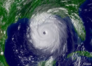
Largest Hurricanes Are they determined by wind speed, value of damage, most deaths?
Green River Fossils
The Green River Formation is one of the most famous rock units in the world for its fossils.
Colored Diamonds
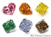
Colored Diamonds are diamonds with a noticeable body color. They can sell for over $1M/carat.
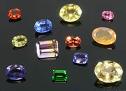
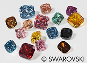
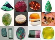
100+ Gemstones

100+ Gems - Photos of over 100 beautiful gems ranging from the popular to the obscure.
Rare Earth Elements
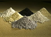
Rare Earths - Special materials used in electronics, defense, medical & many other products.
Petrified Wood
Petrified Wood is a fossil that forms when silica replaces and infills the cavities of wood.
Sliding Rocks
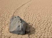
Sliding Rocks Mystery - What causes these rocks to slide across a playa in Death Valley?
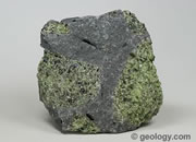
Peridotite
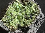
Peridotite is a chromite host rock, a source of diamonds and a possible carbon dioxide sink.
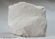
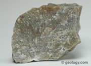
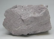
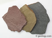
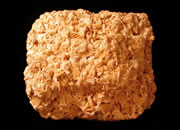
Soapstone
Soapstone is a metamorphic rock with properties that make it suitable for a variety of projects.
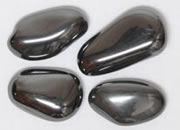
Copper
Copper is a metal used in coins, electronics, pipes, wiring, motors, alloys and many other products.
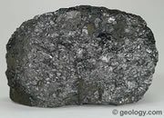
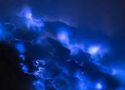
Cinnabar
Cinnabar - the only important ore of mercury. Used in pigments until its toxicity was realized.
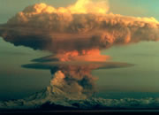
June 6th 1912
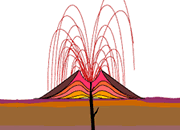
Novarupta - The most powerful volcanic eruption of the 20th century occurred in the U.S.A.
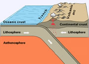
Great Rift Valley
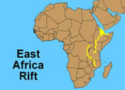
The East Africa Rift System - The extensive fault system that is tearing Africa apart.
Sand Photo Collection
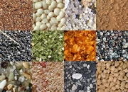
Sand from Around the World . A photo gallery showing the diversity of the material we call "sand".
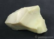
Uses of Talc
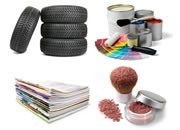
Talc is a soft mineral used in cosmetics, paper, paint, ceramics and many other products.
Tallest Waterfall
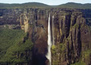
Angel Falls in Venezuela is the tallest waterfall in the world - it is 3212 feet tall.
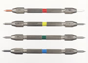
Geology Tools

Geology Tools - Rock hammers, field bags, hand lenses, maps, hardness picks, gold pans.
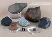
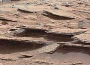
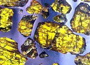
Mars Meteorites
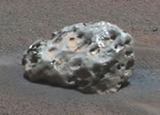
Mars Meteorites Mars rovers have found dozens of meteorites while exploring the red planet.
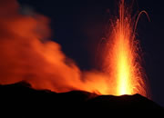
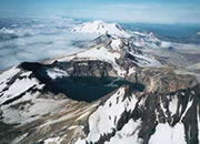
Mount Etna
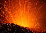
Mount Etna - The most active volcano in Europe continues an eruption that started in 2001.
What is Geology?
What is Geology? The study of Earth materials, structures, processes and life over time.
Rock Tumblers
Rock Tumblers - All about rock tumblers and rock tumbling. Read before you buy a tumbler.
Waterproof Paper
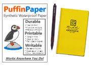
Waterproof Paper - Don't take chances with your field notes and maps. Use waterproof paper.
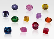
American Gemstones
Mined in America - Small mines in the United States produce a diversity of beautiful gemstones.
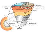
Greatest Ocean Depth
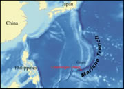
Deepest Point in the Ocean The deepest point in the ocean is in the Mariana Trench.
Opals
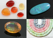
Pictures of Opal - A collection of different types of opal from all around the world and Mars too!
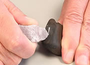
The Acid Test
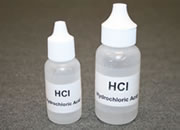
The Acid Test - Geologists use dilute hydrochloric acid to identify carbonate minerals.
Life on Europa?
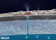
Life on Europa (a moon of Jupiter) could exist in a salty ocean below its frozen surface.
Gems from Space
Extraterrestrial Gems - A number of materials from space are used as attractive gems.
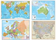
Map of the Oceans
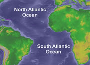
Map of the Oceans - showing the Atlantic, Pacific, Indian, Arctic, and Southern Oceans.
Record Lightning
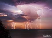
World Record Lightning - this lake has more lightning than any other place in the world.
Volcanic Explosivity
Volcanic Explosivity - Rating volcanic eruptions based upon the volume of tephra ejected.
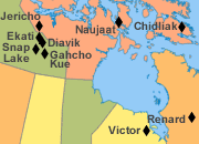
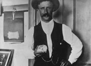
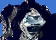
Crater of Diamonds
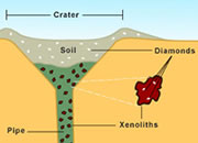
Crater of Diamonds - The only diamond mine in the world where you can be the miner.
Troglobites
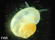
Troglobites are creatures that have adapted to a permanent life in the darkness of a cave.
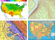
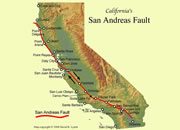
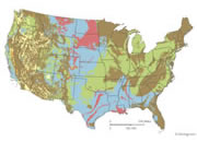
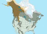
Earthquake Maps
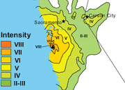
California Earthquake Maps - A collection of isoseismal maps for earthquakes in California.
Lightning Strikes Map
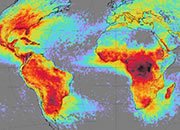
Lightning Strikes Map by NASA shows the worldwide distribution of lightning activity.
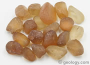
Ant Hill Garnets
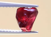
Ant Hill Garnets - tiny gems that ants haul to the surface and discard on their anthill. Honest!
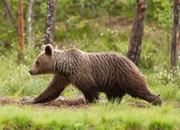
Watch out for Ticks!

Ticks are a problem for geologists in some areas. Learn to recognize and avoid them.

Morganite
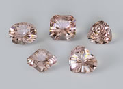
Morganite is an orange to pink gemstone, a variety of beryl, that is growing rapidly in popularity.
What Is Earth Science?

What Is Earth Science? The study of Earth and its neighbors in space. Learn more!
The British Isles
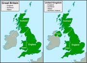
Names Used for Great Britain, British Isles, United Kingdom, and Ireland. What they mean.
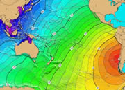
Tallest Tsunami
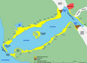
Tallest Tsunami - A wave with a run-up height of 1720 feet occurred in Lituya Bay, Alaska.
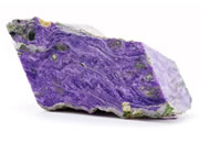
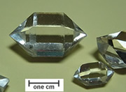
Crystal Habit
Crystal Habit is the external shape displayed by a crystal or an aggregate of crystals.
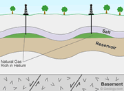
What is LNG?
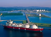
What is LNG? Liquefied Natural Gas. The gas is condensed into a liquid for efficient transport.